CHAPTER 2
The Global Trade
Carousel 1400–1800
‘World economic integration’ is as significant a fact of organized life in earlier centuries (despite all appearances to the contrary) as it more obviously is in the days of instant computerized markets…. We must conclude that major changes involve transitions informs of integration and not, as is alleged, the emergence of integration itself…. The history of the world should not be characterized as a movement from locally constituted closures toward increasing world integration and homogenization…. The conventional notion of ‘diverse cultures’ being ‘penetrated’ by emergent universalist forces is misfounded…. Whether in the ninth and tenth centuries, twelfth and thirteenth centuries, or seventeenth and eighteenth centuries, the world has always been complex in its connectedness…. The continuum of medieval and early-modern times has no single centre, not even a handful of particular centres conceived as the sources affecting integration. Instead, its character is prolific multicentredness.
Frank Perlin (1994: 98, 102, 104, 106)
An Introduction to the World Economy
The major thesis of this book is that, contrary to widespread doubts and denials, there was a single global world economy with a worldwide division of labor and multilateral trade from 1500 onward. This world economy had what can be identified as its own systemic character and dynamic, whose roots in Afro-Eurasia extended back for millennia. It was this world political economic structure and its dynamic that had motivated Europeans to seek greater access to the economically dominant Asia ever since the European Crusades. The same Asian magnet led to the “discovery” and incorporation of the Western Hemisphere “New” World into the Old World economy and system after the 1492 voyage of Columbus and to closer European-Asian relations after the 1498 circum-African voyage of Vasco da Gama. An alternate route to China via the Northwest Passage around and/or through North America—and also eastward through the Arctic Sea—continued to be eagerly sought for centuries thereafter.
The world economy continued to be dominated by Asians for at least three centuries more, until about 1800. Europe's relative and absolute marginality in the world economy continued, despite Europe's new relations with the Americas, which it used also to increase its relations with Asia. Indeed, it was little more than its new and continued access to American money that permitted Europe to broaden, though hardly to deepen, its participation in the world market. Productive and commercial economic activities, and population growth based on the same, also continued to expand faster and more in Asia until at least 1750, as this and the following two chapters document.
This chapter oudines the globe-encircling pattern of world trade relations and financial flows, region by region. The examination of the structure and operation of these global economic relations will demonstrate the existence of a world market in the early modern period beyond a reasonable doubt. My insistence on the same is intended to counter the widespread neglect and even frequent denial of the existence of this world economy by so many other students of that period. Indeed, it has recently become fashionable to claim that the world economy is only now undergoing “globalization.” Moreover, the explicit denial, not to mention neglect, of the early modern world market and its underlying division of labor is still the mistaken basis of much historical research and social science theory about the “European world-economy” by Braudel and the “modern world-system” by Wallerstein and by their many disciples, not to mention their detractors like O'Brien, cited in chapter 1.
An “intercontinental model” of world trade between 1500 and 1800 on the basis of interregional competition in production and trade was proposed by Frederic Mauro (1961). However, its early existence was already observed by Dudley North in 1691: “The Whole World as to Trade, is but one Nation or People, and therein Nations are as Persons” (quoted in Cipolla 1974: 451). Moreover, this world market and the flow of money through it permitted intra- and intersectoral and regional divisions of labor and generated competition, which also spanned and interconnected the entire globe:
The records show that there was competition…between alternative products, such as East Indian and European textiles; between identical products from different regions enjoying similar climates, e.g., sugar from Java and Bengal, sugar from Madeira and Sao Tome, and Brazilian and West Indian sugar; or between products grown in different climatic regions, as in the case of tobacco…. Chinese, Persian and Italian silk; Japanese, Hungarian, Swedish and West Indian copper; the spices of Asia, Africa and America; coffee from Mocha, Java and the West Indies: all of these competed…. The best barometer, however, is represented by the prices on the commodity exchange of Amsterdam. (Cipolla 1974: 451)
The Amsterdam that Cipolla singles out may have been the best market price barometer for a time, but that should not be confused with the climate itself and the ups and downs in its economic and financial weather, which were worldwide. Of course, the global inter- and intraregional competitive and complementary or compensatory division of labor went far beyond Cipolla's few examples. For instance, Rene Barendse observes regarding the Arabian Sea and the operation of the Dutch East India Company (or VOC, from its commonly used Dutch initials) there and elsewhere that
The production was centralized on places where the costs of labour were lowest. This, not primarily low transport-costs, explains [that]…comparative cost-advantages were pulling Asian and American markets together—no matter what mercantilist restriction. Another case was the substitution of Indian, Arab and Persian products like indigo, silk, sugar, pearls, cotton, later on even coffee—the most profitable commodities traded in the Arabian seas in the late seventeenth century—by goods produced elsewhere; generally the American colonies…. Due to this global process of product-substitution, by 1680 the transit-trade of the Arabian seas with Europe had disappeared or was in decline; this was for a brief period cushioned by the rise of the coffee-trade. But it contributed to a prolonged depression in the commerce between the Gulf, the Red Sea and the Indian west coast. This decline of transit-trade was smoothed by internal trade within the Arabian seas. But the Middle East had to pay for imports from India by selling bulk products in the Mediterranean, like grain or wool. A precarious balance…spawned an inflationary pull both on the Ottoman and the Safavid currency. (Barendse 1997: chap. 1)
These globe-encircling world market relations and their underlying division of labor and its resulting (im) balances of trade are outlined in this chapter and illustrated in the accompanying maps.
In the “regional” accounts of this chapter, we repeatedly see how the changing mix and selection of crops, or indeed the replacement of “virgin” forested land by crops, and the choice of manufactures and the commercialization of all of the above responded to local incentives and exigencies. We observe in both this and the following chapter how that resulted in the clearing of the jungle in Bengal and the deforesting of land in southern China. As a result, land, rice, sugar, silk, silver, and labor were exchanged for each other and timber or its products, which were then imported from Southeast Asia. However, we also see how many of these local and sectoral incentives were transmitted by regional and interregional market forces. Many of these in turn emanated from competitive or compensatory activities on the opposite side of the globe. Indeed, some of these pressures met, say in a village in India or China, after being simultaneously transmitted halfway around the globe in both eastward and westward directions, as well as in additional crisscross directions. Of course as chapter 6 stresses about Europe as well, the import of sugar from the Americas and of silk and cotton textiles from Asia supplemented the local production of food and wool and liberated forest and cropping land; thus the extent to which “sheep ate men” and men ate at all was also a function of the world market.
The wheels of this global market were oiled by the worldwide flow of silver. In chapters 3 and 6 we see how it was only their newfound access to silver in the Americas that allowed the Europeans even to participate in this expanding world market. More detailed attention to how the production and flow especially of silver money stimulated and extended production and trade around the globe is reserved for chapter 3, which demonstrates how the arbitraged interchange of different currencies and other instruments of payment among each other and with other commodities facilitated a world market for all goods. All this trade was of course made possible only by commonly acceptable forms of money and/or the arbitrage among gold, silver, copper, tin, shells, coins, paper money, bills of exchange, and other forms of credit. These had been in circulation across and around Afro-Eurasia for millennia (and according to some reports, also across the Pacific especially between China and the Western Hemisphere). Nonetheless, the incorporation into this Old World economy of the New World in the Americas and their contribution to the world's stocks and flows of money certainly gave economic activity and trade a new boost from the sixteenth century onward.
THIRTEENTH-AND FOURTEENTH-CENTURY
ANTECEDENTS
Two recent books begin to offer a non-Eurocentric alternative reading of early modern world history. They are Janet-Abu-Lughod's (1989) Before European Hegemony: The World System A.D. 1250– 1350 and N. K. Chaudhuri's (1990a) Asia Before Europe, which peruses its theme to 1750. Abu-Lughod offers an especially suitable point of departure for the analysis of the present book. She argues that eight interlinking city-centered regions were united in a single thirteenth- century Afro-Eurasian world system and division of labor. The eight interlinked regions are categorized as three related and interlocked subsystems: (1) the European subsystem, with the Champagne fairs, industrial Flanders, and the commercial regions of Genoa and Venice; (2) the mideastern heardand and its east-west routes across Mongol Asia, via Baghdad and the Persian Gulf, and through Cairo and the Red Sea; and (3) the Indian Ocean-East Asian subsystem of India, Southeast Asia, and China. Their major fortunes and misfortunes, as well as the mid-fourteenth-century crisis and the Black Death epidemic, were more or less common to all of them.
Europe was “an upstart, peripheral to an ongoing operation” in Asia, so that “the failure to begin the story early enough has resulted…in a truncated and distorted causal explanation for the rise of the west,” rightly insists Abu-Lughod (1989: 9, 17). Indeed she sees Europe's own twelfth- and thirteenth-century development as at least in part dependent on trade with the eastern Mediterranean, which had been generated by the Crusades. These in turn would not even have taken place or would have been fruidess, had it not been for the riches of “the Orient.” Indeed, the trade, industry, and wealth of Venice and Genoa were due primarily to their middlemen roles between Europe and the East, some of which the Italian cities had preserved even through the Dark Ages. During the periods of economic revival after A.D. 1000, both tried to reach into the trade and riches of Asia as far as they could. Indeed, Genoa attempted in 1291 to reach Asia by circumnavigating Africa.
Failing that, Europe had to make do with the three major routes to Asia that departed from the eastern Mediterranean: the northern one through the Black Sea, dominated by the Genovese; the central one via the Persian Gulf, dominated by Baghdad; and as its replacement, the southern one through the Red Sea, which gave life to Cairo and its economic partner in Venice. The expansion of the Mongols under Genghis Khan and his successors cemented the decline of the middle route after the capture of Baghdad in 1258 and favored the southern one. The Mongols then controlled the northern route onward from the Black Sea and also promoted the trans-Central Asian routes through such cities as Samarkand, which prospered under Mongol protection. Yet all of these trade routes suffered from the long world economic depression between the mid-thirteenth-century and the end of the fourteenth century, of which the Black Death was more the consequence than the cause (Gills and Frank 1992; also in Frank and Gills 1993). The economic determinants of this growing and ebbing trade, production, and income, however, lay still farther eastward in South, Southeast, and East Asia. As we will observe below, a long cyclical economic revival began there again around 1400.
But before that, according to Abu-Lughod's (1989) reading, this world system experienced its apogee between 1250 and 1350 and declined to (virtual) extinction thereafter and was then reborn in southern and western Europe in the sixteenth century. In her words, “of crucial importance is the fact that the ‘Fall of the East’ preceded the ‘Rise of the West’” (Abu-Lughod 1989: 388). We must agree with the latter statement but not with her timing nor with her claim that there was no continuity between the thirteenth and sixteenth centuries in a single world economy and system. I have criticized Abu-Lughod's interpretation of the “substitution” of one “system” by another, rather than the “restructuring” of the same system elsewhere (Frank 1987, 1991a, 1992, Frank and Gills 1993), and she has answered (Frank and Gills 1993). We may now take up our examination of the global world economy and system where Abu-Lughod's account ended around 1400.
The world economy was predominantly Asian-based and so were the economic enterprise and success of Venice and Genoa, both of which derived their wealth from their intermediary position between the riches of Asia and the demand for the same in Europe. Their trade with the western terminus of Asian trade in West Asia, from the Black Sea, via the Levant to Egypt was also the precursor of European expansion into the Atlantic Ocean and eventually down it around Africa to India and across it to the Americas, also in search of Asia. The reasons for the voyages of Columbus in 1492 and of Vasco da Gama in 1498 have been long debated. These events were not accidental. After all, Columbus “discovered” America because he went in search of markets and gold in East Asia. That happened when a growing bullion shortage and the consequent rise in the Afro-Eurasian world market price of gold made such an enterprise attractive and potentially profitable (which it turned out to be). As John Day, admittedly a monetarist, writes
The problem [of specie shortages], in the long run, engendered its own solution. Rising bullion prices, the corollary of contracting stocks, largely account for the intensified prospecting for precious metal all over Europe, as well as the ultimately successful search for new techniques of extraction and refining. And it was the acute “gold fever” of the fifteenth century that was the driving force behind the Great Discoveries which would end by submerging the money-starved European economy with American treasure at the dawn of modern times. (Day 1987: 63)
Moreover, Iberian access to that treasure was blocked not so much by the oft-heralded Muslim expansion and the advance of the Ottomans and their capture of Constantinople in 1453, as has often been alleged. Probably more important were Venetian and Genovese competition on the trade routes through the eastern Mediterranean, Genovese interests in Iberia, and their attempts to circumvent the Venetian stranglehold on commerce through Egypt. That is the significance, Lynda Shaffer (1989) points out, of the oft-quoted observation by the Portuguese Tome Pires that “whoever is lord of Malacca has his hands on the throat of Venice.” Recall that Columbus was Genovese, first offering his services to Portugal to open a new route to the Orient, and only later accepting Spanish patronage.
Moreover, whatever the immediate incentives for the voyages of Columbus, Vasco da Gama, and then Magellan and the others, they had a long-standing and widely shared European impulse. As K. M. Panikkar (1959: 21–22) insists, “the full significance of da Gama's arrival at Calicut can be recognized only if we appreciate that it was the realization of a 2oo-year-old dream and of seventy-five years of sustained effort. The dream was shared by all mercantile peoples of the Mediterranean, with the exception of the Venetians; the effort was mainly that of Portugal.” However, C. R. Boxer (1990: ix) quotes an official 1534 Portuguese document which observed that “many people…say that it was India which discovered Portugal.” We will have further occasion to reflect on this European enterprise regarding Asia in chapters that follow. Here we shall proceed to examine some of the results.
THE COLUMBIAN EXCHANGE
AND ITS CONSEQUENCES
Three major consequences of the 1492 and 1498 voyages and their subsequent migratory and trade relations merit more attention than the brief reference they can receive here. The first two are “the Columbian exchange” of germs and of genes and “ecological imperialism,” as Alfred Crosby (1972, 1986) has termed them. The germs that the Europeans brought with them were by far their most powerful weapons of conquest. They were most devastating in the New World, whose population had no immunities to the disease germs the Europeans brought with them. This devastation is described by, among others, Crosby (1972, 1986) as well as by William McNeill in his Plagues and People (1977). In the Caribbean, almost the entire indigenous tribal population was wiped out in less than fifty years. On the continent, the germs of disease were carried faster, further, and far more devastatingly than the conquering troops of Cortez and Pizarro, who found that the smallpox they brought on shore preceded them inland. The new weeds and animals they also brought spread their damage more slowly.
In the New World of the Americas, the consequences were devastating. The populations of the Mesoamerican Aztec and Maya civilizations were reduced from about 25 million to 1.5 million by 1650. The Andean Inca civilization fared similarly, with a population decline from perhaps 9 million to 600,000 (Crosby 1994: 22). In North America also, the germs brought by the first European arrivals, probably in 1616–1617, cleared the land of many indigenous inhabitants even before the bulk of the settlers arrived. One estimate for the ultimate European impact in the United States is a decline of the indigenous population from 5 million to 60,000 before it began to rise again. Some estimates suggest a population decline in the New World as a whole from some 100 million to about 5 million (Livi-Bacci 1992: 51).
Even in nomadic Inner Asia, the Russian advance through Siberia would be spurred on by the germs of the soldiers and settlers as much as by their other arms. As Crosby (1994: 11) observes, “the advantage in bacteriological warfare was (and is) characteristically enjoyed by people from dense areas of settlement moving into sparser areas of settlement.” On the other hand, the transfer of germs within Afro-Eurasia never caused population declines on a scale remotely comparable to the population decline in the Americas initiated by the new transatlantic contacts. The reason of course is the much greater immunity the peoples of Afro-Eurasia had already inherited from their many generations of mutual contacts through prior invasion and migration as well as long-standing trade. Similarly, the relatively greater impact of the Black Death on Europe had also been a reflection of the isolation and marginality of Europe within Eurasia.
The Columbian gene exchange involved not only humans but also animals and vegetables. Old World Europeans introduced not only themselves but also many new animal and vegetable species to the New World. The most important animals, but by no means the only ones, were horses (which had existed there previously but had died out), cat-de, sheep, chickens, and bees. Among vegetables, Europeans brought wheat, barley, rice, turnips, cabbage, and lettuce. They also brought the bananas, coffee, and, for practical purposes if not genetically, the sugar that would later dominate so many of their economies.
Through the Columbian exchange, the New World in turn also contributed much to the Old World, such as animal species like turkeys as well as many vegetables, several of which would significantly extend cropping and alter consumption and survival in many parts of Europe, Africa, and Asia. Sweet potatoes, squash, beans, and especially potatoes and maize vastly increased cropping and survival possibilities in Europe and China, because they could survive harsher climates than other crops. The absolute and probably the relative impact was greatest on new crops in the more populated China where New World crops contributed to doubling agricultural land and tripling population (Shaffer 1989: 13). The growing of sweet potatoes is recorded in the 1560s in China, and maize became a staple food crop in the seventeenth century (Ho Ping-ti 1959: 186 ff.). White potatoes, tobacco, and other New World crops also became important. Indeed as we note below, the resultant population increase was far greater in China and throughout Asia than in Europe. Today 37 percent of the food the Chinese eat is of American origin (Crosby 1996:5). After the United States, China today is the world's second largest producer of maize, and 94 percent of the root crops grown in the world today are of New World origin (Crosby 1994: 20). In Africa, subsistence was extended especially by cassava and maize, along with sunflowers, several nuts, and the ubiquitous tomato and chili pepper. Later Africa also became a major exporter of cacao, vanilla, peanuts, and pineapple, all of which were of American origin.
Of course, the third major consequence of the Columbian exchange was the New World's contribution of gold and silver to the world's stocks and flows of money, which certainly also gave a new boost to economic activity and trade in the Old World economy from the sixteenth century onward. These flows are examined in detail in chapter 3, but some of their consequences for trade flows and balances are reviewed in the present chapter.
SOME NEGLECTED FEATURES
IN THE WORLD ECONOMY
Several features of the interregional world trade network deserve special preliminary comment (though they cannot receive as much attention in this summary as they probably merit in reality). They are regionalism, trade diasporas, documentation, and ecology.
The identification of “regions” below—”the Americas,” “Europe,” “China”—is in part an arbitrary heuristic notational convenience and in part a reflection of reality, as Lewis and Wigen (1997) stress under the title The Myth of Continents. There have been and are regions in the world, within whose “boundaries” the division of labor and the density of trade relations is greater than across them. That greater “internal” than “external” density of trade relations may be due to geographic factors (mountains, deserts, or seas that divide and therefore also bound), political ones (the reach and cost of empires and their competition with each other), cultural factors (ethnic and/or religious affinity and language), and other factors, or any combination thereof. The bounding of the grouping depends on the purpose and changes from time to time, sometimes very suddenly. The regional “unit” or “group” may be an individual, a nuclear or an extended family, a village or town, a local “region,” a “society,” a “country,” a “regional” region (the circum-Mediterranean), or a “world” region (the Americas, West Asia, Southeast Asia, the South Pacific). The very mention of these examples illustrates how ill-defined (indeed ill-definable) and fluid these “regional units” are and how arbitrary their identification is. The same exercise also serves to emphasize that the intra-regional ties, no matter what their density, are no obstacle to having inter-regional ones as well. Indeed, what is intra- or interregional is itself a function of how we identify the region or regions to begin with. If the world is a “region,” then all are intrarelations. Similarly, the assertion that there is or was a world economy/system does not dispute that it is or was also composed of regional ones. Where, what, and when such regions existed, however, all depends.
So whether the Americas, or Europe, or Southeast Asia, or China were “regions” in our 1400–1800 period or not depends on our definitions. Intra-American trade, not to mention cultural affinity and contact or political relations, were surely less among most Western Hemisphere “subregions” than they were between each of them and one or another part of Europe. Some parts of Europe also had less relations among themselves than they did with peoples and areas in the Americas and Asia. On the other hand, perhaps most major regions (or, subregions?) on the Indian subcontinent or within “China” probably had denser intra-Indian or intra-Chinese interregional trade (also outside the changing confines of the Mughal and Qing empires) than they did with other parts of the world. (There are some observations about Indian intra- and interregional trade below and in the maps). However, parts of Southeast Asia, especially Manila and Malacca, and also Aden and Hormuz in West Asia, were entrepots whose sixteenth- and seventeenth- century trade relations with many other parts of the world were greater than those with their own essentially nonexistent “regional” hinterlands.
Another notable but related feature of interregional trade in the world economy were the expatriate merchant and trade diasporas. They had already played important roles in the facilitation of trade in the Bronze Age and certainly did so in the early modern period. They also continue to do so today, as is testified by the “overseas” Chinese who now invest on the mainland and by expatriate Japanese and American “colonies” and even their “local” newspapers like the International Herald Tribune, a U.S. periodical originally published in Paris and now printed in a dozen cities around the world.
In the period under review, Malacca was peopled almost entirely by expatriate merchants, so much so that Pires counted eighty-four different languages spoken among them. Maharatshi merchants from Cambay and Surat were probably the most numerous in Malacca, but they were also residents—not to mention seasonal arrivals—in dozens of other port cities in Southeast, South, and West Asia. Manila counted up to 30,000 Chinese residents in the seventeenth century to oil the wheels of the transpacific-China silver and porcelain trade. Armenians from a landlocked country in western Central Asia established an also landlocked trade diaspora base in the Safavid Persian city of Isfahan, used it to trade all across Asia, and published an Armenian how-to-do-it handbook in Amsterdam. Arab and Jewish merchants continued to ply their worldwide trade as they had for at least a millennium and continue to do so today. New Englanders not only sought Moby Dick and other whales throughout the world oceans; they also plied the slave trade between Africa and the Caribbean, and they regularly buccaneered off the coast of Madagascar. Thousands if not millions of Chinese—not to mention Muslim trading expatriates, who “indianized” Southeast Asia—migrated overseas. Central Asia also continued to be a crossroads for itinerant merchants and migrating peoples, as it had from time immemorial.
Ironically, most of the still-extant documentary evidence on Asian trade comes from private European companies, who of course only recorded what was of commercial or other interest to them, especially in regard to these trade diasporas. Therefore much of the evidence on Asian production and trade fell through the European cracks. This is particularly the case with the inland economies and the transcontinental caravan trade, which the Europeans hardly saw. However, there is reason to believe that they were fully as important as, and complementary to, the maritime trade throughout this entire period up to 1800.
All this “development” also had other far-reaching impacts, which recent studies call ecological or green imperialism. A major consequence has been widespread deforestation, both to make way for new cropland and to provide timber for shipping and other construction and even more wastefully for charcoal for smelting ores and refining metals and for other fuel (Chew 1997, and forthcoming). On the other hand, planting potatoes and maize presumably relieved pressure on land more suitable for other crops. And New World sugar supplied calories to Europe that it did not have to provide for itself. Later of course, imports of wheat and meat from the New World fed millions of Europeans and permitted them to put their scarce land to other uses, as did the import of cotton, replacing wool from sheep that had grazed enclosed land. We will return to the matter of ecological imperialism in some of the regional reviews below and again in chapter 6.
World Division of Labor and Balances
of Trade
Of course, there were some abrupt and then secular changes in interregional relations, particularly because of the incorporation of the Americas by Europeans and the consequent growing participation of Europe in Afro-Eurasian and world trade from the sixteenth century onward. There were also—in other contexts important—cyclical changes, some of which are examined in Frank (1978a, 1994, 1995) and in chapter 5 below. Moreover, there was the rise to dominance of Europe beginning at the end of the eighteenth century, which we analyze in chapter 6. By and large however, the pattern of world trade and division of labor remained remarkably stable and displayed a substantially continuous, albeit cyclical, development over the centuries, if not millennia (as examined for the period before 1400 in Gills and Frank 1992; also in Frank and Gills 1993). There was certainly sufficient continuity in the period 1400–1800 to recognize the pattern outlined below.
MAPPING THE GLOBAL ECONOMY
A schematic and incomplete mapping and summary of the global division of labor, the network of world trade with its balances and imbalances, and how they were settled by flows of money in the opposite direction is set out in the maps and their legends below. It seems most efficient to use maps to identify some of the large variety of commodities—including many bulk commodities such as rice—that were exchanged in a complex network of trade in the world division of labor between about 1400 and 1800. The most schematic and least detailed world economic overview is in map 2.1.1 have chosen a “Nordic/ polar” global projection to permit a summary representation of circumglobal trade, including particularly the shipments of silver across the Pacific on the Manila Galleons. The reader should be aware however that to simplify and clarify their presentation, all trade routes on this and the following regional maps are only schematic. They do not pretend to be accurate, even if an effort was made to reflect global and regional geographical realities as well as the schematic representation permits. Moreover, contrary to the tide and message of this book, the global Map 2.1, like map 3.1, is not oriented toward Asia as I wished. The reason is that my cartographer's university geography department in Western Canada did not have a less Eurocentric sample map to guide his computerized design, and even his cartographic software is not flexible enough to meet my request to spin this one just a little on its polar axis in order to reorient the map. So here we have yet another example of how difficult but therefore also how necessary it is to reorient. Related problems in the representation of land mass and distance appear on the regional maps; for instance, India appears smaller and regions to its north and south relatively larger than they are in reality.
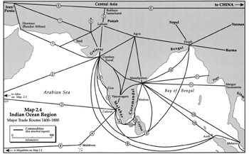
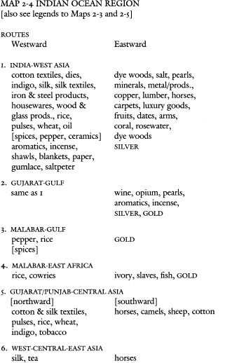
The regional maps and their respective legends present in more detail the major regional and interregional trade routes. Map 2.2 represents the Atlantic region, including the Americas, Africa, and Europe, Map 2.1 with their famous “triangular” trades along with the important transatlantic shipments of silver from the Americas to Europe. Map 2.3 overlaps with the previous one and features the major trade routes between Europe and West, South, and Central Asia, both around the Cape of Good Hope in South Africa and through the Baltic and Red seas and the Persian Gulf. Map 2.4 details the continuation of these major East-West trade routes through the Indian Ocean (and Arabian Sea), whose maritime trade connected East Africa and West Asia with South and Southeast Asia. However, the same map also shows some of the important overland caravan routes across parts of West and Central Asia and between them and South Asia, which, as the text below will insist, were more complementary to than competitive with the maritime routes. The western part of map 2.5 also overlaps with the previous one but features the major Bay of Bengal and South China Sea trade routes between India, Southeast Asia, Japan, and China as well as their connection with the transpacific trade at Manila. However, it is also intended to emphasize maritime and overland trade among the various Indian regions like Punjab, Gujarat, Malabar, Coromandel, and Bengal as well as the oft-neglected overland trade between China and Burma, Siam, and Vietnam in continental Southeast Asia as well as with India.
Map 2.1 Major Circum-Global Trade Routes, 1400 - 1800

These four regional maps are constructed also to illustrate the major interregional imbalances of trade and how they were covered by shipments of silver and gold bullion. Therefore, these maps represent commodity trade routes by solid lines, which are numbered from 1 to 13 and are accompanied by correspondingly numbered legends that list the major commodities traded along each of these major routes. Chronic trade deficits, resulting from insufficient exports of commodities to cover imports of others had to be paid for and balanced by corresponding exports of gold and mostly silver bullion or coin. This chapter and the next (on money) emphasize the predominant eastward flow of silver—and profit from the export of bullion or coin itself—to balance the trade deficits that most westerly regions maintained with those farther to the east. The global overview map 2.1 represents this flow of mostly silver by eastward-pointing arrows, except westward-pointing ones from the Americas and Japan to China, placed on the commodity trade lines themselves.
The regional maps use a different convention: silver flows and their directions are represented by dashed lines and gold flows by dotted lines parallel to the solid, numbered ones representing commodities. Therefore, an eastward-pointing arrow on a dashed line of silver exports also indicates a predominant reverse commodity export surplus from east to west along the parallel solid line representing a commodity trade route. In particular, almost all European imports from the east were paid for by European exports of (American) silver. This is represented by the dashed lines with eastward-pointing arrows between Western Europe and the Baltics as well as West Asia, and from these regions onward successively to South, Southeast, and eventually East Asia, that is predominantly China. That was the “sink” for about half of the world's silver, as will be shown in chapter 3, which offers a separate map of major world silver production and flows.
Multilateral world trade around the globe is also discussed region by region in this chapter, beginning with the Americas and proceeding eastward around the globe. As we visit each major region in the world, we will note some of the specificities of each region and how these intervene in and help generate its relations with other regions, particularly those immediately to the west and east.
The net export of silver and/or gold bullion and coins is evidence of a negative, or deficitary balance of trade, except perhaps in some cases where the exporter is also a producer and commercial exporter of precious metals (for example, American and Japanese silver and African and Southeast Asian gold). Records of the shipment and remission of bullion and/or coin therefore offers the most readily available evidence of interregional trade deficits and surpluses, and of how these were settled and balanced. Unfortunately, we know less about the undoubtedly also very extensive use of bills of exchange and letters or other instruments of credit.
Europe, the Americas, and even Africa will receive relatively short shrift in this review for the following good reasons: First, as we have noted above, their economic weight, participation, and importance in the world economy (except for the exceptional role of American money distributed by the Europeans), was far less than that of many other regions in the world, in particular of East and South Asia, but probably also of Southeast and West Asia. Second, the available historical, economic, and social literature has already devoted an immense amount of ink and attention to Europe and the Americas, and of the relation of Africa to both, which is all out of proportion to their relatively small importance in the world economy before 1800. Moreover, far too much of the literature (including Frank 1978a, b) has been written from an excessively Eurocentric perspective, which the present book is intended to help correct and replace. Therefore it seems only right and proper to focus on those other regions and their relations that have been neglected out of all proportion to their real weight and importance. That is not to say, of course, that this modest effort here can hope thereby to right the wrongs that have been done. The third reason for giving short shrift to Europe, the Americas, and Africa is that the purpose here is not so much to right such wrongs by examining different “regions”; their identification is in any case arbitrary, as was noted above. The more important purpose is to demonstrate the nature, kind, and changes in the relations among these regions.


Thus, the real object and fourth reason for the choices made below is to add to a basis for the inquiry into the structure and dynamic world economy and system as a whole. As cannot be repeated often enough, it is the whole (which is more than the sum of its parts) that more than anything else determines the “internal” nature of its parts and their “external” relations among each other. So we begin our historical around- the-world-in-eighty-pages by going predominantly eastward around the globe, starting in the Americas but always keeping this holistic perspective in mind.
THE AMERICAS
We have already examined the reasons for the “discovery” and incorporation of the Americas into the world economy and the impact on its native peoples, beginning with their population decline from about 100 million to 5 million people. For the rest of the world, the early impacts were mostly the Americas” contribution of new plants, the export of plantation crops, and of course the production and export first of gold and then of large amounts of silver. Gold exports started from the “discovery” in 1492 and large-scale silver exports by the mid-sixteenth century. To what extent this American production and export of silver declined, only slackened off, or indeed even increased during the seventeenth century has been the subject of much debate. Either way, production and trade appears to have continued to increase during the “seventeenth century crisis,” either despite (or perhaps because of?) less stimulus from European-supplied American money or making still better use of its supply. During the eighteenth century, the production and export of bullion increased again (or continued its rise still farther), and so did the production and trade of other goods around the world.
Over these same centuries and especially during the eighteenth century, the well-known “triangular” trade across the Atlantic developed into a significant adjunct of the Afro-Eurasian trade and the world economic division of labor (see map 2.2). Actually, there were several related transatlantic triangles in operation. The most important one coordinated European, and especially British, manufacturing exports, including many re-exports of textiles and other goods from India and China to the Americas and Africa; African exports of slaves to the Caribbean and the South and North American slave plantations; and primarily Caribbean exports of sugar and secondarily North American exports of tobacco, furs, and other commodities back to Europe. In the seventeenth and even more the eighteenth centuries, North America, the Caribbean, and Africa also became ever more important export markets (which were still not available in Asia) for European manufactures, including especially guns to Africa for use in rounding up the supply of slaves. There was also a large European re-export of Asian goods, especially of Indian textiles to Africa, the Caribbean, but also to the Spanish colonies in Latin America.
However, there were also other related triangles, which involved particularly the North American colonies as importers of sugar and molasses from the Caribbean in exchange for exports of grain, timber, and naval stores to the latter and the export to Europe of rum produced with the imported molasses. The most important secondary trade in these triangular trades, however, was trade itself, including shipping, financial services, and the slave trade. The earnings from this trade served especially the American colonists to cover their perennial balance of trade deficits with Europe and to accumulate capital themselves. The literature on this transatlantic trade is vast (for my own analysis, see Frank 1978a) and much more abundant than on the quantitatively much greater and more important trans-and circum-Afro-Eurasian trade. Yet far too neglected in this literature is how much the attraction of North America continued to be its own role as a waystation to the East. The continually sought-after Northwest Passage to China defined much of the history of Canada, which in turn was valued as a conduit and counterpoint to the United States and its also still intermediary position. As recently as 1873, a Canadian Tory paper welcomed a contract for a railroad to the Pacific for “bringing the trade of India, China and Japan to Montreal by the shortest route and the cheapest rate possible” (Naylor 1987: 476).
AFRICA
African population was at about 85 million in 1500 but was still only about 100 million two and a half centuries later in 1750, of which about 80 and 95 million respectively were south of the Sahara (see tables 4.1 and 4.2 in chapter 4 below). Of course, the slave wars and trade intervened to subtract population and especially men (thus changing the ratio in favor of women, but also subtracting fertile women) from the slaving areas. Moreover, slaving was not limited to the Atlantic slave trade from West and Southwest Africa, but included intra-African slaving as well as in and from East Africa to Arab lands. However, the earlier suggestions of 100 million slaves exported by the slave trade have long since been revised downward to about 10 million and then up again to about 12 million; and the direct demographic impact appears not to have been very substantial (Patrick Manning: personal communication). Whether it had a more indirect one is hard to tell, although population and socioeconomic growth seems to have slowed relative to earlier centuries. It is certainly remarkable that African population remained stable while population throughout most of Eurasia expanded rapidly. That raises the question whether Africa, far from being further incorporated, was rather relatively more isolated from the worldwide forces stimulating the growth of production and population elsewhere (which of course also decimated the population in the Americas).
In the fifteenth century, intra-African trade far outweighed the better known African-European-transadantic trade (Curtin 1983: 232). Moreover, trans-Saharan trade grew in the succeeding centuries (Austen 1990: 312). West African long-distance trade—especially of gold—had been oriented northward across the Sahara (especially but not only on the heralded Timbuktu-Fez route) to the Mediterranean (see map 2.3). This trade was supplemented, but never replaced, by maritime trade around Senegal and then also by the slave trade across the Adantic, both from northwest and southwest Africa.
That is, Africa's participation in transatiantic trade neither initiated its far-flung trade relations and division of labor, nor did it replace trans-Saharan trade. On the contrary, in Africa (and as we will note below in West, South, Southeast, and East Asia as well), the new maritime trade instead complemented and even stimulated the old and still ongoing overland trade. As Karen Moseley (1992: 536) aptly observes, “the form and content of the new trade,…at least until the eighteenth century, was very much an extension of preexisting patterns.” “When the region was integrated into both desert and oceanic commercial systems, Sudanic trade and industry reached its peak” (Moseley 1992: 538, quoting Austen 1987: 82). So trans-Saharan trade continued to thrive in general, and in particular its transport of slaves from West Africa grew from 430,000 in the fifteenth century to 550,000 in the sixteenth, and to over 700,000 in each of the seventeenth and eighteenth centuries (Moseley 1992: 543,534, also citing Austen 1987). There always also was some west-east trade, including the legendary amounts of gold carried by “pilgrims'” via or from the Maghreb overland via Libya or through the Mediterranean to Egypt and Arabia.
In West Africa, cowrie shells became a major medium of exchange. They were produced in the Maldive Islands, were in use as money in South Asia, and Europeans brought them to Africa to buy slaves for export. The import of cowrie shells increased massively—and later again decreased—concomitantly with the slave trade. The demand for cowries was African, so that they were imported into Africa, where cowrie shell money co-existed with and even displaced gold dust and gold and silver coins and sometimes became regionally dominant. Like metal and all money elsewhere, cowries served to expand economic activity and commercialization into the interior, especially among the poorer people. However, cowries could not again be exported, since Europeans and others refused to accept them in payment. This one-way cowrie trade therefore helped to marginalize Africans from world trade as a whole (Seider 1995; for further discussion of cowries, see chapter 3 on money). However, textiles were an important, and often more important, medium of exchange within Africa; but the imported cloth of higher quality was monetized less than African cloth was (Curtin 1983: 232).
East African trade, which had been described in Roman times in the Periplus of the Erytrean Sea, was predominantly oriented northward to the Fertile Crescent and eastward across the Indian Ocean. In the period under discussion in this book, exports were primarily “natural” products, especially ivory and gold, but also slaves; and the imports were Indian textiles and grains, Arabic earthenware, Chinese porcelain, and cowrie shells from the Maldives for use as money. East African ports served as conduits for trade between southern Africa, especially Zimbabwe and Mozambique, and northern Africa and/or Indian Ocean ports. The shipping and trade was largely in Arab and also Indian hands, although even Americans from New England were active on the southeast African and Madagascar coasts, if only as privateers:
The Americans switched between looting, preying on Arab or French ships and exchanging Indian textiles, ropes, sailcloth, arms or munitions against coral, beads, or other products in use in other slave-markets. For, besides to Madagascar, the Americans traded at Mozambique, Bela Goa Bay, the Swahili coast and—if we are to believe Defoe—even at Mogadishu. The hold would contain, in addition to the inevitable arms and rum, a good array of other goods since it was unknown how much and where products had been traded by the French, Dutch and metropolitan English competitors. (Barendse 1997: chap. 1)
EUROPE
The major importers and re-exporters of both silver and gold bullion were western and southern Europe, to cover their own perpetual and massive structural balance of trade deficits with all other regions, except with the Americas and Africa. Of course, the Europeans were able to receive African and especially American bullion without giving much in return, and much of that they provided as intermediaries in their re-export of Asian goods. Western Europe had a balance of trade deficit with—and therefore re-exported much silver and some gold to—the Baltics and eastern Europe, to West Asia, to India directiy and via West Asia, to Southeast Asia directly and via India, and to China via all of the above as well as from Japan.
An indication of the European structural balance of trade deficit is that gold and silver were never less than two-thirds of total exports (Cipolla 1976: 216). For instance in 1615, only 6 percent of the value of all cargo exported by the Dutch East India Company was in goods, and 94 percent was in bullion (Das Gupta and Pearson 1987: 186). Indeed, over the sixty years from 1660 to 1720, precious metals made up on the average 87 percent of VOC imports into Asia (Prakash 1994: VI-20). For similar reasons, the British state, representing also manufacturing and others interested in “export promotion,” obliged the British East India Company by its charter to include British export products of at least one-tenth of the value of its total exports. Yet, the company had constant difficulty to find markets even for this modest export, and most of that went only as far as West Asia. Later, a small amount of broadcloth woolen textiles were placed in India for use not in clothing but as household and military goods, such as rugs and saddles. Most European exports were of metal and metal products. Unable to fill even its 10 percent export quota, the company had to resort to over-and under-invoicing to reduce “total” exports, and it was under constant pressure to find financing for its Asian imports in Asia itself. Therefore, it engaged in the intra-Asian “country trade,” which was much more developed and profitable than the Asia-Europe trade.
In summary, Europe remained a marginal player in the world economy with a perpetual deficit despite its relatively easy and cheap access to American money, without which Europe would have been almost entirely excluded from any participation in the world economy. Europe's newfound sources of income and wealth generated some increase in its own production, which also supported some growth of population. That began to recover from the disastrous fourteenth-century decline in the fifteenth century, and for the next two and a half centuries Europe's population grew at an average of about 0.3 percent a year, to double from 60 or more million in 1500 to 130 or 140 million in 1750. By Eurasian standards however, European population growth was relatively slow; for in Asia in general and in China and India in particular, population grew significantly faster and to much higher totals (see tables 4.1 and 4.2).
WEST ASIA
West Asia (or more properly, the many different regions and cities scattered throughout the Ottoman and Safavid Persian empires and contiguous regions) contained an interlocking series of productive and commercial centers of its own. Ottoman population grew in the sixteenth century but leveled off after that, and by Eurasian standards West Asian population as a whole seems to have remained rather stable at about 30 million (see table 4.1).
Since time immemorial, the location of West Asia made it into a sort of commercial and migratory turntable between the Baltics/Russia/ Central Asia to the north and Arabia/Egypt/East Africa to the south, and especially between the transatlantic/West African/ Maghreb/European/Mediterranean economic centers to the west and all of South, Southeast, and East Asia to the east. Productive centers were widely scattered, and trade among them, as well as between them and the rest of the world, was both maritime and overland. There was also a combination of overland, maritime, and riverine trade, which were transshipped at many cities in West Asia. For centuries the Persian Gulf route to and from Asia had favored Baghdad as a meeting place and transshipment center of caravan, riverine, and maritime trade from and to all directions. Alternatively and in perpetual competition with the same, the Red Sea route favored Cairo, the Suez region and of course Mocha and Aden near the Indian Ocean. Trade was in the hands mostly of Arabs and Persians and—as also elsewhere in Asia—of merchants from the Armenian diaspora, based especially in Persia.


The Ottomans. The European view that the Ottoman Empire was a world onto itself and “virtually a fortress” (Braudel 1992: 467) is more ideological than factual. Moreover, the “traditional” Eurocentric put-down of the Ottomans as stuck-in-the-mud Muslim military bureaucrats only reflects historical reality insofar as it is an expression of the very real commercial competition that the Ottomans posed for European commercial interests and ambitions. Although the same Braudel also called the Ottoman Empire “a crossroads of trade,” it had a far more important place and role in the world economy than Europeans like Braudel recognized.
The Ottomans did indeed occupy a geographical and economic crossroads between Europe and Asia, and they sought to make the most of it. The east-west spice and silk trade continued overland and by ship through Ottoman territory. Constantinople had developed as and lived off its role as a major north-south and east-west crossroads for a millennium since its Byzantine founding. That also made it attractive for conquest by the Ottomans, who renamed it Istanbul. With a population of 600,000 to 750,000, it was by far the largest city in Europe and West Asia and nearly the largest in the world. As a whole, the Ottoman Empire was more urbanized than Europe (Inalcik and Quataert 1994: 493, 646). Other major commercial centers, which vied with each other over trade routes, were Bursa, Izmir, Aleppo, and Cairo. The fortunes of Cairo had always depended on the Red Sea route as an alternative to the Persian Gulf one. In the late eighteenth century, the competition between Caribbean and Arabian coffee undermined Cairo's prosperity.
Of course, the Ottomans like everybody else had no desire to choke off the goose that laid (or at least attracted) any golden eggs through transit trade. Particularly important was the transit trade of money even though “world economic and monetary developments often had consequences for the Ottoman monetary system…[which] was often vulnerable to and adversely affected by the large movements of gold and silver” which passed through from west to east (Pamuk 1994: 4). Moreover, the Ottomans were linked not only with Europe to the west but also directly with Russia to the north and Persia to the east:
Imperative economic interdependency compelled both [Ottoman and Persian] sides to maintain close trade relations even during wartime…. The impact of the expansion in the use of silk cloth and the silk industry in Europe cannot be underestimated. It formed the structural basis for the development of the Ottoman and Iranian economies. Both empires drew an important part of their public revenues and silver stocks from the silk trade with Europe. The silk industries in the Ottoman Empire…depended on imported raw silk from Iran…. Bursa became a world market between East and West not only for raw silk but also for other Asian goods as a result of the revolutionary changes in the network of world trade routes in the fourteenth century [and remained so through at least the sixteenth century]. (Inalcik and Quataert 1994: 188, 219)
However, the Ottoman court and others also had their own resources—and transcontinental trade connections—to import large quantities of distant Chinese goods, of which over ten thousand pieces of porcelain in only one collection today is testimony.
The wealth of the Ottoman Empire also derived from substantial local and regional production and commercialization, interregional and international specialization, division of labor, and trade. The Ottoman economy involved substantial intersectoral, interregional, and indeed international labor migration among the private, public, and various semipublic enterprises, sectors, and regions. Evidence for these comes from, among others, studies by Huri Islamoglu-Inan (1987) and Suraiya Faroqhi (1984, 1986, 1987) of silk, cotton and their derived textiles, leather and its products, agriculture in general, as well as mining and metal industries. For instance, Faroqhi summarizes:
First of all, the weaving of simple cotton cloth was in many areas a rural activity. Secondly, it was carried out in close connection with the market. Raw materials in quite a few cases must have been provided commercially, and linkages to distant buyers assured. In passing, a further document…reveals that here lay an opportunity for profitable investment. (Faroqhi 1987: 270)
Furthermore, the Ottomans expanded both westward and eastward. This expansion was motivated and based not only politically and militarily but also, indeed primarily, economically. Like everybody else, be they Venetians, French, Portuguese, Persians, Arabs, or whatever, the Ottomans were always trying to divert and control the major trade routes, from which they and especially the state lived. Therein, the main Ottoman rivals were these same European powers to the west and their Persian neighbors to the east. The Ottoman Muslims fought, indeed sought to displace, the Christian Europeans in the Balkans and the Mediterranean, where economic plums were to be picked, obviously including control of the trade routes through the Mediterranean. However, the Balkans also were a major source of timber and dye wood, silver, and other metals, and the conquest of Egypt assured the Ottomans a supply of gold from Sudanese and other African sources.
A realistic approach to this problçmatique from a wider world economic perspective is offered by Palmira Brummett (1994). She studies Ottoman naval and other military policy as an adjunct to and battering ram for its primarily commercial regional interests and world economic ambitions:
The Ottomans were conscious participants in the Levantine trading networks among which their empire emerged. Their state can be compared to European states on the bases of ambitions, commercial behaviours, and claims to universal sovereignty. The Ottoman state behaved as merchant, for profit, and to create, enhance, and further its political objectives. These objectives included the acquisition and exploitation of commercial entrepôts and production sites…. Pashas and vezirs, far from disdaining trade, were attuned to commercial opportunities and to the acquisition and sheltering of wealth to which those opportunities could lead…. There is evidence of the direct participation of members of the Ottoman dynasty and of [the administrative-military class] askevi in trade…particularly of long established grain export…. Also important were the Ottoman investments in the copper, lumber, silk, and spice trades. It is clear that the Ottomans were attracted by the prospect of capturing the oriental trade, rather than simply by the possibilities of territorial conquest, and that state agents urged the sultans to conquest for commercial wealth. Ottoman naval development was directed to the acquisition and protection of that wealth. (Brummett 1994: 176,179)
Eastward, the first obstacle to Ottoman ambitions for a greater share of the South Asian trade were the Mamluk traders from Egypt and Syria. However, many Mamluks were quickly put out of business—with Portuguese help. Arab traders also continued to do Indian Ocean business under Ottoman sovereignty, and there were few Turks in the trade. The next major obstacle, especially for Turkish-manned trade to the East, was the Safavid empire in Persia. That obstacle was never overcome, despite the Ottoman-Safavid wars and notwithstanding the tactical alliance of convenience between the Ottomans and the Portuguese against the Persians. Nonetheless, the Portuguese had their own ambitions in the Indian Ocean. They competed with both the Ottomans and Persians for the same trade. The Portuguese intervention did substantially eliminate the Venetian monopoly position in the silk trade and aided the Ottomans in establishing their own substantial monopoly position, at least in the Levant trade (Attman 1981: 106–7, Brummett 1994: 25).
Incidentally, these shifting tactical diplomatic, political, and military alliances and competitive maneuvering or outright war in pursuit first and foremost of commercial advantage belie the myth of alleged common fronts and interests between the Christian West on the one hand and the Muslim East on the other. Muslims (Mamluks, Ottomans, Persians, Indians) fought with each other, and they forged shifting alliances with different European Christian states (for example, Portuguese, French, Venetian, Hapsburg), which also vied with each other all in pursuit of the same end: profit. The Muslim Persian Shah Abbas I sent repeated embassies to Christian Europe to elicit alliances against their common Ottoman Muslim enemies, and later made commercial concessions to the English in compensation for their help in throwing the Portuguese out of Hormuz. Before that, however, the Portuguese had supplied the Muslim Safavids with arms from Muslim India to use against the Muslim Ottomans.
So only when it was convenient, “the use of religious rhetoric…was a strategy employed by all the contenders for power in the Euro-Asian sphere. It served to legitimize sovereign claims, rally military and popular support, and disarticulate the competing claims of other states” (Brummett 1994: 180). A case in point was the alliance among the Muslim Ottomans, Gujaratis in India, and Sumatrans at Aceh, to which the Ottomans sent a large naval mission as part of their common commercial rivalry against the Portuguese. Also incidentally, this “business” of ever-shifting alliances and wars of all against all also has another interesting implication: there is no foundation in fact for the alleged differences between European states and those in other parts of the world in their international behavior. That demolishes still another Eurocentric fable about European “exceptionality.”
So in conclusion and contrary to the conventional wisdom, we must agree with Faroqhi when he summarizes that
Trade between the Ottoman Empire and the Indian subcontinent, as well as Ottoman-Iranian commerce and interregional trade within the Empire itself…[largely] used the Asian land routes, and their control by the Ottoman state was a factor staving off European economic penetration…. The Ottoman Empire and Moghul India have both been placed in the category of “gunpowder empires.” But they share an even more significant feature: they were both cash-taxing empires, and as such they could not exist without internal and external trade. (Faroqhi 1991: 38, 41)
Safavid Persia. Persia was less vulnerable, perhaps both because its location gave it an even stronger trading position and because it had more of its own sources of silver, which it coined—also for circulation among the Ottomans.
Routes criss-crossed the Iranian plateau linking east with west, the steppes of Central Asia and the plains of India with the ports of the Mediterranean and north and south, down the rivers of Russia to the shores of the Persian Gulf carrying trade from the East Indies, India and China to Europe. Along the roads were strung the main towns, their sites determined as much by geographical and economic factors as political. It is notable that the main trading routes, while fluctuating in importance, remained almost constantly in use throughout (Jackson and Lockhart 1986: 412).
Moreover, Persian overland and maritime trade was more complementary than competitive, as we observed also in the Sahara and will again in India. Indeed, the caravan trade between India and Persia flourished through the eighteenth century and carried as much merchandise as the sea route. Merchants also diversified risks by sending some shipments through Kandahar and other inland hubs and others via Hormuz/ Bandar Abbas (Barendse 1997,1).
At Hormuz, long before the Portuguese arrived there, a mid-fifteenth-century observer reported the arrival of “merchants from the seven climates” (Jackson and Lockhart 1986: 422). They arrived from Egypt, Syria, Anatolia, Turkestan, Russia, China, Java, Bengal, Siam, Tenasserim, Socotra, Bijapur, the Maldives, Malabar, Abyssinia, Zanzibar, Vijayanagara, Gulbarga, Gujarat, Cambay, Arabia, Aden, Jidda, Yemen, and of course from all over Persia itself. They came to exchange their wares or buy and sell them for cash and to a lesser extent on credit. Merchants were in good standing. Persian trade with India and the East was particularly high at the end of the fifteenth century. Persia became the major West Asian producer and exporter of silk, at costs that were lower even than either those of China or later of Bengal (Attman 1981: 40). Major importers were Russia, Caucasia, Armenia, Mesopotamia, the Ottomans, as well as the Europeans via the Ottomans. This trade generated important earnings of silver and other income for the Persian producers from Russia, Europe, and the Ottomans, but also made profits for the Ottoman middlemen. Shah Abbas I (1588–1629) and his successors did all they could to promote and protect trade, including battling against the Ottomans, importing and the protecting Armenian artisans and merchants from embattled Ottoman territories, and recovering Hormuz from the Portuguese. The Ottoman-Safavid war of 1615–1618 and indeed other on-and-off conflicts between Persia and the Ottomans between 1578 and 1639 were over control of the silk trade and its alternative routes. The Persians sought to bypass the Ottoman intermediaries, and the latter to cement their position. Persian trade then turned increasingly eastward across the Indian Ocean, and after the fall of the Safavid monarchy in 1723, Persian silk was largely replaced by that from Syria.
First the Portuguese and after them the Dutch traded in and around Persia. Persian silk and some wool were the main items in European demand. They were paid for with Asian spices, cotton textiles, porcelain, assorted other goods, and European metal products—and gold. Chronic and recurrent commercial conflicts between Europeans and the Shah as well as with private traders in Persia generated frequent diplomatic and occasional military conflicts. However, the Europeans mostly lacked both the commercial bargaining power and political military power to get their way.
To say, for example, that the Dutch East India Company (VOC) made Persia subservient to its worldwide trading connection is to state a belief that would not have been shared by either Dutchmen or Persians. It is therefore sometimes necessary to look at historical reality—at how things probably really were…. [This] shows that Europeans did not order Persians about, but rather the other way around…. The Europeans might take action in the face of such a situation, and in fact they did, but they were unable to create a structural improvement of their situation throughout the entire 140 years that the VOC was present in Persia. (Floor 1988:1)
To summarize the trade of West Asia as a whole, it had a balance of trade surplus with Europe, but a balance of trade deficit with South, Southeast, and East Asia (and probably with Central Asia, across which silver moved predominantly eastward, but gold westward). West Asia covered its balance of trade deficits to the East with the re-export of bullion derived from its balance of trade surplus with Europe, the Maghreb and via it with West Africa, and gold from East Africa, as well as some of its own production of both gold and silver, especially in Anatolia and Persia. An observer wrote in 1621:
The Persians, Moores, and Indians, who trade with the Turkes at Aleppo, Mocha, and Alexandria, for Raw Silkes, Drugs, Spices, Indico, and Calicoes; have alwaies made, and still doe make, their returnes in readie money; for other wares, there are but few which they desire from foreign partes…[which] they do yearly vent in all, not for above 40. or 50. thousand pounds sterling [or only 5 percent of the cost of the above mentioned imports that had to be paid for in specie], (cited in Masters 1988: 147)
Nonetheless, Chaudhuri writes that
whether or not the Islamic world [of West Asia] suffered a perpetual deficit on its balance of trade is debatable. There is little doubt that its trade to India, the Indonesian archipelago, and China was balanced by the export of precious metals, gold and silver. [However] the Middle East appears to have enjoyed a financial surplus with the Christian West, Central Asia, and the city-states of eastern Africa. The favorable balances materialised in the form of treasure, and what was not retained at home as a store of wealth flowed out again in eastward directions. (Chaudhuri 1978:184–45)
INDIA AND THE INDIAN OCEAN
We may visualize a sort of necklace of port-city emporia strung around Asia (see map 2.4):
The most important of these port-cities were, going clockwise, Aden and later Mocha, Hormuz, several in the Gulf of Cambay (at different times Diu, Cambay, and Surat), Goa, Calicut, Colombo, Madras, Masulipatam, Malacca and Aceh. All no doubt rose and fell in importance during our period, but certain common characteristics can be mentioned. In all of them the population was exceedingly diverse, including usually representatives of all the major seafaring communities of the Indian Ocean, and sometimes from outside: Chinese in Malacca, Europeans in most of them…. all of these port cities also acted as transhipment centres. Some with unproductive interiors, such as Hormuz and Malacca, had this as their almost exclusive role, but even exporting ports funnelled on goods from elsewhere. Politically all these port cities had a large, or at least a necessary, degree of autonomy. Some were completely independent. (Das Gupta and Pearson 1987: 13)
The geographical and economic center of this Indian Ocean world was the Indian subcontinent itself. Much of it was highly developed and already dominant in the world textile industry before the Mughal conquest. However, that conquest further united, urbanized, and commercialized India, notwithstanding the imperial Mughal's alleged financial dependence on agriculture and its tax yields. In fact by the seventeenth century, the principal Mughal capitals of Agra, Delhi, and Lahore each had populations of some half million and some of the commercial port cities listed above had 200,000 inhabitants each. Urbanization in cities over 5,000 reached 15 percent of the population. This was significantly higher than later Indian urbanization in the nineteenth century and dwarfs the 30,000 inhabitants of European-controlled enclave cities in Asia such as Portuguese Malacca and Dutch Batavia (Reid 1990: 82). Total population in the Indian subcontinent also expanded, more than doubling in two and a half centuries from between 54 and 79 million in 1500 to between 130 and 200 million in 1750 (see tables 4.1 and 4.2). Other estimates are some 100 million in 1500, 140 to 150 million in 1600, and 185 to 200 million in 1800 (Richards 1996).
Turning to India, Chaudhuri explains that
taken as a whole, the caravan and seaborne trade of India was oriented more toward exports than imports, and the favorable balance was settled in precious metals…. India's trade to the Middle East was dominated by the import of treasure, just as exports to South East Asia were balanced by imports of spices, aromatics, and Chinese goods…. There was even considerable re-export of silver from the subcontinent in the direction of Java, Sumatra, Malaya, and China…. Large quantities of cotton textiles were exported to Manila and were then sent to Spanish America by way of the galleon trade to Acapulco. The returns were made largely in silver. (Chaudhuri 1978: 185)
So, India had a massive balance of trade surplus with Europe and some with West Asia, based mostly on its more efficient low-cost cotton textile production and also of course on pepper for export. These went westward to Africa, West Asia, Europe, and from there on across the Atlantic to the Caribbean and the Americas. However, India also exported food staples, like rice, pulses, and vegetable oil both westward (as had been the case as early as the third millennium B.C.—see Frank 1993) to the trading ports of the Persian Gulf and Red Sea (which also depended on Egypt for grain supplies), and eastward to Malacca and elsewhere in Southeast Asia. In return, India received massive amounts of silver and some gold from the West, directly around the Cape or via West Asia, as well as from West Asia itself. Mocha (which has given its name to coffee) was called “the treasure chest of the Mughal” for the silver from there. Since India produced little silver of its own, it used the imported silver mostly for coinage or re-export, and the gold for coinage (of pagoda coins), jewelry, and hoarding.

India also exported cotton textiles to and imported spices from Southeast Asia. The same route was used to exchange cotton textiles for silk and porcelain and other ceramics with China. However, India seems to have had a balance of trade deficit with Southeast Asia, or at least India re-exported silver to there, and especially to China. However, the vast bulk of this trade was in Muslim Indian hands and on Indian-built shipping, although some was also in Arab and Southeast Asian—also Muslim—hands. A very small, albeit in the eighteenth century growing, share was in one or another European country's ships, which however employed Asian captains, crews, and merchants as well (Raychaudhuri and Habib 1982: 395–433, Chaudhuri 1978).
Inland trade moved by water and overland. Ubiquitous short-haul (or, small-boat) shipping went all along and around the coasts of India. Inland waterways were available in many parts of India, especially in the south. Even in the north, shipping was built in many provinces, including Kashmir, Thatta, Lahore, Allahabad, Bihar, Orissa, and Bengal. Caravans numbering from ten to forty thousand pack and/or draught animals at a time moved overland. Combinations of all of the above crisscrossed the subcontinent and were transshipped to and from long-distance maritime trade. “We see the relation between activities on land and sea as asymmetric. Most of the time sea activities had less influence on those on land than vice versa” (Das Gupta and Pearson 1987: 5). Almost all the port cities were in organic symbiosis with the caravan routes into and from their respective hinterland interiors and sometimes also with distant transcontinental regions, especially in Central Asia. Indeed, Chaudhuri (1990a: 140) suggests that the continental overland trade and the Indian Ocean maritime trade should be viewed as mirror images of each other.
In southern India, the inland capital of Vijayanagara was for a long time the focal point of trade to and from Goa in the west, Calicut in the south, and Masulipatam and Pulicat on the Coromandel coast to the east. These and many other port cities, and of course especially those with no or relatively unproductive hinterlands, were highly dependent on staple food imports. These came via other port cities from father up or down the coast, but often also from ports with access to rice and other grain producing areas thousands of miles distant. Moreover, the first and last named port cities and Vijayanagara also had overland connections to the north, both to inland centers such as Hyderabad and Burhanpur and to the west Indian port of Surat (or at other times Cambay), which in turn were entrepots for the Punjab and Central Asia (for more details see Subrahmanyam 1990). However,
the trade of Central Asia had no such direct connections with the sea, and yet the whole region itself exercised a vital influence on the lives of the people closer to the monsoon belts of the Indian Ocean. In terms of direct relationships, the Central Asia caravan trade was complementary to the trans-continental maritime commerce of Eurasia. (Chaudhuri 1985: 172)
Moreover, there was the India-China trade across Nepal and Tibet, which had been going on for more than a millennium. Bengal and Assam exported textiles, indigo, spices, sugar, hides, and other goods to Tibet for sale to merchants there, who took them on for sale in China. Payment was in Chinese products, tea, and often gold (Chakrabarti 1990). (I have discussed some of these Central Asian routes and their “Silk Road” history in Frank 1992; Central Asia is covered in a separate section below in this chapter.)
Different Indian regions also traded and had balance of trade surplus and deficits with each other. The major coastal regions (Gujarat, Malabar, Coromandel, and Bengal) all traded with each other—and with Ceylon—and also served each other as entrepots in transoceanic and continental caravan trade. They also competed with each other as “exporters” to the interior of India, where their market areas overlapped. However in general, the interior had an export surplus with the coastal ports and in exchange received imported goods and coin, which had been minted from imported bullion (or melted-down foreign coins) in or near the ports. Silver tended to move north into regions governed by the Mughals, and gold went south, especially to Malabar and Vijayanagara. Below we look more closely at some major Indian regions.
North India. North India was active in interregional and international” trade with Central and West Asia, as we have already noted. B. R. Grover summarizes:
Trade in the industrial products of many a region of north India was well established. Most villages…produced a variety of piece goods…. The industrial products of commercial regions in many a province of north India were exported to other places. (Grover 1994: 235)
Many are itemized in the legends to the maps.
Gujarat and Malabar. The west coast of India on the Indian Ocean/Arabian Sea was the site of the major port-city entrepots of Diu, Cambay (and then Surat) in Gujarat, as well as the Malabar coast, including the Portuguese entrepot at Goa. They were the major ports of call for monsoon-driven coast-hugging ships from the Red Sea and Persian Gulf, as well as for ships on some circum-African maritime routes from Europe and for regional shipping to the Indus estuary and northward to the Sind. Cambay/Surat were also the turnaround points for the overland caravan trade with Persia, Russia, Central Asia, the Punjab, and the southeasterly inland regions of India; and they supplied rice and/or wheat to most of them. Moreover, the Gujarat and Malabar ports maintained trade relations with Coromandel and Bengal on the east side of the Indian subcontinent, and with Southeast Asia, China, and Japan. Their manufacturing industries specialized in the production and export of textiles, especially westward and northward. Over and above their imports of horses, metals, consumer and other goods (see legends to maps 2.3 and 2.4) from these directions, their balance of trade surplus with these regions was covered by the inflow of silver. Some of that was, however, re-exported to cover deficitary maritime import trade from the East. From there, Gujarat was both an importer for itself and its hinterland and very importantly for transshipment westward to West Asia, the Mediterranean, and Europe—and from there to Africa and the Americas. Nonetheless, most trade was in Indian hands, although some was also in Arabian and Persian hands. Even as late as the eighteenth century only about 12 percent of Surat trade was European (Das Gupta and Pearson 1987: 136).
Coromandel. The Coromandel coast, which faces the Bay of Bengal on the east of India, had many important centers of production and export, although perhaps only about one-tenth of its production was for export. A major export was cotton textiles eastward to Southeast Asia and China, from which it imported spices, porcelain, and gold. Another role was its entrepot function, both in trade with and among other regions of India and worldwide, most of which was also in Indian hands. However, the Dutch and later other Europeans also used the Coromandel locations and resources for their own Indian and worldwide operations. Coromandel “domestic” Indian trade was especially with Bengal to the northeast, from which it imported food grains and silk, and with Gujarat to the northwest, as well as of course to the interior. However, its geographical location and productive diversity in textiles, pepper, indigo (for dyes), rice, iron/steel, diamonds, and other commodities too numerous to mention here (see legends to maps 2.4 and 2.5 for a partial list) as well as slaves made Coromandel the major way station for international and indeed intercontinental trade both eastward and westward. It also imported Persian and Arabian luxury consumer goods and horses from the west for transshipment eastward.
From the east, Coromandel imported spices, woods, elephants, lead, zinc, tin, and especially copper and gold, some for transshipment further west. Eastward the trade was with continental and island Southeast Asia and especially to Aceh and Malacca, China and Japan as well as to Manila and on to Acapulco (and of course with neighboring Ceylon both as a trading partner and as another way station). Westward, Coromandel was the major area not only of transshipment but also of reprovisioning and exchange of commodities and precious metals for trade with the Maldives. From there—and also directly—trade was with Africa, with port cities along the Persian Gulf and the Red Sea and from there to the Mediterranean and/or around South Africa to Europe—and then on across the Atlantic to the Americas. Coromandel also traded with Goa and Cambay/Surat, both for Indian interregional trade and as way stations on the world trade routes. Of course, Coromandel ports also served as entrepots for the inland trade, but in competition with ports elsewhere on the Indian coast (Arasaratnam 1986).
Bengal. The most productive region of all came to be Bengal. It exported cotton and silk textiles and rice to most of the other regions of India. Some goods went southward to and along the Coromandel coast, and goods went or continued over to Cambay/Surat on the west coast, as well as overseas westward to West Asia and Europe and eastward to Southeast Asia and China. Hence, Bengal absorbed silver and gold from all directions, including overland from Tibet/Yunnan/Burma and across the Bay of Bengal from Burma. Bengal supplied 20 percent of Indian and 15 percent of all the English East India Company's (referred to hereafter by its acronym, EIC) imports in 1670, about 35 percent of both in 1700, but almost 80 percent of Indian and 66 percent of all imports by 1738–1740. By 1758–1760 just after the Battle of Plassey, the Indian share of EIC trade was 80 percent. Then the share of the total declined to 52 percent, as the Chinese share rose from nothing a century earlier to 12 percent in 1740 and 34 percent by 1760. However, by then part of the Bengali exports were opium, with which the EIC replaced some of the silver as its medium of payment to China (Attman 1981: 51).
An interesting observation in the light of the recurrent Bengal famines since 1770 is Chaudhuri's (1978: 207) observation that up through the early eighteenth century Bengal could always be depended on as a supplier of food when crops failed in other regions. Another interesting observation is Perlin's (1983: 53) on “the lack of any serious regional monographs on [Bengali or other Indian] textile industries, in the seventeenth or eighteenth centuries, of a kind [that have been] long legion in the European historiography” (Ramaswamy 1980 and recently S. Chaudhuri 1995 seem to be exceptions).
SOUTHEAST ASIA
Southeast Asia has been far too neglected by historians, who tend to devote no or only the briefest attention to it before 1500 and after that focus mainly on European activities there. Therefore, it may be well to take a longer look back into the history of Southeast Asia and its relations with other parts of the world. Domesticated rice dates from 3000 B.C., Bronze Age archaeological finds from 1500 B.C., and Iron Age ones from 500 B.C. (Tarling 1992: 185). Southeast Asian world trade ties also date back several millennia. On the basis of his research on the manufacture of beads (which survive in the archaeological record better than most things) Peter Francis (1989,1991: 40) shows that Arikamedu in eastern India was an Tndo-Roman trading-station” but looked east far more than it looked west.” Documentation from the Chinese Eastern Han dynasty also attests to significant trade with Southeast Asia in the second century A.D., and there is also evidence of the same from the second century B.c.:
By the early Christian era these trade routes reached out to bring together the previously rather separate Southeast Asian exchange systems, linking them into a vast network stretching from Western Europe, via the Mediterranean basin, the Persian Gulf and the Red Sea, to India, Southeast Asia and China…[in] what has been called the World System. (Glover 1991)
Southeast Asia was one of the world's richest and commercially most important regions. Significantly however, the most developed productive and trading area in Southeast Asia was located on the eastern side of the peninsula at what the Chinese called Funan on the South China Sea, and not on the Indian Ocean side of the Isthmus of Kra. However, from the perspectives of the Chinese, Indian, Arab, and European “civilizations,” not to mention the later Portuguese, Dutch, and other European interests, Southeast Asia was only a way station populated by peoples of little account and little more. Even Abu-Lughod (1989: 282 fF.) does not give Southeast Asia its due, treating it as little more than a region of “peripheral” entrepots between China and India.
Yet the archaeological and historical evidence speaks for a vast Southeast Asian region of highly civilized and productive peoples in their own right long before as well as long after the birth of Christ. Highly developed societies, economies, and polities came and went both on the mainland and in island Southeast Asia. The most notable of these were Viet and Champa in Vietnam, Angkor in Khmer Cambodia, Pegu in Burma, Ayutthaya in Siam, Srivijaya on Sumatra and, after its decline, Majapahit. They had extensive economic and cultural relations among each other and with India and China. Sumatran Srivijaya and for some time its capital Palembang was dominant over a vast insular and peninsular area from the seventh to the thirteenth centuries. Java was reputed to be the richest place on earth in the thirteenth century, and the Mongols invaded Southeast Asia and sought but failed to exploit its riches. After the decline of Srivijaya, the Javanese Majapahit empire controlled almost the entire area of central Indonesia in the fourteenth and fifteenth centuries. They competed for and attempted to monopolize the economy and trade of the South China Sea.
The Cambridge History of Southeast Asia summarizes:
The Southeast Asian region was eulogized as a land of immense wealth; developments there were of crucial importance to the entirety of world history in the pre-1600 period. Writers, travellers, sailors, merchants, and officials from every continent of the neastern hemisphere knew of Southeast Asia's wealth, and by the second millennium of the Christian era, most were aware of its power and prestige…. Until the nineteenth-century “industrial age,” all world trade was more or less governed by the ebb and flow of spices in and out of Southeast Asia…By contrast, the early history of Southeast Asia and its international significance is not appreciated in the contemporary age. (Tarling 1992: 183)


Southeast Asia's geographical location also made it a natural crossroads and meeting point for world trade, not to mention migration and cultural exchange. That is because it lies between China and Japan to the north, South Asia to the west, and the Pacific to the east. At the beginning of the fifteenth century, the narrowest part of the Malay Peninsula at the Isthmus of Kra was used for portage between the Bay of Bengal and the South China Sea (and today it is being considered for a pipeline and/or canal). It was replaced by a sea route through the straits of Malacca and Singapore between the southern end of the Malay Peninsula and the island of Sumatra. That was in turn complemented by still another sea route to the China Sea around the south of Sumatra and through the Sunda Strait separating it from Java (see map 2.5). For centuries, most shipping used the entrepots in Southeast Asia as turnaround points at which cargo was transferred to and exchanged for that coming from the other direction.
The coastal trading ports, riverine settlements, and their agrarian hinterlands were always intertwined; and port and inland polities waxed and waned in response to the ups and downs of these relations as well as the shift of trade routes.
“When we look with care at the factors critical to the early modern era in Southeast Asia, however, most of them begin before the arrival of European fleets” (Reid 1993:10). The “long sixteenth century” (1450–1640) expansion, renowned in Europe and the Americas, probably started even earlier in Southeast Asia (in 1400) in response to increasing demand from East Asia, especially China, South and West Asia and then also from Europe for spice and pepper. Several hundred thousand workers were incorporated into the boom in production and trade, which—with a three-decade lull after 1500—lasted until at least 1630. Imports of American silver and Indian textiles peaked between 1600 and 1640, when Southeast Asia was still a trading partner equal to others (Reid 1993: il, 17). The peak of the Southeast Asian trading boom from 1580 to 1630 coincided with and was also generated by the simultaneous economic expansions in and demand by Japan, China, India, and Europe. Several spices were almost exclusive to some islands and Southeast Asian pepper displaced Indian pepper because its costs of production were a third less than Indian costs. However, cotton was an even more widespread cash—and export—crop. Cash cropping in the countryside and urbanization to commercialize the same also implied large-scale maritime imports of staple foodstuffs (Reid 1993: 7–16; also see Tarling 1992: 463–68). After 1662, Tongkin also entered the world market as a major exporter of ceramics.
By 1600, Southeast Asia had a population of 23 million (Tarling 1992: 463), or about one-fifth to one-fourth of all of China, and they traded with each other as well as with others worldwide. At least a half dozen trade-dependent cities—Thang-long in Vietnam, Ayutthaya in Siam, Aceh on Sumatra, Bantam and Mataram on Java, Makassar on Celebes—each counted around 100,000 inhabitants plus a large number of seasonal and annual visitors (Reid 1990: 83). Another half dozen cities had at least 50,000 inhabitants. Malacca also had 100,000 inhabitants, but that number declined to between 25,000 and 33,000 after the Portuguese took over. So during this period, Southeast Asia was highly urbanized, both relative to many other parts of the world, including Europe, and to later centuries (Tarling 1992: 473–75).
Archipellago and Islands. The division of labor and pattern of trade in Indonesia and adjacent regions combined three interrelated axes of interisland and peninsular short-haul trade, regional trade with India and China/Japan/Ryukyu Islands, and world trade with West Asia, Europe, and the Americas. All three axes depended not only on the exchange of products from afar, but also on the productive capacities and specializations within Indonesia and Southeast Asia. Following B. Schrieke (1955), Ashin Das Gupta summarizes for the fifteenth century:
Essentially it was a pattern of east-west exchange of goods within the Indonesian archipelago with Javanese rice being carried everywhere. The central fact of Indonesian trade was that two major products—pepper and spices—were located at the two extremities of the archipelago. Pepper was produced in Sumatra, Malaya, west Java and Borneo. Spices—cloves, nutmeg and mace—were available only in the eastern island groups of the Moluccas and Bandas. Java produced rice, salt, salt-fish and a variety of foodstuffs as well as some cotton, thread and textiles…. Rice and other Javanese product were carried by Javanese traders and junk-owners to Sumatra to have them exchanged for pepper and other foreign goods. Pepper was then taken to Java and farther on to Bali in order to collect in exchange Balinese cotton fabrics which were in great demand in the spice islands. In the final stage the Javanese sailed out to the Moluccas and Bandas carrying rice, and other Javanese products, Balinese cloth, along with Indian textiles and Chinese porcelain, silk and small coins…. A marked feature of Indonesian trade was the intertwining of inter-island and international trade. (Das Gupta 1987: 243)
Southeast Asia's international trade is summarized by Anthony Reid:
The pattern of exchange in this age of commerce was for Southeast Asia to import cloth from India, silver from the Americas and Japan and copper-cash, silk, ceramics and other manufactures from China, in exchange for its exports of pepper, spices, aromatic woods, resins, lacquer, tortoise shell, pearls, deerskin, and the sugar exported by Vietnam and Cambodia. (Reid 1993: 23)
By the late seventeenth century, Java also exported important amounts of sugar to Japan, Surat, Persia (where it forced out Bengali sugar), and as far as Europe (Attman 1981: 41).
Moreover, several Southeast Asian ports—as also the Ryukyu Islands then or Hong Kong today—became important entrepots in trade among China, Japan, other parts of Eurasia, and the Americas, especially when direct trade was restricted but never eliminated by China and Japan. Even the minor entrepot of the Vietnamese port of Hoi-an illustrates the connections among overlapping markets:
Vietnam found itself a junction for the world flow of precious metals…. Ships from Japan brought large amounts of silver and copper cash which went mainly for silk, sugar, aloeswood, deerskins, rayskins, and ceramics. Japanese traders controlled the local silk and sugar markets by prepayment with imported cash. The Chinese merchants gathered during this four month “fair” and traded their silk, copper cash, and tutenag for the Japanese silver and the goods of Southeast Asia. The Vietnamese welcomed [all these]…and drew revenue from the exchanges which took place on their soil. The Portuguese mingled with the Chinese traders…[and] brought American and Persian silver via Goa as well as American silver from Manila and Japanese silver. The Dutch, also carrying American silver, made contact with the Chinese in Hoian…. (Whitmore 1983: 380, 388)
The Japanese also established a merchant colony at the regional entrepot of Ayutthaya (near modern Bangkok) in Siam until many of them were massacred and the others expelled in 1632. Indeed a few years earlier, a Portuguese visitor had reported, perhaps with some exaggeration, that of the 400,000 households in Ayutthaya, 100,00 were foreigners from all over (Lourido 1996a: 24). The city was an entrepot for extensive trade not only with Japan and of course Macao/Canton, but also with archipelago Southeast Asian ports and Pattani on the east coast of the Malay Peninsula. Moreover, Ayutthaya maintained overland connections with Mergui/Tenasserim on the western side of the peninsula and from there northward to Pegu in Burma and westward across the bay to Bengal, Coromandel, and other parts of India (see map 2.5). The oft-cited Portuguese Tome Pires observed “over one hundred junks leaving for China, Ainam, Lequois, Cambodia and Champa…Sunda, Palembang and other islands, Cochinchina and Burma and Jangoma [Chiangmai]. From the Tenasserim side Siam also traded with Pase, Pedir, Kedah, Pegu, Bengal; and Gujarati came to its ports every year” (quoted in Lourido 1996a: 25–26). Rui D'Avila Lourido (1996a: 29) himself summarizes: “Siam was, in economic terms, a ‘half-periphery’ of the Chinese trade, but at the same time, was a centre of its own economic region, with all the countries of the Gulf of Siam's recognizing its own economic region.”
However, the major entrepot was Malacca, control of which offered a stranglehold on the throat of Venice, as Pires observed. Malacca was founded in 1403 as Ming Chinese sea power expanded and Zheng He (Cheng Ho) began his celebrated seven voyages (from 1405 to 1433) with three-hundred-ship fleets carrying 27,000 men to India, Arabia, and even to East Africa. Most Chinese shipping, however, used Malacca as its turnaround point, though that was also temporarily halted in 1433, as the Chinese state turned inward to counter renewed Mongol threats. Nonetheless, Malacca continued to prosper and attracted more and more Gujaratis, of whom one thousand came to live there and several thousand more came and went each year in trade with Cambay. They were joined by Turks, Armenians, Arabs, Persians, and Africans, who also used Malacca as a trading center with Southeast and East Asia. It became the world's biggest spice emporium and sent most of them on to China. However, Malacca also served as a point of distribution of Indian textiles throughout Southeast Asia—and via Manila on to the Americas. Its food supply came from Java and India.
The Portuguese capture of Malacca in 1511 had far-reaching consequences. Although they themselves never numbered more than 600 residents and averaged only 200, the Portuguese sought but failed to monopolize the Malaccan trade and through it other trade as well. However, the Portuguese did succeed in driving many Muslims out of Malacca to Johore in Malaya, Brunei in Borneo, Bantam in Java, and especially to Aceh on Sumatra. All of these centers competed for the Malaccan trade and with each other. One result was to open an alternative trade route to Java and the China Sea around the other side of Sumatra. That favored Bantam in Java, which catered to the China trade, and especially the development of Aceh on the westernmost tip of Sumatra. It soon imposed itself in the sixteenth century and attracted the Gujarati, Coromandel, and Bengali trade. Malacca was correspondingly weakened, and in 1641 the Dutch took it over from the Portuguese, with the help of Malacca's rival, Johore.
However, soon after the Dutch sought to establish themselves more firmly in the spice-producing Moluccas and in Java, where they had established their headquarters at Batavia in 1619. Like the Portuguese before them, the Dutch tried to monopolize spice production and trade. In the vain effort to do so and to practice price maintenance, they repeatedly destroyed spice trees in the islands, spice stocks in Batavia, and even in Amsterdam. So, the most far-reaching and deep-going large-scale European presence in Asia was undoubtedly in Southeast Asia, or more properly in Malaya and Indonesia. Yet even there, indigenous production and trade continued; and none of the Europeans were successful in their repeated attempts to control, let alone monopolize, it.
For the fifteenth and sixteenth centuries, J. C. van Leur (1955: 126) estimates Southeast Asian trade to have been carried on some 480 large and medium-sized ships, weighing between 200 to 400 tons. Of these, 330 to 340 medium-sized ships plus many more small ones handled the Indonesian interisland trade, and 115 ships the China and India trade. Elsewhere, he estimates the shipping tonnages for the year 1622: Indonesian, 50,000 tons; Chinese and Siamese, 18,000; Achenese, 3,000; Coromandel, 10,000; and Dutch, 14,000 (or less than 15 percent of the 95,000-ton sum) (Van Leur 1955: 235). Another undated estimate yields 98,000 tons, of which 50,000 tons are Indonesian and 48,000 others, which he attributes by percentages to the following: China, 18 percent; Siam, 8 percent; Far India, 8 percent; northwest India, 20 percent; Coromandel, 20 percent; Aceh, 0.6 percent; Pegu (in Burma), 10 percent; and Portugal, 6 percent; plus another 10 percent for trade with Japan (Van Leur 1955: 212).
Even in the eighteenth century, the bulk of the spice exports still went to China, and most of them remained in Asian hands. In Southeast Asia, notably, these “hands”—and heads—normally included women, who regularly traveled on trading ships and engaged in large-scale commercial as well as other market transactions at home and abroad. Significantly however, much of the China trade was in the hands not of Southeast Asians (and certainly not of Europeans) but of Chinese. Manila and Batavia have been called “Chinese colonial towns” (Wills 1993: 99, 100). Many Chinese also came to settle as artisans, craftsmen, and merchants and so constitute the now-renowned overseas Chinese diaspora in Southeast Asia (Tarling 1992: 482, 493–97).
Chinese junks from the provinces of Guandong, Zhejiang, Fujian, Tchekian, and Kiannan traded with Japan, the Philippines, the Solo Islands, Sulawesi, Celebes, the Moluccas, Kalamatanon-Borneo, Java, Sumatra, Singapore, Rhio, the east coast of the Malayan Peninsula, Siam, Cochin China, Cambodia, and Tongkin. The eastern coastal route connected Fujian, opposite Taiwan, with the Philippines and Indonesia. The western route connected especially Guandong along the coast with mainland Southeast Asia. Of 222 junks counted at one time (not dated but presumably not long after 1800), 20 each went to Japan, Cochin China, and Tongkin; and about 10 each to the Philippines, Borneo, Sumatra, Singapore, and Cambodia. In addition numerous smaller junks left from Hainan Island (Hamashita 1994a: 99).
Mainland. This survey of trade between Southeast Asia and other regions has privileged the island or archipelago regions over the continental ones and especially their overland trade. The reason is not that the former were much more active or important than the latter, but that the evidence is more abundant. Maritime trade was of greater interest to Europeans, who kept contemporary records; and recent historical, especially underwater, archaeology has also concentrated in these regions. Nonetheless, Burma, Siam, and Vietnam also maintained far-reaching maritime, riverine, and overland caravan trade relations with each other and archipelago Southeast Asia, and perhaps more importantly with India and China (see map 2.5). But this trade has left fewer records, or at least they have not been subjected sufficiently to studies by nineteenth-and twentieth-century chroniclers and scholars. Since most of these records are physically and/or linguistically beyond my reach, I confine myself here to reporting on the still on-going survey and analysis of the literature by Sun Laichen (1994a, b) and Lourido (1996a, b).
Sun (1994a) records three periods of particularly active trade between Burma and China, after the Yuan conquest in the late thirteenth century, another in the late fourteenth and early fifteenth century (which corresponds to our observations about the expansion elsewhere of production and trade since about 1400), and one that began at the end of the eighteenth century. Although trade with China also took the form of some “tribute” missions (examined in the section on China below), Sun emphasizes that contemporaries as well as later scholars were quite aware of their commercial motives. Any temporary interruption of this trade for political or climatic reasons made “people run out of daily necessities” in Burma. It imported much silk, salt, iron and copper utensils, arms, and powder, as well as cloth, satin, velvets, brocades, thread, carpets, paper, fruits, tea, and copper-cash from China. In turn, Burma exported amber, rubies, and other precious stones, jade, ivory, fish, birds' nests, shark fins, jaggery, jasper, catechu, betel nuts, tobacco, and, certainly by the eighteenth century but probably also earlier, raw cotton to China.
Sun's sources record substantial caravans of beasts of burden, 30 boats on the Irrawaddy River, and 100 to 150 ships plying other Burma-China trade. Thus in value terms, Burma's abundant maritime trade was two to three times that of its nonetheless significant overland caravan trade, some of which was also, presumably, in contraband imports of prohibited metals and arms exports from China. This trade was in turn tied into numerous Burmese trading fairs, which for instance in Mong Mit were held daily on a small scale and every five days on a large scale. Additionally, Burmese mines attracted Chinese entrepreneurs, merchants, and labor in the several tens of thousands, who produced metals both for the domestic market and for export to China. That permitted Burma to cover its otherwise unfavorable balance of trade and payments, which like its internal trade was progressively monetized through copper coin, cowries, but also silver and its coinage.
Similar trade, migratory, and other relations flourished between Vietnam and China. Vietnam imported silk, sugar, tea, cloth, shoes, stockings, paper, dyes, lamp oil, betel nuts, candy, and medicines as well as the usual copper-cash. Vietnam in turn exported wood, bamboo, sulfur, medicines, dies, salt, rice, and lead. Mining was even more extensive in Vietnam than in Burma, and yielded copper, lead, and probably zinc and silver, some of which was also exported to China. Miners and related craftsmen in Vietnam reportedly numbered upward of several hundred thousand, many of which were Chinese who were expulsed by growing unemployment and poverty at home and attracted by opportunities in Vietnam and elsewhere in Southeast Asia (Sun 1994a).
Siamese trade deserves special consideration. Not only was most of it concentrated on the Chinese market, but it was in Chinese junks or in Chinese-manned Siamese shipping, which was treated as “domestic” trade by the Chinese authorities themselves (Cushman 1993). The pattern of trade was the usual. Siam exported commodities, especially rice, cotton, sugar, tin, timber and woods, pepper, cardamom, and some high-value luxury goods like ivory, rhinoceros horn, sappan wood, benzoin, and deer and tiger skins, but also lead and silver. The principal value added was probably the production and export of Siamese ships. Jennifer Cushman (1993: 78) explains that “Siam's exports should not be seen as marginal luxuries, but as staple products intended either for popular consumption or for the manufacture of consumer goods by the Chinese.” Chinese exports were primarily manufactures such as ceramics, textiles, fans, paper and books, brass and copper wares, and preserved fruits for popular consumption in Siam.
Siamese ports and especially Ayutthaya (on the river north of Bangkok) also served as important north-south and east-west emporia for interregional transshipment. However, as elsewhere in Southeast Asia, another important Chinese “export” to Siam, especially from Fujian, was people: laborers, artisans, entrepreneurs, and merchants (Viraphol 1977, Cushman 1993).
To summarize its position in international trade, Southeast Asia exported spices and tin of its own production to Europe, West Asia, and India. It also re-exported imports from India to China, which was its major customer, some eight times more than Europe. Additionally, Southeast Asia exported forest products, cotton, and gold from its own production to India, China, and Japan. Southeast Asia received silver from India, some of which it also re-exported to China via Malacca. So, Southeast Asia had a balance of trade surplus with India (and of course with West Asia and Europe) but a balance of trade deficit with China.
The “domestic” economic consequences for Southeast Asia are summarized by Reid:
The entire period 1400–1630 was one of rapid monetization and commercialization of the economy, with the most rapid expansion in the period 1570–1630. A large proportion of the population, by any contemporary standard, was drawn into production and marketing for the world economy and came to rely on long-distance imports for such everyday items of consumption as cloth, ceramics, utensils, and coinage. Trade occupied a relatively high share (again by contemporary standards) of Southeast Asian national income and made possible a degree of urbanization probably higher than was achieved again before the twentieth century. Within these cities were communities that devoted themselves wholly to trade and commerce, and such institutions as bottomry, profit-sharing, and lending for interest were well established. In a number of crucial areas, however, China, India, and Japan were economically more advanced than Southeast Asians, even though their techniques [including embryonic banks] were known to many urban Southeast Asians. (Reid 1993:129)
Nonetheless, Southeast Asia also had a financial system with a “sophisticated and reliable money market” where money could be borrowed at interest rates of about 2 percent a month, similar to those in Europe (Reid 1990: 89; Tarling 1992: 479). (The “real revolution” in Europe had been, as Cipolla [1976: 211–12] suggested, the sharp decline in the interest price of money, thanks to the big increase in the latter's American supply.)
The productive contributions of Spanish Manila in the Philippines and of Vietnam and Taiwan as well as of Portuguese Macao on the South China coast were far more modest than others in Southeast Asia. However, they contributed important entrepot functions, especially in the China and Japan trade. Chinese vessels trading to Manila alone numbered between thirty and fifty a year. Over 60 percent of Mexican transpacific imports from Manila had Chinese origins and included Chinese quicksilver, which was always in short supply but essential for mining and refining silver in the Americas (some of which then returned to China). To promote this trade at the beginning of the sixteenth century, Manila had upward of 27,000 (some say 30,000) Chinese residents. They were however victims of several pogroms, including one in which as many as 23,000 (some say 25,000) were massacred in 1603 and again in 1640 (Yan 1991, Quiason 1991). The roles of these entrepots in the transfer of money is reviewed in chapter 3.
JAPAN
Recent research offers
evidence that important economic developments were occurring in Japan as early as the thirteenth century. Several scholars have shown that Japan was deeply enmeshed in a network of foreign trade with other parts of Asia at this early period…. Trade with China and Korea became an important part of the Japanese economy…. During the fifteenth and sixteenth centuries foreign trade grew rapidly in intensity and trade ventures were extended to other parts of the Far East, even as far as the Straits of Malacca. (Sanderson 1995: 153)
Korea, Japan, and the Ryukyu Islands, which are south of Japan by 500 miles and opposite the Chinese coast, were in the first circle of China's tributary center-periphery system. However, the Japanese were also a serious would-be competitor of China and sought to press any competitive advantages they could muster, particularly when the Chinese experienced “times of trouble,” such as with the Mongols and/or internally. Stephen Sanderson also notes that “it seems that Japan was involving itself in a vigorous Far Eastern trade at basically the same time that late Sung and early Ming China was withdrawing from world trade and declining economically. These events are undoubtedly connected. A large economic vacuum was created, and Japan was quick to fill it. Japan picked up impetus where China left off.” (Sanderson 1995: 154)
After 1560, Japan became a major producer and exporter of silver and then copper to China and Southeast Asia, but also of some gold and considerable sulfur, as well as such goods as camphor, iron, swords, lacquer, furniture, sake, tea, and high quality rice as far as India and West Asia. In return, Japan received Chinese silks and Indian cotton textiles, as well as a whole gamut of other producer and consumer goods like lead, tin, woods, dyes, sugar, skins, and quicksilver (used for smelting its own silver) from Korea, China, and Southeast Asia. As Satoshi Ikeda (1996) suggests, the Japanese and European positions with regard to Asia and especially to China were analogous: the former imported manufactures from the latter and exported silver to pay for them (albeit Japan produced its silver at home, while Europe plundered it from its American colonies). The bulk of Japanese cargo was carried on Chinese ships; and only some of it was carried first by the Portuguese and then by the Dutch who came to fetch Japanese silver, copper, and other exports. Ryukyu-based traders and ships also served as intermediaries, both with China and with Southeast Asia. Japan also established a domestic and export ceramics business in competition with China. Taking advantage of the transition from the Ming to Qing dynasties and the temporary political holdouts in southern China, Japan after 1645 reduced its ceramics imports from China by 80 percent and from 1658 became a significant exporter itself, both to Asian and to Persian Gulf and European markets.
In the seventeenth and eighteenth centuries, Reid (1993) notes that Japan's economic advances matched those of the advanced European countries.
For Japan the period 1570–1630 was a unique moment when the country was unified, cities prospered as the nuclei of flourishing internal trade, and exceptional quantities of silver were extracted from the mines to form the basis of a vigourous trade with Southeast Asia. Japanese vessels were still forbidden to trade directly with China, so the exchange of Japanese silver for Chinese silk and other goods had to take place in Southeast Asian ports, notably Manila and Hoi An (known to Westerners as Fiafo, central Vietnam). Throughout the period 1604–35 about ten Japanese vessels a year were licensed to trade with the south, the largest number going to Vietnam (124 ships during the thirty-one years), the Philippines (56), and Siam (56). In 1635 this activity was stopped abruptly…[but] Japanese trade remained high throughout the rest of the century, but only through the tightly controlled Dutch and Chinese trade at Nagasaki. (Tarling 1992: 467–68)
Nonetheless, Japanese exports have been estimated to have reached 10 percent of its GNP (Howe 1996: 40). Between 1604 and 1635 the Japanese recorded 355 ships sailing officially to Southeast Asia, where the Japanese controlled the trade of Siam (Klein 1989: 76). Over about the same period, Japanese imports of Chinese silk quadrupled to 400,000 kilos; and even after the mid-century economic and political crisis in China, 200 ships arrived in Nagasaki every year in the 1650s (Howe 1996: 37, 24).
Japanese population doubled from 16 million in 1500 to between 26 and 32 million in 1750 (see tables 4.1 and 4.2). However, Christopher Howe (1996) has population growing at 0.8 percent a year and more than doubling to 31 million between 1600 and 1720 alone. The earlier demographic study by Susan Hanley and Kozo Yamamura (1977) put the population at 26 million in 1721. After that, all sources show population leveling off in Japan.
The course of Japanese economic development in the second half of the seventeenth and during the eighteenth centuries has been the subject of some dispute. Recent research has revised the earlier opinion that “seclusion” resulted in “stagnation.” Although population stabilized in Japan (while it continued to grow in many other parts of Asia), Japanese agricultural and other production also continued to grow. Therefore, per capita income increased during the eighteenth century, according to the more recent calculations of Hanley and Yamamura (1977) and Howe (1996).
Howe (1996) still subscribes to the thesis that Japanese foreign trade declined especially after 1688 and remained low throughout the eighteenth century. However, Ikeda (1996) reports on important new Japanese scholarship, which shows that the policy of seclusion did not result in less foreign trade at all. Chinese silk imports continued, indeed even increased until 1660, and did not end until 1770. Moreover, silk imports via Korea and the Ryukyus sometimes exceeded those via Nagasaki, and unauthorized trade with South China remained beyond official control. Trade also continued to flourish between Japan and Southeast Asia, including Burma. Contrary to earlier suppositions, even Japanese silver exports now seem to have continued until the middle of the eighteenth century. Of course, foreign ships, especially from China, continued to call on Japan.
In conclusion, Japan's population grew rapidly and then stabilized, and its economy commercialized and urbanized extensively, as these and other sources testify (for example, The Cambridge History of Japan edited by John Hall 1991). We will review Japan's population growth and some of its institutions in chapter 4. Here I only wish also to make note of Japan's spectacular urbanization. In the century and a half after 1550, the number of cities with over 100,000 population increased from one to five. By the eighteenth century the urban population of Japan was higher than in contemporary China or Europe. Osaka/Kyoto and Edo (now Tokyo), each had populations of at least one million, and the latter reached 1.3 million inhabitants (Howe 1996: 55). By the late eighteenth century, 15 to 20 percent of the population was urbanized (Howe 1996: 55, also 63); and 6 percent of the population—or even 10 to 13 percent according to Sanderson (1995: 151, citing Spencer)—lived in cities over 100,000 in Japan, when it was still 2 percent in Europe (Hall 1991: 519). Indeed, with only 3 percent of the world's population, Japan accounted for 8 percent of the inhabitants of cities over 100,000 in the world. So on the evidence, the view of Tokugawa and even earlier Japan as “stagnant” and “closed,” not to mention “feudal,” must be rejected. Indeed, we must revise even the notion that the arrival of Commodore Perry “opened” Japan in 1853 and that the Meiji Restoration in 1868 spelled an abrupt break from its Tokugawa past. Like Rome, modern Japan was not built in a day or even in a century.
CHINA
Ming and Qing China experienced massive increases of production, consumption, and population, which were only briefly interrupted at the time of the Ming/Qing transition in the mid-seventeenth century. The latter is examined in chapter 5 below. Here we examine some aspects of Chinese production and trade, and especially what place they had and the role they played in the world economy as a whole. China had undoubtedly been the economically most advanced region of the world under the Song dynasty in the eleventh and twelfth centuries. To what extent that may have been changed by the Mongol invasion and during the Yuan dynasty is beyond our temporal scope here. The question we must address, however, is the place and role in the world of the Chinese economy during Ming and Qing times from 1400 to 1800. The evidence presented below challenges the widespread supposition that China was an economic world only onto its own, especially after the Ming reversed naval expansion in the fifteenth century and the Qing imposed limitations on maritime trade in the seventeenth century.
It is true that Chinese maritime expansion, especially under Zheng He after 1403, was halted in 1434. The reasons have been the subject of much speculation, but both the earlier expansion and then the later recoil were certainly related to Chinese relations with the Mongols and others in the continental northeast and the Ming transfer of the capital to Beijing near the frontier in order better to control renewed Mongol threats. The opening of the Grand Canal in 1411 to provision especially distant Beijing and the border outposts with rice from the centers of production and population in the Yangzi Valley also diminished the previous reliance on the coastal sea route, and therewith the merchant marine and navy. The political economic conflicts of interest between the southern maritime and northern continental orientations and interests were increasingly resolved in favor of the latter. The concomitantly increasing challenge of Japanese, but also Chinese, pirates and smuggling at sea reinforced the hand of those who sought their fortunes inland and led to the imposition of further limitations on maritime commerce, until—catering to southern interests especially in Fujian—these were abandoned again in 1567. At the same time in 1571, China retreated from confrontation with the Inner Asian Mongols, reduced the size of its army by over two-thirds, and (again) switched to a policy of negotiated appeasement toward the nomads on its northwest frontier.
Yet the southeastern maritime trade had never stopped. Indeed, illegal trade, which soon became mixed up with “Japanese” (but really more Chinese) piracy, prospered so much that its volume exceeded the official “tribute” trade by far (Hall 1991: 238). The trade to and from the southeast China coast experienced periodically renewed mini-booms; and it revived and prospered between at least 1570 and about 1630, by which time Ming state finances also took a nose-dive (examined in chapter 5).
Population, Production, and Trade. Estimates for Ming China's population vary. The 1393 census was 60 million, but the real number was probably higher (Brook 1998). For 1500, William Atwell (1982) suggests 100 million. Others give that estimate only for a century later, in 1600. However, for that date John King Fair-bank (1992: 168) says 150 million, and Timothy Brook (1998) regards 175 million possible. Ho Ping-ti's (1959) careful Studies on the Population of China suggests that the real population mostly exceeded the officially recorded number, and in the 1740s it did so by at least 20 percent (Ho Ping-ti 1959: 46). All sources agree that the population doubled or more during Ming rule, when the Chinese economy expanded rapidly. After the mid-seventeenth century crisis (discussed in chapter 5) growth of population, urbanization, and production resumed. The composite population estimates in table 4.1 are 125 million in 1500 (the lower estimate in table 4.2 is 100 million), 270 million (or 207 million) in 1750, and 345 million (or 315 million) in 1800. Thus in these three centuries population in China may have tripled, which is far more than its rise in Europe. There were large cities (although less so than half a millennium earlier in Song times) with Nanjing at a million and Beijing at over 600,000 population in the late Ming dynasty during the early seventeenth century. By 1800 Canton (now Guangzhou) and its neighboring sister city Foshan had a million and a half residents by themselves (Marks 1997a), which about equals the urban population of all of Western Europe put together.
This growth of production and population in China was fueled by imports of Spanish American and Japanese silver, and it was supported first through the introduction of early maturing rice that permitted two harvests per year and then by the expansion of arable land and food crops through the introduction of American-derived maize and potatoes, which could grow where rice could not. In the early to mid decades of the seventeenth century, the economy and polity were however temporarily troubled, perhaps in part because of this population increase but also for climatic reasons (see chapter 5). Population and production slowed down and temporarily even declined, but they recovered again toward the end of the seventeenth century and accelerated throughout the eighteenth century to about 300 million by 1800, or nearly triple (Eberhard 1977: 274).
A convenient summary of Chinese agricultural, commercial, and industrial expansion is offered by Bin Wong:
The broad features of increased cash cropping, handicrafts and trade are well known in the Chinese and Japanese literature…. Most famous are the expanding cotton and silk industries of the Lower Yangzi region near Shanghai, the two principal handicraft industries that join rice and other cash crops to create China's richest regional economy. To feed the population of this area, rice grown in the upstream provinces of Anhui, Jianzxi, Hubei and especially Hunan and Sichuan moves down the Yangzi River. Other cash corps and handicrafts, like cotton, indigo, tobacco, pottery and paper, emerge in parts of these provinces as market expansion connects increasing numbers of locales.
Market expansion was most salient along the Yangzi River, but hardly limited to this vast area. In south and southeast China, cash crops and handicrafts expanded in several areas. The Pearl River delta in Guangdong produced sugar cane, fruits, silk, cotton, ironware, and oils from sesame and tung plants. Along the southeast coast, sixteenth-century foreign trade ties stimulated cash crop production in tea and sugar. (Wong 1997)
Lingnan, that is South China, and particularly Guangdong and Guangxi provinces, as well as Fujian, prospered. Economic growth in these provinces was stimulated by foreign trade, especially their export of silk and porcelain in return for silver. A provincial governor may have exaggerated when he said that a thousand ships come and go from Guangdong every year, but an English captain referred to five thousand junks and small boats outside Guangzhou in 1703 (Marks 1996: 62). Robert Marks analyzes the impact of this external trade on domestic trade, the commercialization of agriculture, and the environment during the sixteenth through the eighteenth and into the nineteenth centuries. In the last four decades of the sixteenth century, the number of food markets increased by 75 percent, or much faster than population, in Guangdong (Marks 1996: 61). Marks summarizes:
Commercialization of the economy was a powerful force remaking the landscape. Not only did peasant farmers in the Pearl River delta dig up rice paddies to make way for fish ponds and mulberry tree embankments [which were productively, commercially and to some extent ecologically mutually supportive and necessary to feed the silkworms], but their consequent need for food transformed much of the agricultural land in the rest of Lingnan into monocropping, export-oriented rice regions…. The peasant farmers of the Pearl River delta grew nonfood crops, pushing rice production into the river valleys. There, peasant farmers subsisted on sweet potatoes and maize grown on more marginal lands in the hills, shipping rice grown in paddies downstream to the Pearl River delta…. [However] the system as a whole was not sustainable without greater and greater inputs from outside. (Marks 1996: 76)
Nonetheless, rice came to be in short supply anyway. Commercialized agriculture, including sugar cane and for a while cotton, occupied up to half the arable land in Guangdong, which produced only half the rice it needed in the early eighteenth century. Therefore, increasing amounts of rice had to be imported from elsewhere, including from Southeast Asia. In response, the central government in Beijing offered more and more tax exemption incentives to promote the reclamation of ever more marginal land and to clear hilly land. This led to increased deforestation, soil erosion, and other environmental damage.
China in the World Economy. Two related factors, already mentioned in the discussion of the trade patterns above, were perhaps of the greatest significance for the world economy. One was China's world economic preeminence in production and export. China was unrivaled in porcelain ceramics and had few rivals in silk, which was China's largest export product, mainly to other Asian buyers and secondarily for the Manila-Americas trade (Flynn and Giraldez 1996). The other important factor, also emphasized by Dennis Flynn and Arturo Giraldez (1994,1995a, b) was China's position and function as the final “sink” for the world's production of silver. Of course, the two were related in that China's perennial export surplus (until the mid-nineteenth century) was settled primarily through foreigners' payment in silver.
However, the Chinese magnet for silver also had another source: the Ming abandoned the previous Yuan and even earlier Song dynasties' partial reliance on paper money. In times of crisis, its printing had been abused with inflationary consequences. The Ming discontinued the printing and later also the use of paper money and relied on copper-cash and silver bullion. Moreover, increasing shares and ultimately all payments of revenue were transformed into a “single-whip” tax in silver. This Chinese public demand for silver and the large size and productivity of the Chinese economy and its consequent export surplus generated a huge demand for, and increase in the price of, silver worldwide.
Therefore, Flynn and Giraldez (1994: 72) barely exaggerate when they write that “there would have been neither the same type of ‘price revolution’ in Europe and China nor a Spanish Empire [which lived from its sales of silver] in the absence of the transformation of Chinese society to a silver base in the early modern period.” Indeed, except that production of goods in general responded sufficiently in China itself to keep inflation under control there, as I will argue in chapter 3.
First the Portuguese and then the Dutch arrived at the ports of East Asia, seeking to profit from the Chinese (and Japanese) economic expansion by inserting themselves as middlemen in the trade between China and its neighbors. Of course, they and others also introduced a number of important American crops to China, some of which like maize and tobacco would significantly increase Chinese agricultural production and consumption.
We may now inquire into where and how China's vast and productive economy fit into the world economy. We have already noted China's exports of silk, porcelain, and quicksilver and, after 1600, tea. However, China was also the source of zinc and cupronickel, both of which were used as alloys for coinage elsewhere. The contemporary observer Botero remarked that “the quantity of silk that is carried out of China is almost not credible. A thousand quintals of silk are yearly carried thence for the Portuguese Indies, for the Philippines they lade out fifteen ships. There are carried out to Japan an inestimable sum…” (cited in Adshead 1988: 217).
Ming China had a virtual monopoly in porcelain and other ceramics (still called china to the present day) on the world market. Yet over 80 percent of Chinese ceramics exports went to Asia, including over 20 percent to Japan, and 16 percent in volume but up to 50 percent in value of high-quality goods to Europe. However, the Ming-Qing transition occasioned a more than two-thirds decline in ceramics exports after 1645. Exceptionally during the 1645–1662 period, the Fujian-based Zheng family that still remained loyal to the Ming had almost complete control over this now much reduced export trade. The reduced ceramics export lasted until 1682, after which it recovered both absolutely and to a lesser extent relatively. In the meantime, Japan and after 1662 the Vietnamese Tongkin also entered the market as major exporters (Ho Chuimei 1994: 36–47). Briefly, Tongkin also afforded supplies of silk to the Dutch to carry to Japan in exchange for silver (Klein 1989: 80). China also shipped silk to Batavia for re-export to Japan, along with silk that had arrived from Bengal. In return, China imported cotton textiles from India (some of them for re-export), spices, sandalwood, and other timber for ships or the ships themselves from Southeast Asia, and silver from everywhere. At the same time, China also produced vast quantities of cotton textiles for itself as well as some for export also to Europe. Jesuit visitors to Shanghai in the late seventeenth century estimated that it alone had 200,000 weavers of cotton and 600,000 spinners to supply them with yarn (Ho Chuimei 1959: 201).
Takeshi Hamashita (1988, 1994b) has recently proposed an interesting interpretation of a separate Chinese-based Asian world-economy in his articles on “The Tribute Trade System and Modern Asia” and “Japan and China in the 19th and 20th Centuries.” Hamashita (1988: 7–8) argues for recognizing “Asian history [as] the history of a unified system characterized by internal tribute/tribute-trade relations, with China at the center…[which was] an organic entity with center-periphery relations of southeast, northeast, central and northwest Asia…connected with the adjacent India trade area.” Hamashita centers his analysis on the ancient Chinese “tribute” system that survived into the nineteenth century:
The ideal of Sinocentrism was not solely a preoccupation of China but was substantially shared throughout the tribute zone…. Satellite tribute zones surrounding the Chinese-dominated one had a historical existence of their own which continued…. Thus all these countries maintained satellite tribute relations with each other that constituted links in a continuous chain. The other fundamental feature of the system that must be kept sight of is its basis in commercial transactions. The tribute system in fact paralleled, or was in symbiosis with, the network of commercial trade relations. For example, trade between Siam, Japan and southern China had long been maintained on the basis of profits from the tribute missions, even when much of the non-tribute trade was scarcely remunerative…. The story of the commercial penetration of Chinese merchants into South-East Asia and the emigration of “overseas Chinese” is historically intertwined with the building of this trade network. Commercial expansion and the tribute-trade network developed together. Trade relations in East and South-East Asia expanded as tribute relations expanded. It should be noted that this tribute trade functioned as an intermediate trade between European countries and the countries of East Asia…. Tribute relationships in fact constituted a network of tribute trade of a multilateral type, absorbing commodities from outside the network…. To sum up, the entire tribute and interregional trade zone had its own structural rules which exercised systematic control through silver circulation and with the Chinese tribute system at the centre. This system, encompassing East and South-East Asia was articulated with neighbouring trade zones such as India, the Islamic regions and Europe. (Hamashita 1994a: 94, 92, 97)
We may note especially that Hamashita (1988: 13) recognizes that “in fact, it is quite legitimate to view tribute exchange as a commercial transaction…[which] in reality embraced both inclusive and competitive relations extending in a web over a large area.” Indeed, Central Asian merchants were known often to bring phony credentials as “political emissaries” who paid “tribute” as a fig leaf for humdrum commercial trade. European travelers like the Jesuit Matteo Ricci had already remarked on it centuries earlier, and Ming documents freely admitted the same (Fletcher 1968). Similarly, the Japanese also used tributary forms of fealty to enjoy profitable, and where possible monopoly, trade with China. Other authors as well insist that, “tributary” or not, “Chinese traders to Siam were invariably moved solely by commercial motives” (Viraphol 1977: 8, also see pp. 140 ff.). Cushman (1993) observes the same.
Hamashita also argues that “the foundation of the whole complex tribute trade formation was determined by the price structure of China and…the tribute trade zone formed an integrated ‘silver’ zone in which silver was used as the medium of trade settlement” of China's perennial trade surplus (Hamashita 1988: 17).
Hamashita's rendition of the Chinese tribute trade system follows that of the Ming and Qing institutional codes. They distinguished and ranked—and, in response to changing circumstances, modified—geographical groupings of “tributaries” and specified their respective allowable ports of entry. These ranged from Korea and Japan in the north through various parts of Southeast Asia in the south and India in the east, and also included Portugal and Holland. However ideologically intent on regarding the celestial Middle Kingdom as the center of the earth, the Chinese were also realistic and pragmatic enough to recognize that commercial trade and its quid pro quos were a form of what they liked to term “tribute,” which others had to pay to them.
Therein however, the Chinese courts were then (and Hamashita is now), essentially realistic: others preponderantly did have to pay China for readily available exports that it considered of less value than the massive amounts of scarce silver shipped into China every year. That these payments were ideologically called “tribute” did not change their essential function, which indeed did express the commercial “tribute” in silver that others, including of course the Europeans, were obliged to pay to the Chinese in order to trade with them. Their ranking of these tributaries in concentric circles with China in the center may seem excessively ideological to us, but it rather accurately expressed an underlying reality: the entire system of multilateral trade balances and imbalances, including the subsidiary roles of India and Southeast Asia relative to China's industrial superiority, acted as the magnet that resulted in China being the ultimate “sink” of the world's silver! These bullion settlements of commercial transactions (call them “tribute” if you will) and the center-periphery relations with and among Korea, Japan, Southeast Asia, India, West Asia, and Europe and its economic colonies played a central role in the world economy right through the eighteenth century. Hamashita calls them a “continuous chain of satellite tribute relations” among these regions. China's central position probably did permit its internal price structure to exert significant influence—which bears more attention than it has received—though it seems more doubtful that it alone was able to “determine” all other prices in Asia, let alone in the world economy, as Hamashita claims.
On the other hand, Hamashita (1988:18) is right when he insists that in order to do any business at all, Westerners had little choice other than to participate in the already established “tribute trade network…as the basis of all relations in the region…[and establish] a working base within it.” However, that is saying little more about de facto trade with China than what was the rule everywhere in Asia: the only choice the Europeans had was to attach their trading wagon to the much larger Asian productive and commercial train, which was steaming ahead on an already well-established track (or rather caravan and maritime network). Moreover, the Chinese “tribute trade network” in East and Southeast Asia was—and for two millennia already had been—an integral part of this wider Afro-Eurasian world economic network. What the Europeans did, was to plug the Americas into it as well. However as already mentioned, there is also evidence that the Chinese themselves had already done so to some extent—and precisely also to obtain scarce means of payment!—centuries before Columbus set sail. See for instance Hans Breuer's Columbus Was Chinese (1972).
The economic and financial results of the “China trade” were that China had a balance of trade surplus with everybody else, based on its unrivaled manufacturing production and export of silks, porcelain, and other ceramics. Therefore, China, which like India had a perpetual silver shortage, was the major net importer of silver and met much of its currency needs out of imports of American silver, which arrived via Europe, West Asia, India, Southeast Asia, and with the Manila Galleons directly from Acapulco. China also received massive amounts of silver and copper from Japan and some through the overland caravan trade across Central Asia (see chapter 3). Gold was both imported to and exported from China, depending on changing gold/silver/copper price ratios. In general over the centuries, silver moved eastward (except westward from Japan and Acapulco via Manila), and gold moved westward (except eastward from Africa) over both overland and maritime routes. Some eastward-moving gold even reached Europe.
So, the Sinocentric international order also absorbed commodities from outside China's East and Southeast Asian “tributary” network. That means that this network itself was part of the world economy/ system, and not a separate world onto its own, as Hamashita would have it. However, Hamashita is essentially right and so were the Chinese themselves in their perspective of a “Sinocentric international order…[which] in fact constituted a network of tribute trade of a multilateral type, absorbing commodities [especially silver] from outside the network” (Hamashita 1988: 14). The dispute is only about how far-reaching the economy was, of which China was central.
Ikeda (1996) also makes much of Hamashita's “model” of a Sinocentric East Asia to counter received Eurocentrism and to offer a perspective that accommodates the resurgence of China today. However, Ikeda also limits himself to describing a second, Sinocentric “world-economy” in East and Southeast Asia and barely to the “European world-economy.” Ikeda speculates on the past, present, and probably glorious future of this Asian “world-economy,” but he is still unwilling or unable to see that both and other regional “world-economies” as well were all part and parcel of a single global world economy. That global economy may have had several “centers,” but if any of them (pre)-dominated over the others in the system as a whole, it was the Chinese (and not the European!) center. “China, not Europe, was the center of the world” writes Brook (1998) in the introduction to his study of Ming economy and society.
Some other observers have also noted the possibility that the China may have been central to the entire world economy: Frederic Wakeman (1986: 4,17) writes that “according to Chaunu, the Chinese domestic [seventeenth-century] crisis may actually have helped precipitate the global crisis: ‘It is the ups and downs of trade with the Chinese continent which commands the ups and downs of the galleon trade itself.’…The Chinese polity and the society it governed were thus able to recover from the seventeenth-century crisis sooner than any major power in the world.” Dennis Flynn's focus on silver also leads him to recognize the centrality of China at least in the world silver market. Thus, Flynn and Giraldez(1995c) plead for “reserving a central place for China” and by extension its East Asian tributary system, which included perhaps two-fifths of the world's population, in the world silver trade. Elsewhere Flynn and Giraldez (1995b: 16,3) go on to say that “we view silver as a crucial driving force underlying the emergence of global trade” and therefore “we argue that the emergence of a new monetary and fiscal regime within Ming China was the driving force behind global trade in the early-modern period…in the context of a Sino-centered world economy.” That was certainly very much the case. However, neither China's—nor anybody else's—hunger and thirst for silver would then (and still does not now) translate into effective demand for silver or money, unless there was (and is) an equivalent effective supply forthcoming, for which there is a demand by those who can pay in silver or other money. So equally or even more significant is that China did effectively produce this supply of goods (including also some gold) thanks to the high productivity/low cost competitiveness of its manufactures on the world market.
Thus, we can and should make an even stronger case than Hamashita does: the entire world economic order was—literally—Sinocentric. Christopher Columbus and after him many Europeans up until Adam Smith knew that. It was only the nineteenth-century Europeans who literally rewrote this history from their new Eurocentric perspective. As Braudel observed, Europe invented historians and then put them to good use in their own interests but not those of historical accuracy or objectivity.
CENTRAL ASIA
The history of mostly Islamic Central Asia during the period 1400 to 1800 is largely dismissed by the Cambridge History of Islam:
Central Asia was thus isolated from the early sixteenth century…and therefore led an existence at the margin of world history…. The discovery of the sea-route to East Asia rendered the Silk Road increasingly superfluous…. From the threshold of modern times Central Asian history becomes provincial history. This justifies us in giving no more than a rapid sketch of the following centuries. (Holt, Lambton, and Lewis 1970: 471, 483)
This dismissal is unacceptable, both in principle and on factual grounds. To begin with, the peoples of Islamic Central and Inner Asia certainly were not “at the margin of world history,” if only because the Timurid dynasty descended from Tamerlane, who had made his capital in Samarkand. Also, the major Muslim states and regimes of the Ottomans in Turkey, the Safavids in Persia, and the Mughals in India were formed by people who had arrived from Central Asia. Indeed, the Mughals considered themselves to be—and continually imported many high level administrators and other members of the intelligentsia—from Central Asia (Foltz, 1996,1997). Moreover, Inner Asian Mongols gave rise to the “Chinese” Yuan dynasty, much of whose administrative structure was inherited by the Ming, who were then displaced by the Manchus, also from Inner Asia.
Regarding the economy and caravan trade of Central Asia, Rossabi (1990: 352) refers to their “decline” but also observes their continuation into the early seventeenth century and adds that there is a “paucity of precise information about this commerce.” Actually, evidence is not all that scarce; Russians and Central Asians have marshaled quite a lot of it during Soviet times, as surveyed by Eli Weinerman (1993). Alas however, the evidence is difficult to interpret since it was used and misused for largely ideologically motivated debates in accord with Soviet political interests. To legitimize Soviet power in Central Asia, it was convenient to contrast it favorably with czarist contributions to the “decline of Central Asia.” When Central Asian nationalism challenged Moscow's rule and the latter wanted to defuse it, the Soviets argued that even Russian czarist rule had not been so bad after all. Then the evidence was marshaled to show that the seventeenth-century “decline” in Central Asia was overcome and reversed in the eighteenth century. Related debates pitted Russians and Central Asians against each other about whether the former or the latter themselves deserved the credit for the “recovery” and/or whether the earlier “decline” was only a Russian myth in the first place.
Additionally, the debates about decline and/or progress in Central Asia were also a function of the perennial dispute about “modes of production” and “capitalism.” Did “capitalism” germinate and flourish indigenously in Central Asia? Was it strangled or promoted there by Russian colonialism? How does Soviet power and/or ideology serve anticolonialism and the “noncapitalist” and then “socialist” path in the “Third” World—and in Central Asia? Here is yet another illustration of how literally misleading these “mode of production” categories are: as is argued in chapters 1 and 7, they distract our attention from what really went on. The political/ideological motivation and underpinning of this still ongoing debate renders the “evidence” marshaled by all sides rather suspect for our more “innocent” use, although readers of Russian may be able to separate some grain out from all that chaff. I am obliged to turn to other sources.
Rossabi, like Niels Steensgaard (1972), observes that transcontinental caravan trade was not replaced by circum-Asian maritime trade. One reason is that the maritime route around Africa did not lower transportation costs, and another was that these costs accounted for a small proportion of the final selling price anyway (Menard 1991: 249). Therefore, the Portuguese round-the-Cape trade was brief and was soon again replaced by the trans-Central and West Asian route. Steensgaard (1972: 168) estimates that European consumption of Asian goods coming by caravan was double that brought around the Cape by ship.
Both authors do observe declining trans-Central Asian trade in the seventeenth century. Rossabi attributes this decline to two main factors: severe drought (the “Little Ice Age”) and political upheaval, including especially that which ended the Ming dynasty in 1644 and replaced it by the Manchus, the fall of the Timurid empire in western Central Asia, and problems with Mughal rule in northern India. Chinese tribute trade missions to the Tarim Basin oases did decline at the end of the sixteenth century, and even more so before 1640 during the last decades of Ming rule, when Turfan also sought to assert control over the northern Tarim Basin trade routes. Mongol-Ming relations also deteriorated again (Rossabi 1975, 1990). However, one student attributes at least some of the decline also to more distant problems among the Safavids along the other end of the line in Persia (Adshead 1988: 196–67).
It is easy to accept Rossabi's empirically based observation that “the common assumption that seaborne commerce superseded caravan trade needs qualification” (Rossabi 1990: 367). More doubtful is his claim in the next sentence that the seventeenth-century decline must be due to “the political disruptions that afflicted most of the Asian regions through which caravans travelled…. In sum, the decline of central Asian caravan trade cannot be attributed solely to economic considerations.” Perhaps, but why could the cause-effect relation not have been the other way around, that is, drought and economic decline generated political conflict? That has generally been even more true elsewhere and at other times, and could more plausibly explain why “commerce via northwest China declined considerably” (Rossabi 1975: 264). In East and South Asia however, climatic problems were especially severe only in the decade of the 1630s. Both the early and late seventeenth century were periods of marked economic expansion in both China and India. That renders the thesis of such “decline” doubtful also in Central Asia. This is all the more the case inasmuch as trans-Central Asian trade revived again along with the eighteenth-century trade expansion and “commercial revolution” elsewhere. Steensgaard (1972) observed that trade then shifted to a more northerly route between Russia and China.
Similarly, Fletcher (1985) also rejects the argument (or rather the assumption) that transcontinental trade was replaced by maritime trade, but he does notice “nomadic economic decline” beginning in 1660 in Outer Mongolia. Like Steensgaard also, he remarks on the establishment of more northerly trade routes by Russian traders also serving a growing population in Siberia. Since 1670, the Russians increasingly displaced “Bukhariot” traders (who were not only from Bukhara), who previously had a corner on the more southerly long-distance routes across Central Asia. Fletcher stresses three additional factors: One is the seventeenth-century demographic decline, which was common to much of Eurasia (and plays the key role in Jack Goldstone's 1991a demographic/structural analysis of crisis after 1640, examined below). Another factor were the advances in military (that is, gun) technology, which made warfare much more expensive and put nomad bands at a—since then permanent—competitive disadvantage with larger/richer states/empires, as proposed by Hess (1973).
A third factor cited by Fletcher is that intraregional trade expanded in various parts of Eurasia. This regionalism may have diminished the market for trans-Central Asian trade. However, that did not deprive particular parts or regions of Central Asia of economic functions as suppliers and markets for regions contiguous to them, which were growing economically and commercially. Thus, we have already observed above that both the spice and the silk trades actually made increasing use of caravan trade routes through parts of Central Asia. These were contiguous and complementary to the Persian Gulf and Red Sea trade routes between Asia and Europe. Similarly, the Mughal expansion southward through the Indian subcontinent generated a large demand for horses, for military and other purposes. Various regions in Central Asia were their “natural” suppliers, both in the west along with Persia and farther east in Tibet and Yunnan. Travelers like Marco Polo and Ibn Batuta had already remarked on these Central Asian regions' very profitable sale of horses southward into India, as analyzed by John Richards (1983) for the thirteenth and fourteenth centuries. The horse trade continued, however, in later times as well. Reportedly, 100,000 horses a year were exported from Central Asia in the early seventeenth century, of which 12,000 alone were for the Mughal's stables (Burton 1993: 28).
Similarly, regional trade persisted—in its age-old fluctuating fashion—between the Mongols and China, although the Mongols' last serious military threat seems to have been repelled by the Ming. To do so however, the Ming had to turn their attention northward—and even move their capital to Beijing—and sacrifice many commercial maritime opportunities in the South after they halted further trade missions, such as Zheng He's in 1433. This regionalization and the new methods and costs of warfare, which may be the explanation for the events, are analyzed by Isenbike Togan (1990):
the aim of this paper is to bring a further qualification to the decline of the Silk Routes by demonstrating that trade and traders did not cease to function [in the seventeenth century], and that, instead, state formations that were playing the role of intermediaries along the Silk Routes were eliminated. Their elimination was due to the expansion of the sedentary empires of the early modern age. It was the moment [1698] when two of these empires, the Chinese and the Russian, came to direct contact with each other…that the intermediaries lost their function. As a result, the merchants, in this case the [Bukharan] Muslim merchants of the Silk Routes, became merchants of the empires who were involved much more with internal trade within these empires than with transcontinental trade, as was the case earlier. (Togan 1990: 2)
However as Adshead (1993: 179) suggests, these developments also meant that the seventeenth-century decline of trans-Central Asian caravan east-west trade was complemented if not replaced by regional north-south trades, so that “Central Asia did not decline” (Adshead 1993: 200). Rossabi (1975: 139–65) catalogs Chinese imports from Central Asia as horses, camels, sheep, fiirs, swords, jade, ginseng and other medicines, as well as gold and silver. He lists Chinese exports of textiles, clothing, drugs, tea, paper, porcelain, and after the late fifteenth century some silver instead of the previously listed export of paper money, which could be used for purchases only in China itself.
Trade between Russia and Central Asia also continued to prosper and indeed in the eighteenth century to grow. First, the caravans from Central Asia also had to carry some gold and silver in settlement for their purchase of Russian exports. However in the later eighteenth century, the exchange became more balanced as Central Asians exported more cotton and textiles to the Russians. Then the balance of trade turned to favor Central Asia, and Russia itself had to export precious metals to the Central Asians and then also to China (Attman 1981: 112–24). Accordingly, one czar after another issued edicts prohibiting the export of precious metals and coin. Beginning in the mid-seventeenth century and all the more so in the eighteenth century, the Russian state sought to reserve trade to its subjects and to exclude Bukharan and other Central Asian competition (Burton 1993).
In her (1993) survey of Bukharan trade from 1559 to 1718, Burton also includes trade by non-Bukharans. Her maps and text provide trade routes and substantial trade—and therefore division of labor—of commodities for sumptuary as well as daily use (far too many to list here). Particularly noteworthy, however, are slaves from all over (including Germany and eastern Europe, but especially “non-Christian” ones from the west and “non-Muslim” Hindu ones from the south); horses and other livestock as well as hides, skins, and furs; fibers and textiles of all sorts; indigo and other dyes; metals and metal wares and especially small arms; porcelain and other ceramics; food of all sorts including grains, sugar, fruits, and especially rhubarb; medicines; tea and tobacco; precious stones; and of course precious metals and coins. The trade routes connected Central Asian emporia such as Khiva, Bukhara, Balkh, Samarkand, Kabul, and many others. Northward they went via Astrakhan and Orenburg to Moscow and onward from there to eastern and western Europe. Westward, they went to Persia, the Levant, and Anatolia and/or via the Black Sea route to Istanbul and the Mediterranean. Southward, they went into India. Eastward, they went along the old Silk Road to China and northeastward to Siberia and on to China. Burton (1993: 84) concludes, “throughout the period reviewed [Central Asians] continued to ply their trade, regardless of dangers and difficulties. They carried an enormous variety of goods, and were always able to adjust to changing circumstances. They continued to trade with Muscovy and Siberia even after the Tsars [imposed impediments].”
After the rapid Russian advance through Siberia in the first half of the seventeenth century, Sino-Russian competition for Central Asian and Siberian trade and territory and political power waxed and waned. The Russians seemed more intent on (long-distance) trade, and the Chinese were apparently more concerned with political control, which offered regional/local tribute and trade. By mutual agreement therefore, Russian trade was safeguarded but its political power in the region was ceded to China in the 1689 Treaty of Nerchinsk, until the latter again lost control in 1858–60 (and only regained any of it in the mid-twentieth century). Indeed, the Western Mongols gained control of the oases along the northern branch of the Silk Road through the Tarim Basin (which the Chinese had controlled only off and on since Han times). Another competitive struggle for this vital area ensued until the Qing regime finally annexed the by now largely Muslim Xinjiang Uygur to China. (These Muslims' interest in regaining independence has only been heightened by the recent separation of the Muslim Soviet Central Asian republics.)
RUSSIA AND THE BALTICS
Russia and the Baltics occupied positions in the structure of international trade and payments analogous to those of the Ottomans and Persia in West Asia. That is, Russia and the Baltics consistently exported more furs especially, but also timber, hemp, grain, and other commodities toward Western Europe than they imported textiles and other manufactures. The favorable trade balance was settled in precious metals, derived largely from the Americas. The same pattern characterized the Russian-Baltic and Baltic-Northwest European trade itself (which included important Swedish exports of copper, iron, and later timber).
The Baltic Sea was one of the three major east-west trade routes. The others from Russia were the more northerly maritime route through the Arctic Sea and the overland route through East-central Europe. However, north-south trade routes also ran through Russia, especially along the major rivers, into the Ottoman and Persian empires. Astrakhan, at the Volga delta to the Caspian Sea, became an important international trading center. To promote this trade and to exclude the Muslims more, Russians planned—but never built—a Volga-Don canal. Southward, Russia exported mostly furs, leather, and some metal products, and imported primarily silk, satin, cotton, indigo, and other dyes. The balance of trade was heavily against Russia, which in settlement had to re-export some of the silver and some gold it received through its Baltic and European trade surplus.
To promote domestic commerce and to compete better in international commerce, the czar favored merchants and permitted their municipal self-government. He also sent consuls to Europe and Asia and, of course, sought to establish an important position for Russia in the Baltic trade. The construction of St. Petersburg (named after St. Peter, not the czar) and of the road to it across the swamps from Moscow against fierce political opposition from the latter city were only some of the related measures designed to substitute Russian-controlled trade through the Baltics for foreign-controlled trade via Archangel (which therefore declined by 90 percent). However, Peter also sought, but failed, to build a combination fluvial-canal system to link the Baltic, Black, White, and Caspian seas. Moreover, “all this emphasis on Baltic commerce tends to obscure the development of Moscovite trade with the east…. [in which] Turkey, Persia, the central Asian khanates, and China played important roles as well,” not to mention Peter's interest to benefit from the flourishing India trade (Oliva 1969:129). There were permanent settlements of over 300 Indian merchants in Astrakhan, and smaller ones in Moscow, Narva, and elsewhere; and Indian textiles were sent to Siberia and from there to what is today the Chinese city of Kashgar (Barendse 1997: chap. 1).
By the end of Peter the Great's reign, there were at least 200 large industrial enterprises in the Moscow region, of which 69 were in metallurgy, 46 were related to textiles and leather, and 17 for gunpowder. The production of pig iron was greater than in England and grew to exceed that of all Europe by 1785 (Oliva 1969: 124). Peter's economic policies also generated an overall balance of trade surplus of 0.8 million rubles between exports of 2.4 million and imports of 1.6 million rubles in 1725 (Oliva 1969: 130).
Moreover, with Russian expansion into and through Siberia beginning rapidly in the first half of the seventeenth century, the export of furs from Siberia increasingly complemented those from European Russia. Therefore, money flowed farther eastward as well and helped open up Siberia. At the eastern end of Siberia and Eurasia, the Russians became important customers for silk and then tea from China. The czarist governments sought trading privileges in the eastern Russian-Central Asian-Chinese regional trade both for the Russian state and private merchants.
We noted above that in the late seventeenth and early eighteenth centuries, transcontinental trade was diverted from the more southerly routes across Central Asia to more northerly ones through Russia. In part, this change followed or accompanied the Russian settlement of Siberia. In part, as a consequence of the same, there was increasing cross-border and Sino-Russian trade. In part also, Russian rulers since Ivan the Terrible in the mid-sixteenth century had been trying to shift or entice the Silk Road to pass through Russian territory (Anisimov 1993: 255). Bukharan traders, both itinerant and resident in Siberia, initially received encouraging privileges and protection. However, they were subject to more and more constraints and eventually prohibitions as Russian merchants increasingly petitioned their state to constrain and then eliminate this foreign competition. These petitions became particularly insistent in the mid-seventeenth century, during the monetary and trade crisis (discussed in chapter 5; also see Burton 1993: 54). They also cropped up again at the end of the seventeenth century, during the reign of Peter the Great.
The market was reserved for Russians, and Bukharans were increasingly eliminated after Peter the Great signed the Sino-Russian Treaty of Nerchinsk in 1689, agreeing to Chinese political privileges in return for Russian ones for trade in Siberia and with China. Precious metals flowed in both directions at the same time, though later mostly bullion went westward and coins eastward (Attman 1981: 114–24). However, Peter the Great prohibited the export of precious metals and any goods other than Russian ones (Burton 1993: 76–81).
Peter the Great was determined to protect and expand Russian trade in the east and to the south. He wrote to his ambassador to Persia (cited in Anisimov 1993: 255):”…is it possible to make some obstacle to the Smyrna and Aleppo trade, where and how?” Moreover, he had other related ideas: war against Persia in 1722 (taking advantage of its temporary weakness due to troubles at the Safavid palace) and then with Turkey in 1723, with whom he sought to partition Persian territories and trade routes, all for commercial reasons. When he captured Baku on the Caspian Sea, he was “toasted joyfully” for having “entered upon the path of Alexander the Great”—to India! (Anisimov 1993: 259).
The magnet was the riches and trade of India, and it became an obsession with Peter the Great to find a water route thither. He sought one or another via the Caspian Sea, the Oxus and other rivers, and inquired about diverting rivers and constructing connecting canals. He even engaged in ocean-borne adventures via Madagascar. And via Madagascar also, he dispatched an ambassador on an ill-fated mission to India with the instructions to approach the Mughal and “by all means…incline him to allow commerce to be conducted with Russia” (cited in Anisimov 1993: 262). As his ambassador to Persia, Artemy Volynsky, later recalled “according to His Majesty's designs, his concern was not for Persia alone. For, if matters had succeeded for us in Persia and his exalted life had continued, of course he would have attempted to reach India, and he nurtured intentions even to the Chinese state, which I was honored from his Imperial Majesty…. to hear myself” (Anisimov 1993: 263). Moreover, the czar also sent the Danish navigator Vitus Jonassen Bering (for whom both the strait and the sea have been named) to seek a passage between the Russian far east and the Americas. Yet all these commercial and imperial policies to benefit from the riches of Asia had to await some satisfactory settlement of the czar's Baltic and European ambitions, in whose pursuit among other things he had built St. Petersburg. And still today Russia remains torn and may yet be torn apart by conflicting interests between East and West.
SUMMARY OF A SINOCENTRIC WORLD
ECONOMY
This chapter has demonstrated beyond reasonable doubt that there indeed was a globe-encircling worldwide trading system and division of labor. It bound agricultural hinterlands and peripheries to their respective provincial and regional metropolitan centers and maritime port and/or inland emporia cities. These in turn developed and maintained dense and far-reaching interprovincial, interregional, and world systemic international economic relations. These are most visible through traders and trade, and in their resultant imbalances of trade. However, the former also reflect widespread interregional and intersectoral complementarities and competition in the global division of labor. All of these in turn also reflect the relative—and indeed absolute—weight and dominance of the Asian economies, and of China in particular. This global Sinocentric multilateral trade expanded through the infusion of American money by the Europeans. Indeed, that is what permitted Europeans to increase their participation in the global economy, which until and even through the eighteenth century remained dominated by Asian production, competitiveness, and trade.
The international division of labor and relative sectoral productivity and regional competitiveness in the world economy are reflected in the global pattern of trade balances and money flows.
In the structure of the world economy, four major regions maintained built-in deficits of commodity trade: the Americas, Japan, Africa, and Europe. The first two balanced their deficit by producing silver money for export. Africa exported gold money and slaves. In economic terms, these three regions produced “commodities” for which there was a demand elsewhere in the world economy. The fourth deficitary region, Europe, was hardly able to produce anything of its own for export with which to balance its perpetual trade deficit. Europe managed to do so primarily by “managing” the exports of the three other deficitary regions, from Africa to the Americas, from the Americas to Asia, and from Asia to Africa and the Americas. The Europeans also participated to some extent in trade within Asia, especially between Japan and elsewhere. This intra-Asian “country trade” was marginal for Asia but nonetheless vital for Europe, which earned more from it than from its own trade with Asia.
Southeast Asia and West Asia also produced some silver and gold money, which contributed to balancing their trade. Unlike Europe however, they were also able to produce some other commodities for which there was an export demand. Both Southeast and West Asia also realized “export” earnings from their respective locations at the southeastern and southwestern trade turntables of the Asian core economies. To some extent, so did Central Asia.
The two major regions that were most “central” to the world economy were India and China. That centrality rested primarily on their outstanding absolute and relative productivity in manufactures. In India, these were primarily its cotton textiles that dominated the world market, and to a lesser extent its silk textiles, especially in Bengal, India's most productive region. Of course, this competitiveness from manufacturing also rested on productivity of the land and in transport and commerce. They supplied the inputs necessary to supply raw materials to industry, food to workers, and transport and trade for both, as well as for export and import.
The other, and even more “central” economy was China. Its even greater centrality was based on its greater absolute and relative productivity in industry, agriculture, (water) transport, and trade. China's even greater, indeed the world economy's greatest, productivity, competitiveness, and centrality were reflected in its most favorable balance of trade. That was based primarily on its world economic export leadership in silks and ceramics and its exports also of gold, copper-cash, and later of tea. These exports in turn made China the “ultimate sink” of the world's silver, which flowed there to balance China's almost perpetual export surplus. Of course, China was only able to satisfy its insatiable “demand” for silver because it also had an inexhaustible supply of exports, which were in perpetual demand elsewhere in the world economy.
Returning to our fourteenth-century point of departure and particularly to Abu-Lughod's (1989) “thirteenth-century world system,” we can observe some “regional” patterns, which persist in the world economy through the eighteenth century. These regional patterns may be summarized in several not mutually exclusive ways. None of them, however, correspond to the received image of a “capitalist world-economy” that began in Europe and only then expanded to “incorporate” one region after another elsewhere in the world until the West dominated them all.
Two possible regionalizations of the world economy are illustrated by the headings and much of the text of this chapter. Following the introductory warning that all regions must be rather arbitrarily defined, chapter sections are designated “The Americas,” “Africa,” “Europe,” and so on. Alas, most accounts of “world” economic history have hardly extended beyond these three. This chapter undertakes to show that they were only relatively minor players in the world economy, which extended over many regions in Asia as well. Of course, for other purposes, each of these regions could be subdivided by points of the compass, or by core/peripheral, continental/insular, highland/lowland, cold/warm, wet/dry, or other geographical and ecological, terms, as well as by economical, political, or cultural designations.
Or they could be grouped into Atlantic, Indian Ocean, China Sea, Inner Asian, and other larger regions, as well as North/South Atlantic, North/South China Sea, and so on. Of course, it is the Atlantic region that has received the lion's share of attention in most previous accounts, although I contend that the others merit far more recognition and study, both relatively and absolutely. De facto, the present chapter focuses on these larger regions, devoting half or more of its attention in each section to the economic relations of a region with its neighboring regions to the east and west. For instance, the account of “India” identifies the division of labor and trade among Gujarat, Coromandel, Bengal, Ceylon, and so on and stresses their respective close-knit economic relations and division of labor with Africa and Central, West, Southeast, and East Asia.
In this way, we can also observe the continuance over the centuries of the essentials of Abu-Lughod's (1989) “thirteenth-century world system.” Recall that in her account of the world economy, Abu-Lughod identifies three major regions—and within each of these some minor ones—in eight mutually overlapping regional ellipses that covered Afro-Eurasia. These include regions centered—going from west to east—on Europe, the Mediterranean, the Red Sea, the Persian Gulf, the Arabian Sea, the Bay of Bengal, the South China Sea, as well as Inner Asia. We have seen how all of these regions continued to play more or less major, but not equal, roles in the world economic division of labor and system of “international” trade, despite the addition of an Atlantic ellipse in the sixteenth century.
However, we have also seen that among these regions some were certainly more equal than others and that their relative positions also underwent some cyclical or other temporal changes. Although the Atlantic Ocean displaced the Baltic and Mediterranean seas as the preponderant locus of European trade in the eighteenth century, it still did not begin to match the importance of the Indian Ocean and the China Sea regions in the world economy and its trade. A number of works by mostly Asian historians, cited above and also in the chapters that follow, are helping to put the Indian Ocean economy on the map, as its important place and role in history well merits. This chapter's section on China in particular argues that there was a Sinocentric subsystem in East Asia, whose economic weight in the world has been grossly underestimated, even when it has been recognized at all, which itself has been all too rare. The work of Hamashita (1988, 1994) and the proposed research by him and by Arrighi and Selden (1996) are designed to help remedy this serious deficiency. The present account can also contribute to the elucidation of the structure and transformation of this East Asian “regional” economy. For instance, this account stresses the longstanding bilateral relations of China with Central Asia and the trilateral ones with Korea and Japan, and the significant roles of the coastal regions of China, of emporia and other ports on the South China Sea and in Southeast Asia and the Ryukyus, and of the trading diasporas especially of overseas Chinese, who not incidentally continue to play vital roles today.
Of course, the emphasis here has been on the global economy and within it of China's and Asia's preponderant place and role in the world economy. Thus another “regionalization” of the world economy may emerge, which can be visualized in the form of concentric circles. Among these, China (and within that the Yangzi Valley and/or South China) would form the innermost circle. The East Asian tribute/trade system studied by Hamashita (1988, 1994) would form the next circle, which beyond China included at the very least parts of Central Asia, Korea, Japan, and Southeast Asia. However, we have seen that the boundaries of this circle as well were porous and uncertain, and Hamashita himself recognizes its extension to South Asia. In turn of course South Asia had millennial-old close relations with West Asia and East Africa, as well as with Central Asia, which in turn became increasingly enmeshed with Russia and then with China. These regions could be said to form a next outer band, which we can then perhaps identify as an Asian, or Afro-Asian, regional circle. To what extent this (Afro-)Asian economy had an identifiable economic structure and dynamic of its own has not really been investigated yet(and is not examined in the present account).
The focus of this book is the world economy as a whole, into whose global outer circle we must place the Asian economic circle as well. Within this global circle, we can then successively view the smaller concentric Asian, East (and South?) Asian, and Chinese economic circles. Europe and, across the Atlantic, the Americas would then occupy their rightful places in the outer band of the concentric circles, since Asia also had economic relations with Europe and, through its mediation, with the Americas. These economic relations included the trade from Asia directly across the Pacific, examined further in chapter 3 on money, which also deals with the Manila Galleon trade between Acapulco in Mexico (or El Callao near Lima) and Manila in the Philippines. Apart from focusing on China, East Asia, and Asia respectively as major world economic regions, such a concentric-circle mapping of the global economy also puts Europe and even the Atlantic economy in their marginal place.
Chapter 3 goes on to examine the flow into Asia and especially China of the new American money supplied by the Europeans and how that affected the world economy as a whole. The unequal structure and uneven dynamic of this single world economy and the intersectoral/inter-regional/international competition within it also generated the incentives for and a process of global economic “development” through increased global production. These developments are examined in chapter 4, where more evidence for the primacy of Asia in the world economy is examined. Chapter 4 also shows how the technological and institutional changes—in Asia as much as elsewhere—made this world development possible. This world (economic) history must also be analyzed and can only be adequately comprehended as a single global process studied everywhere at the same time simultaneously. Chapter 5 therefore begins to analyze several such simultaneous developments, which show that the Asian economic expansion continued into the mid-eighteenth century. Chapter 6 then explores the reasons for the subsequent decline of Asia and the related rise of Europe.