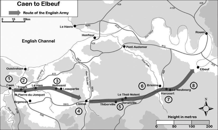
Caen to Elbeuf
This tour covers the itinerary from the English departure from Caen on 31 July 1346 until the arrival at the first potential crossing point of the Seine at Elbeuf on 7 August. The tour covers a distance of 135km.
What Happened
The March to the Seine
Edward’s army remained five days at Caen (Point 1), completing the plundering of the town but unable to capture the castle. There was time for rest and recovery from wounds, and some are said to have indulged in tourism, visiting the tomb of William the Conqueror and the female convent, the Abbaye aux Dames. The king and his council, however, made use of the pause to prepare for future operations. Edward’s plan was to march east and cross the Seine between Rouen and Paris. Once across the river he then intended to turn north towards the river Somme. With the prospect of battle with the French, he had given orders for reinforcements to be sent to France: 1,200 archers were to be raised and 2,450 bows and 6,300 sheaves of arrows procured. Orders were given for 100 ships to be requisitioned to deliver the reinforcements and supplies by 20 August. The disembarkation port was to be Le Crotoy in the Somme estuary, about 120km northeast of Rouen and 200km north of Paris. Even in the worst case of a crossing of the Seine near Paris Edward could expect to reach Le Crotoy at about the planned date for the arrival of the reinforcements. Before Edward’s departure from Caen around 300 prisoners, including the Count of Eu and the Lord of Tancarville, were shipped to England from the port of Ouistreham at the mouth of the Orne just north of Caen. Along with the prisoners went the English sick and the wounded unable to continue the march, plunder from Caen and St Lô and food taken during the march and surplus to requirements.
On Monday, 31 July Edward III’s army was on the move again, probably with the objectives of an attack upon Rouen and bringing Philip to battle. However, a small force was left behind to continue with the siege of the castle in Caen. These unfortunate men were massacred during a sortie from the castle after the departure of the main body of the army. Although Edward could not know the fate of those he left behind, he had probably now abandoned any idea of retaining a base in Normandy, and as a consequence the policy of restraining the army was now discarded. From now on the army would, with official approval, rampage far and wide looting and burning a swathe of territory up to 60km wide on occasion.
The army advanced across wide open, flat countryside with a gentle climb onto a low ridge where Troarn (Point 2) stands, only 15km east of Caen. The Benedictine abbey at Troarn, of which the abbey church remains, was not fortified until 1359, at the time of another invasion by Edward III. Thus, although there was some resistance from the inhabitants of the abbey, this was quickly overcome and the town, which had been evacuated, was occupied. The king lodged here for the night. Argences, 8km south of Troarn, was reported to have been burnt.
The following day was again a short march, 18km, but this can be explained by the challenge of crossing the tidal salt marshes and river Dives with its many channels just to the east of Troarn. The army probably passed through the small settlements of St-Pierre-du-Jonquet and Le Ham during the crossing of the river, and stopped for the night near Rumesnil (Point 3) and the nearby hamlet of Leaupartie.
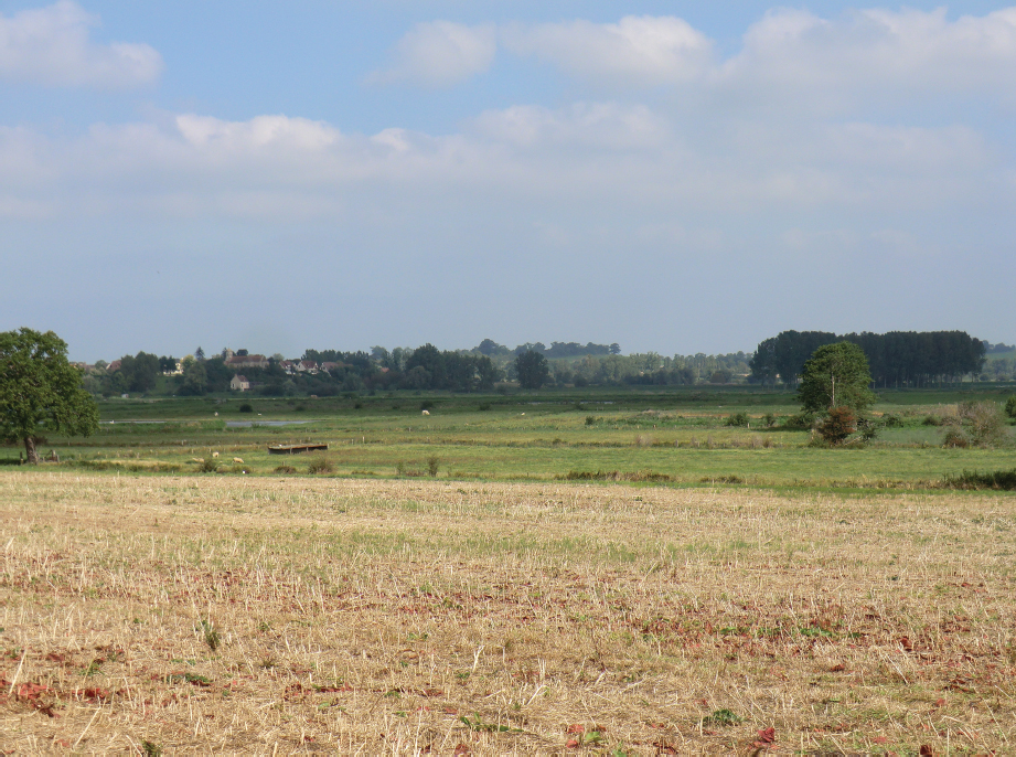
Marshland near the river Dives east of Troarn, which can be seen in the left background. (Peter Hoskins)
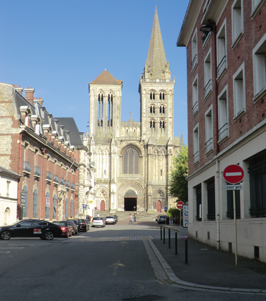
On the Wednesday the army moved on to Lisieux (Point 4). The terrain now changes. The low-lying land that had been crossed since leaving Caen gives way to undulating hills rising 160m above the salt marshes of the Dives. It is not clear whether or not the rich town of Lisieux had walls at the time, but the cathedral close was walled and the bishop gave refuge to the town’s inhabitants, who appear to have been left in peace by Edward’s men. Perhaps they were content with the plunder in the deserted town.
Edward stayed at Lisieux for two nights, and on the Thursday two cardinals, the Italian Annibale Ceccano, Cardinal-Archbishop of Naples, and the Frenchman Étienne Aubert, Cardinal-Archbishop of Ostia, came to the king and pleaded with him to stop his advance. Ostensibly they came on behalf of Pope Clement VI, but they were really there at the behest of Philip. However, they had no authority to treat on behalf of the French king and nothing of substance to offer and were dismissed by Edward. On their arrival the cardinals had been robbed of twenty of their horses by Welsh troops and they had been forced to approach the king on foot. Before they left, their horses were restored to them.
On Friday, 4 August Edward’s army left Lisieux in flames and resumed its march at a faster pace than hitherto since leaving Caen, covering 23km through Thiberville to Duranville (Point 5) and Le Theil-Nolent and then on Saturday, 5 August 34km through Brionne (Point 6) to Le Neubourg (Point 8). From Lisieux the army probably used the old Roman road to Brionne, which for much of the way is followed by the modern D613, and makes the most of the flat, open terrain before descending 100m into the valley of the Risle where the town stands.
Brionne was burned, as was the abbey of Bec-Hellouin 4km to the north. The army also passed through the village of Harcourt (Point 7), 6km south-east of Brionne, the ancestral home of Godefroy d’Harcourt’s brother the Count of Harcourt, who was loyal to Philip. The route onwards to Le Neubourg starts with a steep climb out of the river valley, past the castle, which with the view from its dominant position would have given the town early warning of the approach of the English army, and onto gently rolling countryside. Le Neubourg was fortified but undefended and the English entered without opposition. Edward lodged in the castle, elements of which remain from the medieval period and which had an important place in the history of the English kings. Stephen had been proclaimed king here by the Norman barons following the death of Henry I in 1135, and twenty-five years later Henry II’s son Henry the Young King was married to Marguerite of France in the abbey.
Sunday was a day of rest, but a detachment led by Godefroy d’Harcourt, and including Sir Thomas Holland in its number, set out to establish the situation at Rouen, which lies 40km north-east of Le Neubourg on one of the great swinging oxbow bends of the Seine. On the outskirts of Rouen lay the leper hospital of Petit-Quévilly and here they learned from an inmate that the French were present in force and that the bridge had been broken. As their reconnaissance continued they established that the town was well defended with King Philip present with the Counts of Harcourt and Dreux in his company. The suburbs south of the river, which included the monastery of Notre-Dame-du-Pré, had been abandoned with the inhabitants taking refuge in the medieval city on the right bank beyond the broken bridge. The detachment spread fire and destruction as far as the bridgehead on the left bank of the river and then returned to Le Neubourg, but not without suffering casualties, including the death of Sir John Daunay, a banneret of the Prince of Wales.
On Monday, 7 August the army was on the move again, this time to the north-east, almost certainly along the route of the modern D840, from Le Neubourg towards Elbeuf and the Seine 18km away. The going is initially easy, gradually descending towards the river with a final steep descent of 100m into the valley of the Seine from the high ground overlooking the town. Elbeuf lies on the south bank of the Seine with a bridge across the river. The Lord of Elbeuf was another member of the Harcourt family. He was with the French army and was to die at Crécy. The town itself was unprotected. In earlier times there had been a castle but this had been destroyed and not rebuilt by 1346. In addition, there were no walls or ditches, these being constructed later by the Duke of Bedford during the English occupation in the fifteenth century. However, the bridge had been broken and the north bank was defended by French troops. A party of Welshmen spotted some boats on the north bank and swam the river to seize them. They brought them back to the south bank and a raid was launched against the defended north end of the bridge which inflicted casualties on the defenders. Perhaps if sufficient men could have crossed the river the bridgehead could have been taken and held and the bridge repaired for the army as a whole to cross. In the event the raiders withdrew. Having failed to find a crossing at either Rouen or Elbeuf, the challenge now for Edward was to find somewhere else where he could cross to the right bank of the Seine.
The French Response
As Edward prepared to leave Caen towards the end of July, the French king was 140km to the east at Vernon. News reached Philip at around this time that the anticipated invasion from Flanders led by Hugh Hastings was about to start. He also received further bad news as the Duke of Normandy’s attempt to take Aiguillon in Aquitaine went from bad to worse. Faced with challenges on three fronts, Philip seems to have had no clear plan. The Duke of Normandy remained in the south determined to save face if nothing else, while in the north on 29 July the king proclaimed the arrière-ban summoning all men of military age to assemble at Rouen and ordered the garrisoning of castles in Artois as a counter to Hastings’ invasion. Genoese crossbowmen, having beached their galleys in the Seine, had also moved to Rouen. Men were gathering in the march of Flanders, Amiens and Paris, and others were leaving their homes to join the gathering French host.
The commander of the garrison in the castle at Caen, Robert Bertrand, was a resourceful and courageous man. As events elsewhere unfolded, he made a sortie from the castle, massacred the English troops left behind by Edward and then turned his attention to restoring French power in the Cotentin.
Philip was at Rouen around 31 July and initially moved slowly to the west towards Edward’s advancing army. However, by 4 August Philip had changed his mind, and instead of intercepting the English he returned to Rouen, breaking the bridge over the Seine behind him. The plan now appears to have been to hold the English south of the river. A consequence of this course of action was that those living south of the Seine were left at the mercy of the marauding English army as it burnt and pillaged its way along the valley. The desperation of their situation is shown by the decision of the garrison commander of Pont-l’Évêque to release men from prison to man the ramparts.
The Route by Car
Leave Caen (Point 1) initially on the N814 towards the A13 autoroute. Do not join the A13 but turn north onto the D403 until the first roundabout. Follow the D675 to Troarn (Point 2) and then take the D78 through St-Pierre-du-Jonquet and Le Ham to the junction with the D49. Turn left onto the D49 and after 500m right onto the D117. Follow this road to Rumesnil (Point 3). Turn right in the centre of the village onto the D85 and then turn left onto the D85a after 800m. Stay on the D85a through St-Ouen-Le-Pin and cross the D59 onto the D151 which leads to Lisieux (Point 4).
Leave Lisieux on the D613. Follow the D613 through Duranville (Point 5), and at the intersection with the D438 turn left and follow this road to Brionne (Point 6). From Brionne take the D137 through Harcourt (Point 7) to Le Neubourg (Point 8). Follow the D840 from Le Neubourg to Elbeuf.
The route is predominantly on quiet, minor roads with some short stretches on busier roads and with some paths and cycle tracks. The terrain varies, with some flat open countryside mixed from time to time with more undulating terrain.
In Caen (Point 1) join the footpath, the GR36 – GR de Pays Tour du Bessin, which runs along the north bank of the canal and is suitable for cyclists and pedestrians. Leave the path where the D226/D226a crosses the canal and follow the D226 to Sannerville. This road is initially busy, but after crossing the D513 after about 2km the road becomes much quieter. Much of the D226 has tracks or lanes reserved for cyclists and pedestrians. At a roadside cross in the centre of Sannerville carry straight on for 250m and turn left at the church. Follow this unnumbered road until you reach the D37. Turn right and follow this road into Troarn (Point 2).
There is a short section of the D226, just after crossing the river Orne, which is signed as prohibited to cyclists travelling east. However, the path continues on the other side of the road and appears to be used in both directions.
From the centre of Troarn take the D675. Turn right after the church and walk past the abbey through modern housing along the Avenue de Chudleigh to the junction with the D78. Turn left and follow this road through St-Pierre-du-Jonquet and Le Ham to the junction with the D49 at the Carrefour Castelain. Take the D49 towards Beuvron-en-Auge, and after 600m turn right and follow the D117, which also coincides with the GR de Pays Tour du Pays d’Auge footpath, to Rumesnil (Point 3). At the crossroads in the centre of the village turn right onto the D85 and cross the D16. The chapel of St Gilles de Livet is 800m to the west along the D16. After crossing the D16 take the D85a after 800m and follow this road through St-Ouen-Le-Pin to the junction with the D59. Carry straight on and take the D151 to Lisieux (Point 4).
The most straightforward route from Lisieux to Brionne (Point 6) is to follow the course of the old Roman road, which is along the D613 for much of the way. However, the road is quite busy and the route proposed here for the most part avoids the D613 and passes further to the north. As a consequence it is slightly longer. Leave Lisieux on the D613a. At the roundabout where the D613a meets the D613 turn right for 150m and turn left to follow the D510. Just beyond a roadside statue of the Virgin, 1.5km after joining the D510, fork right onto an unnumbered road. Up to this point the road can be busy, but from now on the route is much quieter. Follow this unnumbered road across the D510. Turn right after 600m to rejoin the D510 for 200m and then fork right to follow the D262. On reaching the junction with the D135, 500m before reaching the D613 at l’Hôtellerie, turn left and follow the D135/D157. Turn right onto the D707 through Les Places. Before reaching the D613 once again turn left onto an unnumbered road through La Haudardière and across the D22 onto the D695. On reaching a statue of the Virgin turn right onto an unnumbered road and take the first left onto a further unnumbered road. Turn right at the first junction and continue towards La Harèque. At the junction with the D28 turn left towards St-Aubin-de-Scellon. In St-Aubin turn right onto the D41. To visit Duranville (Point 5) stay on this road until the junction with the D613. To continue without visiting Duranville, turn left onto an unnumbered road through La Grande Rue to Le Theil-Nolent. Turn left in the village onto an unnumbered road. Take the second right to Bazoques. Cross the D834 and follow an unnumbered road across the D29 and through Boissy-Lamberville to the junction with the D43. Immediately before reaching the D613 turn left onto a track, initially grass surfaced, which follows the old Roman road. This track becomes an unnumbered road at the junction with the D31 and then after a further 1.5km the D701. Follow this road to the junction with the D438. Turn right and then take the first left into Brionne.
The old Roman road from near the junction between the D43 and D613 has a grass surface with some potholes for the first 1km, followed by 400m of packed earth and stone. It is then paved for 400m to Le Chemin Chaussé. Beyond this the track consists of packed stone as far as a fiveway junction with the D31. The remainder of the route to Brionne is paved. An alternative route for the cyclist is to leave the walker’s route at La Vastine, turning left onto the D48. At the crossroads near Le Mailly and La Marotte turn left to continue on the D48. Take the next turning to the right and follow an unnumbered road past La Bruyère to rejoin the walker’s route at the junction with the D31.
Leave Brionne on an unnumbered road, which runs parallel to and north of the D26, past the ruins of the castle. At the junction with the D137 take this route to Harcourt (Point 7). Leave the village to the north-east on the D156. Just beyond the Abbaye du Parc, at the bottom of the valley, turn right to follow a paved cycle path (piste cyclable). Follow the path to Pérouzette and then take an unnumbered road into Le Neubourg (Point 8).
The most straightforward route to Elbeuf is along the D840. However, the road is busy with traffic travelling fast. The last 1km into the town is dangerous for the walker, following a left-hand bend with no practicable refuge from traffic accelerating up the hill from Elbeuf. This road is not recommended, despite the savings in distance over the following route. Leave Le Neubourg on the D24. Follow this road to the junction with the D595 1km north of Cesseville. Turn left and follow an unnumbered road to Le Bec Thomas. Follow the D592 to the junction with the D86. Continue straight ahead, initially on an unnumbered road and then on the D26 and D7 to join the D144 to Elbeuf.
What to See
Caen
Point 1: See Tour One, pages 76–82.
Troarn
Point 2: The abbey church of St-Martin, Rue de l’Abbaye (GPS 49.181601, -0.177677) was founded in 1059 and William the Conqueror came to the abbey to confirm its charter in 1068. In addition to the damage done by Edward III’s army in 1346, Troarn suffered under Henry V who confiscated lands belonging to the town and the abbey. Guided visits to the abbey can be arranged with the tourist office in the town: www.troarn.tourisme.free.fr, +33 2 31 39 14 22, office.troarn@wanadoo.fr.
Rumesnil
Point 3: The chapel of St-Gilles-de-Livet on the D16 (GPS 49.179443, 0.024495) south-west of the village dates from the eleventh century.
Lisieux
Point 4: The town suffered very heavy damage during the Battle of Normandy in 1944, but several monuments from the Middle Ages survive. The cathedral of St-Pierre, Place François Mitterand (GPS 49.146413, 0.226022), was initially built in the twelfth century and the western façade dates from this period. There is also a fourteenth-century house, La Tour Carrée, 1 Rue Paul Baston (GPS 49.146746, 0.223938) and a perimeter tower, La Tour Lambert, on the line of the ramparts at 19 Quai des Remparts (GPS 49.145571, 0.221437), although this dates from the late fifteenth century.
The abbey church of St-Martin in Troarn. (Peter Hoskins)
The chapel of St-Gilles-de-Livet in Rumesnil. (Peter Hoskins)
The cathedral of St-Pierre in Lisieux. (Peter Hoskins)
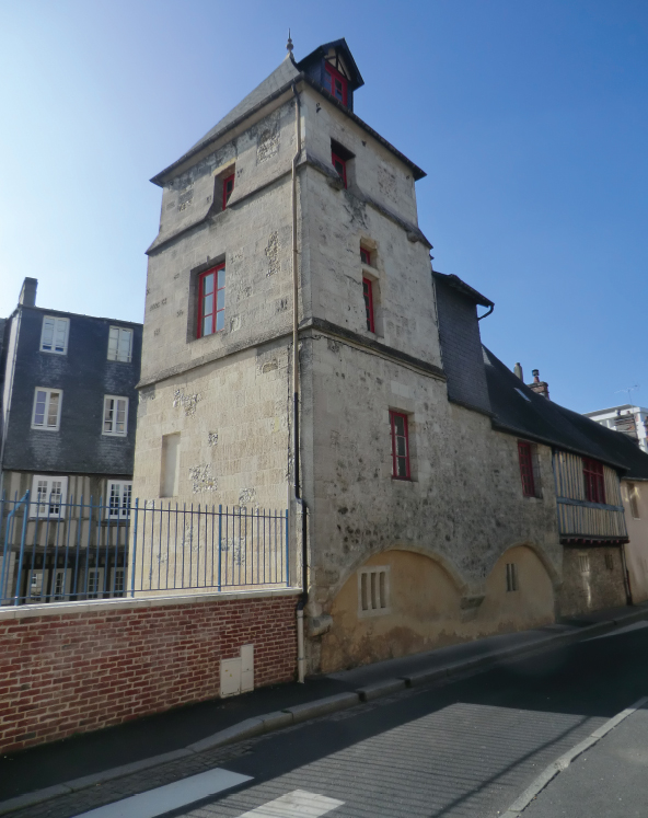
La Tour Carrée in Lisieux. (Peter Hoskins)
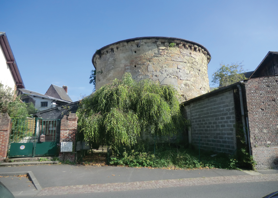
La Tour Lambert in Lisieux. (Peter Hoskins)
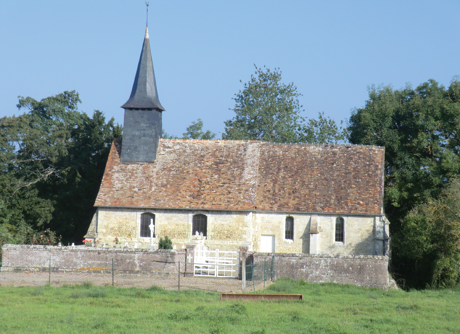
Point 5: The church in Duranville, on the south side of the D613 (GPS 49.149214, 0.509543), is remarkable for the twelfth-century west face and an ancient yew tree.
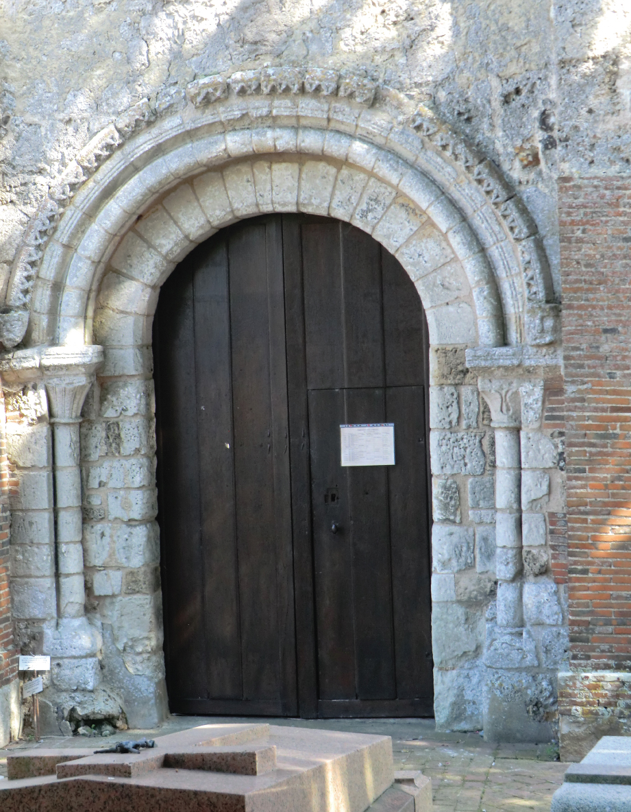
The west face of the church of St-Ouen in Duranville. (Peter Hoskins)
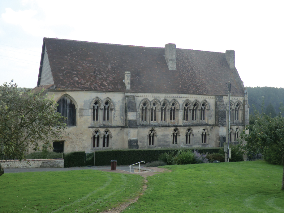
Point 6: The church of St-Martin, Place de l’Eglise (GPS 49.195271, 0.719199), was originally constructed in the eleventh century. It was largely rebuilt in the fifteenth century although elements, notably the nave, remain from the thirteenth century. The ruins of the eleventh-century castle keep stand on the high ground to the east of the town (GPS 49.195192, 0.723022). The ruins can be reached along the Sentier du Vieux Château. The castle walls were 4.5m thick at the base tapering to 3m at the top. The keep had a balcony which could hold 100 men-at-arms.
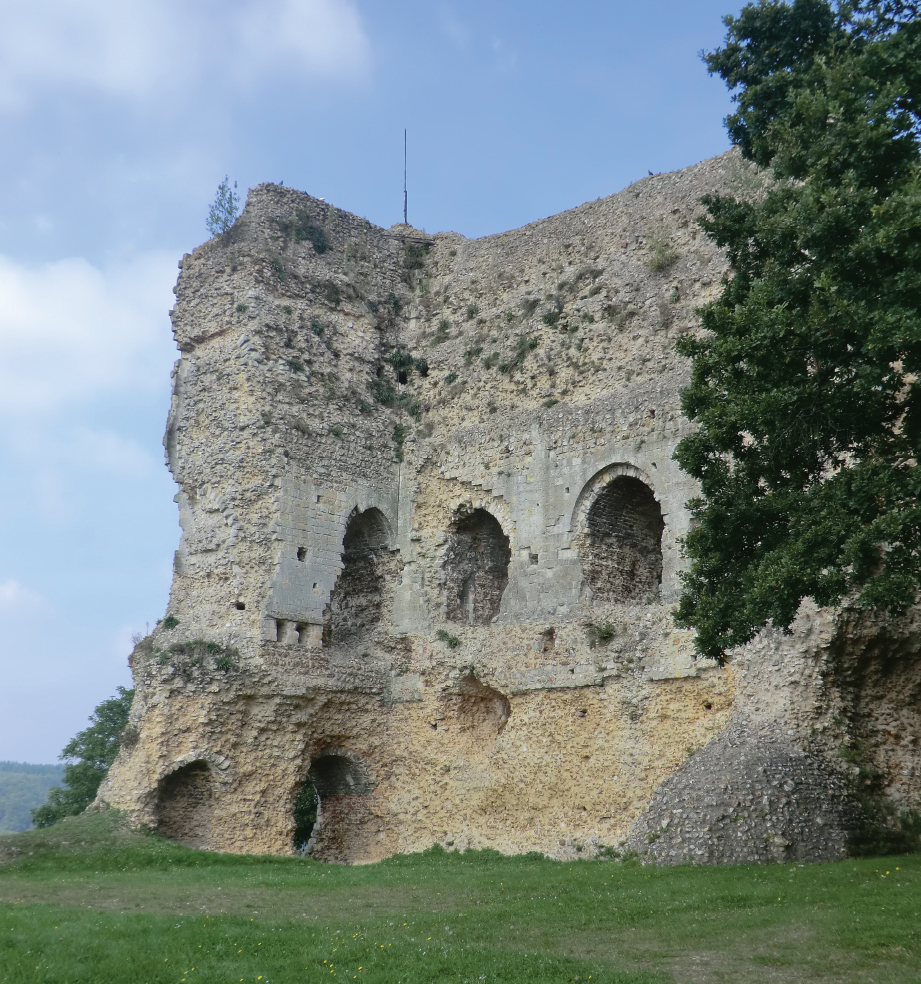
The ruins of the castle keep of Brionne. (Peter Hoskins)
Point 7: Château Harcourt, 7km north of the village of Harcourt (GPS 49.173370, 0.787009), the twelfth- and fourteenth-century seat of the Harcourt family, is open to the public: www.harcourt-normandie.fr.
Le Neubourg
Point 8: The most notable monument here is part of the castle. The keep, chapel and walls were demolished in the late eighteenth century and only part of the living quarters remains. The building stands in the Place du Château (GPS 49.148272, 0.900111), but a view from the north along the Rue des Remparts (GPS 49.149549, 0.898083), although partly obscured by trees, gives a better impression of the defensive features of the castle. The church of Notre-Dame in the Rue de la République (GPS 49.149026, 0.902686), with its thirteenth-century choir, and the thirteenth-century chapel of St-Jean at 8 Rue de Verdun (GPS 49.150984, 0.907018) also survive.
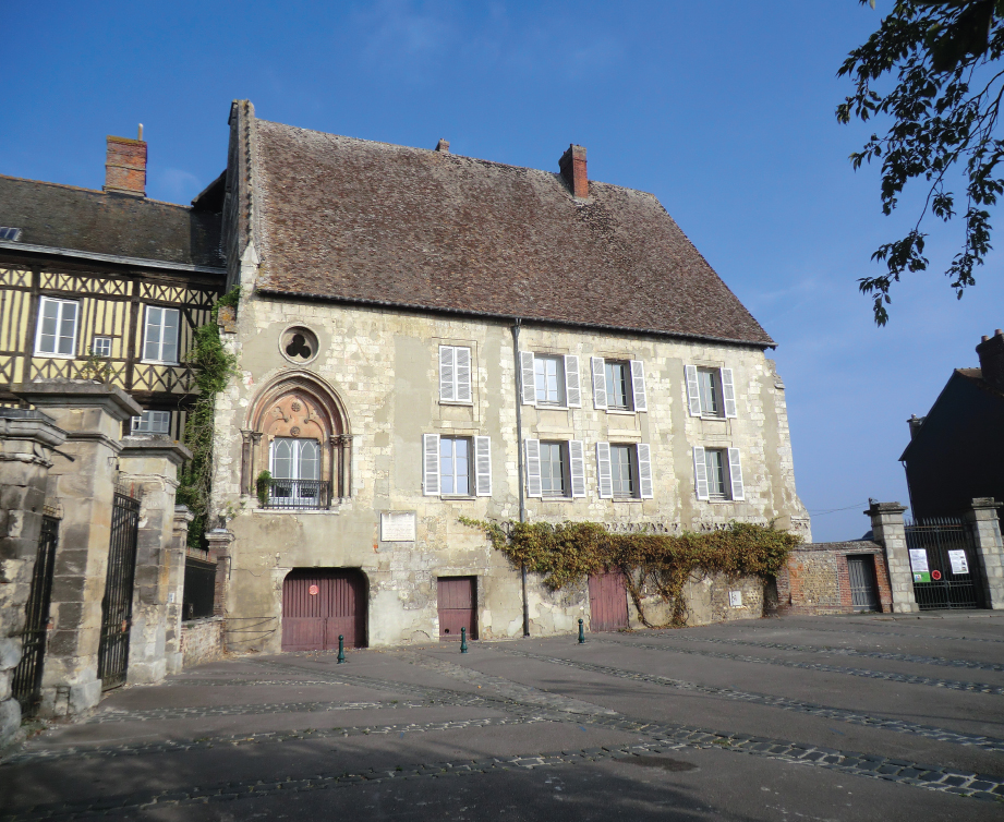
The castle of Le Neubourg seen from the Place du Château. (Peter Hoskins)
Not directly on the itinerary of Edward III’s army, but important to events during the campaign, is Rouen. Among the many monuments to be seen in Rouen are the cathedral in Place de la Cathédrale (GPS 49.440377, 1.09422), the site of Joan of Arc’s execution in the Place du Vieux Marché (GPS 49.443052, 1.088396), and the keep of the castle, La Tour Jeanne d’Arc, in Rue du Donjon (GPS 49.44647, 1.094393), where she was held during her trial. The Rouen tourism website has detailed information on museums and architectural monuments: www.rouentourisme.com.
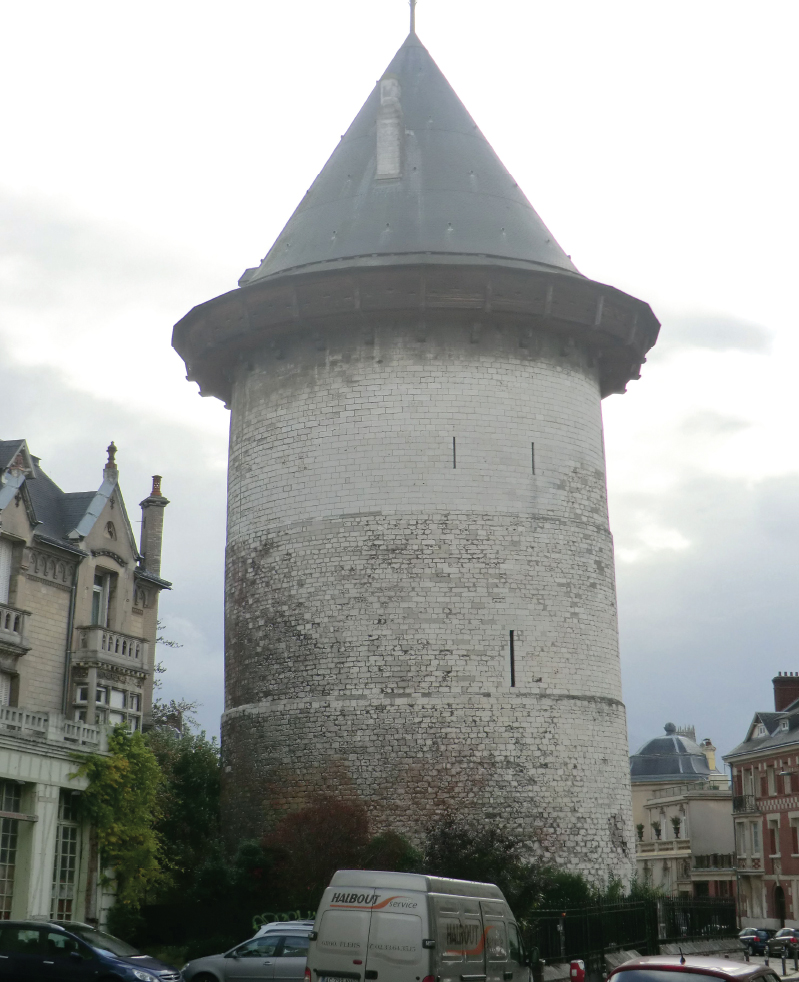
The keep of Rouen castle, now known as La Tour Jeanne d’Arc. (Peter Hoskins)
Maps at 1:25,000 and 1:100,000 scales Published by the Institut National de l’Information Géographique et Forestière (IGN) www.ign.fr |
||
Cartes de Randonnée – 1:25,000 |
||
1612OT Caen, Ouistreham (also Tour 1) |
1712E Lisieux |
1912O Bourgtheroulde-Infreville |
1612E Dives-sur-Mer |
1812O Cormeilles |
1912E Elbeuf |
1712O Cambremer |
1812E Brionne |
|
TOP 100 – 1:100,000 |
||
TOP100117 Caen/Evreux (also Tour 3) |
||
How to Get There and Back by Public Transport
Caen-Carpiquet and Paris airports are convenient for this tour. Caen-Carpiquet has a shuttle service to the city centre. All the Paris airports are well connected to the city centre for onward travel by rail. Ferries run from Portsmouth to Caen-Ouistreham which is 18km from Caen city centre. There is a bus service between the port and Caen (www.twisto.fr) but this does not operate during the evenings. Railway services for this tour are provided by SNCF Basse-Normandie and Haute-Normandie Regions. Caen has a main-line railway station. Regional trains from the Haute-Normandie Region provide a service from Brionne and Elbeuf-St-Aubin to Oissel for main-line trains to Paris. Main-line trains also serve Lisieux. There is a bus service between Caen and Troarn (www.busverts.fr).
Where to Stay and Where to Eat
There are numerous places to eat and drink on this tour, sometimes in even small villages. Refreshments can be found at Caen, Colombelles, Troarn, Beuvron-en-Auge, Le Pré-d’Auge, Lisieux, La Croix-de-Pierre, Ouilly-du-Houley, L’Hôtellerie, Thiberville, Duranville, Brionne, Iville, Fouqueville and Elbeuf.
The local websites below give information on accommodation and refreshments for this tour:
www.troarn.tourisme.free.fr