Buchanan Pass Trail
To reach the Buchanan Pass Trail, drive to Monarch Lake. (See the driving instructions at the beginning of this chapter.) Hiking around the lake is a trip of more than 3.0 miles. The trail along the left (north) shore is the western end of trails traversing both Buchanan and Pawnee Passes. These trails run together for about 1.5 miles along the lakeshore and beyond to a junction where a spur trail branches right. The spur connects with the Arapaho Pass Trail (see page 261) to continue around Monarch Lake’s opposite shore.
The trail to Buchanan and Pawnee Passes bears left from the junction and follows Buchanan Creek. Between a series of switchbacks and a bridge over Hell Canyon Creek, an informal track to the left climbs up Hell Canyon. The path is easy to miss; if you get to the bridge, just head up the creek or backtrack about 150 feet to the path. It is possible to follow this track up to Long and Crawford Lakes, but this steep trail is better used as a path of descent after having reached Crawford via the Roaring Fork Trail (see page 249).
The Cascade Trail continues on to Shelter Rock. This large boulder with overhanging ledges is an easy 4.0-mile walk from the trailhead at Monarch Lake. A few hundred yards beyond Shelter Rock is another trail junction. The right-hand fork leads up Cascade Creek to Pawnee Pass (see page 256).
The left-hand fork is the Buchanan Pass Trail, which climbs steeply through lodgepole to a more moderate grade at the edge of beaver-made meadows along Buchanan Creek. Continuing to climb gradually, the trail crosses outlet streams of Island Lake and Gourd Lake. About 0.2 mile past the brook flowing from Gourd Lake, you arrive at the junction with the Gourd Lake Trail.
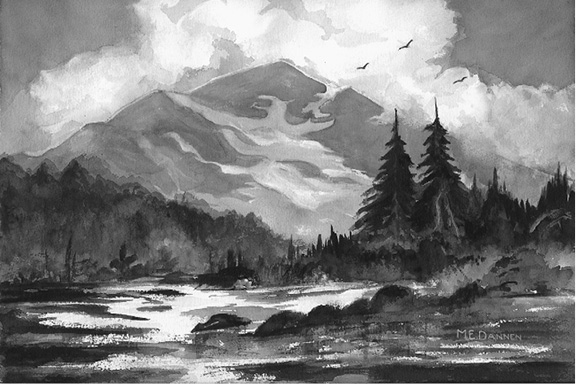
The 1,280-foot difference in elevation between the trail junction and the top of the Gourd Lake Trail is gained in a long 2.0 miles of twisting through innumerable switchbacks. Along the way, the views of Paiute Peak are extremely dramatic. Oddly enough, the best shot can be had from near the bottom as you approach the eastern end of a switchback amid aspens. To frame Paiute with aspen leaves, continue walking a few more yards east off-trail from where the switchback turns west. Afternoon light is best; a polarizing filter will be helpful. Farther up the trail the view expands to include double-topped Mount Toll and, across the valley, Thunderbolt Peak.
When you finally reach Gourd Lake, follow a faint trail around to the right (east) shore for the best photos. The surface of the lake’s deeply indented bays is frequently still enough to reflect Cooper Peak. No campfires are allowed within a quarter mile of this lake.
At the base of Cooper Peak, the large tarn called Island Lake hangs above tree line. Patches of krummholz around its rocky shores do little to soften the austerity of the setting. The ascent from Gourd to Island Lake calls for a rise of 600 feet in about 1.0 mile. Follow the eastern shore of Gourd Lake to that part of the northern shore having the least-steep slope above it. Climb up this slope to a glacial shelf where there is a small unnamed pond. Bear northwest across this shelf and climb up the least steep route to a higher bench where there are more nameless ponds, then contour along the outlet stream past even more small tarns to Island Lake.
The Buchanan Pass Trail continues past the Gourd Lake Trail at an almost level grade until it meets the valley of Thunderbolt Creek. The same glacier that so dramatically sculpted the tower of Paiute carved deeply down the Thunderbolt Creek valley. It cut faster than a tributary glacier flowing from farther north on the Continental Divide at the head of Buchanan Creek. Thus the valley of the tributary glacier was left hanging 700 feet up the mountainside overlooking Thunderbolt Creek.
Subalpine Zone
Fox Park lies on the floor of this hanging valley. To get to it the Buchanan Pass Trail climbs, climbs, climbs through switchbacks distressingly reminiscent of those on the Gourd Lake Trail. Yet if you happen to be at Gourd Lake and want to reach Fox Park (or vice versa), you do not have to lose and regain 1,000 feet of elevation and walk 2.0 extra miles between these two points. What you do is follow an unimproved but marked and mostly distinct trail that extends directly down to a meadow just above Fox Park from the southeastern slope of a low, forested ridge adjacent to the lake’s southeastern shore. This route is not appropriate for horses. In a couple of places, the path heads straight uphill to avoid traversing steep rock. In others it crosses obvious avalanche slopes, which can be very dangerous in early spring. Sometimes it fades away in sheltered places where snowbanks remain into autumn.
But most of the trail is a pure joy of subalpine flowers and magnificent views up Thunderbolt Creek toward Paiute and Toll. Finally the track fades away completely in a marshy meadow with a good view that will be unavailable in Fox Park, only a short way down a tributary brook to Buchanan Creek.
Buchanan Pass rises in plain sight 1,400 feet above Fox Park. The climb for the next 2.0 miles promises to be tough, but it looks worse than it turns out to be. The steepest part climbs through classically beautiful subalpine forest, which gives way abruptly to alpine tundra. Farther uphill the trail steepens somewhat again on a rocky slope below Buchanan Pass.
From the pass you can leave the trail and climb to the south over tundra slopes to the top of Sawtooth Mountain, the easternmost point on the Continental Divide. Sawtooth is 0.5 mile from Buchanan Pass and 467 feet higher. To the east there are 3.0 downhill miles of rocky trail to a four-wheel-drive road at Coney Flats and another 3.0 miles along this road to a road for passenger cars at Beaver Reservoir (see Middle St. Vrain Trail System and Routes from Beaver Reservoir in the East of the Divide chapter).