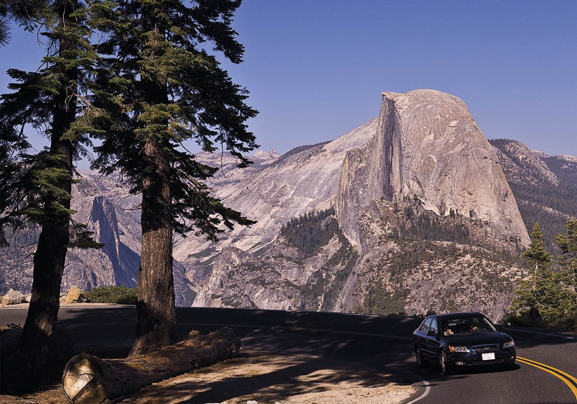

This 16-mile road wraps around Yosemite Valley’s south rim on its way to Glacier Point, one of the most stunning and accessible viewpoints in the park. Perched 3,200 feet above the Valley floor, Glacier Point offers jaw-dropping views of Half Dome and a panorama of Sierra spectacles: Yosemite Falls, North Dome, Clouds Rest, Tenaya Canyon, the Royal Arches. And due to its high elevation and dark night skies, Glacier Point is one of the best places in California to stargaze. Even if you’re only in Yosemite for a day, no first time visitor should leave without a visit to Glacier Point.
Most people drive to Glacier Point, revel in the scenery, then turn around and drive back. There’s nothing wrong with that, but if you’ve got the time Glacier Point Road has some terrific day hikes. A handful of trails venture along Yosemite Valley’s south rim to excellent viewpoints, all of which are far less crowded than Glacier Point. Free ranger-led hikes are often offered (check the Yosemite Guide for seasonal dates and times). If you’d like to spend a day or two exploring the trails along Glacier Point Road, consider spending the night at Bridalveil Creek Campground.
Glacier Point is roughly 30 driving miles from Yosemite Valley—about an hour one-way. If you don’t feel like driving, you can purchase a ticket for the four-hour Glacier Point Tour ($41 adult, $23 child, 209-372-4386), which leaves Yosemite Valley at 8am, 10am and 1:30pm from June to October. You can also ride the bus one-way to Glacier Point ($25 adult, $15 child), then hike down the Four Mile Trail or the Panorama Trail, which heads to Nevada Fall and the Mist Trail.
In winter and early spring, most of Glacier Point Road is closed due to heavy snow, but the first six miles are plowed to Badger Pass Ski Area, a small resort with a handful of lifts. Free winter shuttles run between Yosemite Valley hotels and Badger Pass, and free ranger-led snowshoe walks are offered daily (check the Yosemite Guide). Cross country skiers can explore dozens of miles of nearby trails or plan an overnight trip to Glacier Point or Ostrander Lake, both of which offer overnight accommodations. Note: four-wheel drive or tire chains are required for all vehicles heading to Badger Pass in the winter.
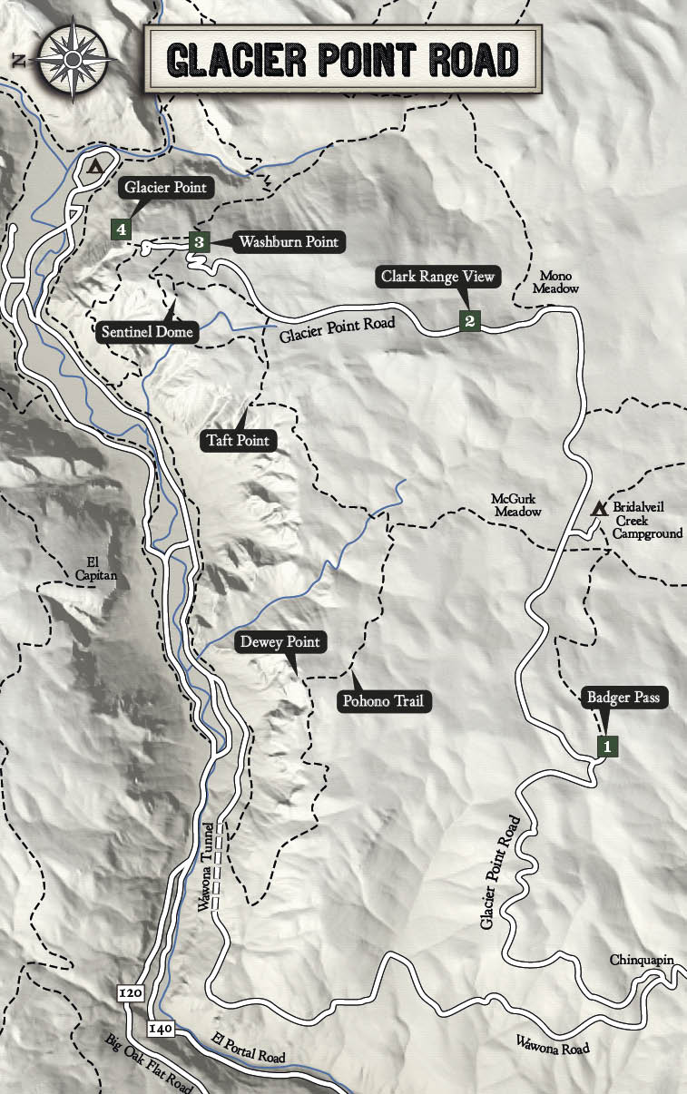

Badger Pass, the oldest ski resort in California, offers five lifts and ten runs for skiers and snowboarders. There’s not much challenging terrain, but the short lift lines and relatively cheap tickets make Badger Pass great for families and beginners. Cross country skiers will love the 90 miles of marked trails and 25 miles of machine-groomed track. Ski season generally runs mid-December to late March, depending on conditions. Equipment rentals and ski instruction are available, and a small base lodge serves food and drinks. Weekend tickets cost $47 for adults, $22 for kids. (209-372-8430, badgerpass.com)
This small pullout offers great views of the Clark Range, one of the most rugged and remote mountain ranges in the park. In the foreground is Mt. Starr King, a uniquely shaped 9,092-foot granite dome named for Thomas Starr King, a famous Unitarian minister who visited Yosemite Valley in the 1860s and helped promote the park. Beyond Mt. Starr King is 11,522-foot Mt. Clark, the highest peak in the Clark Range. Both the peak and the range were named after Galen Clark, the first Guardian of Yosemite. Exploring the Clark Range requires several days of intense backpacking, but the reward is some of the most beautiful scenery in the park.
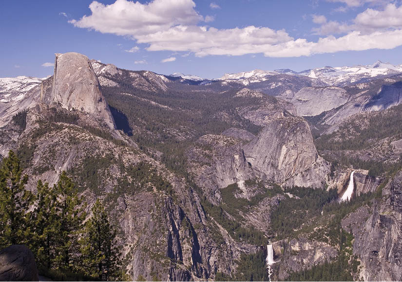
This large turnout features a stunning view framed by Half Dome on the left and conical Mt. Starr King on the right. In the center is Merced Canyon, home to two of the park’s most impressive waterfalls: Nevada Fall (594 feet) and Vernal Fall (317 feet). When the Merced River is swollen with snowmelt in the spring, the roar of these waterfalls reaches all the way to Washburn Point.
Moments before the Merced River tumbles down Nevada Fall, the water is churned and frothed by a series of violent rapids, giving the waterfall an exceptional white color that inspired early explorers to name it Nevada (Spanish for “Snowfall”). Vernal Fall, below, was named for its “cool, vernal spray.” Both waterfalls can be viewed up close along the popular Mist Trail.
The unique view from Washburn Point reveals that Half Dome isn’t really half of a dome. Over 70% of the dome remains intact. And despite its rounded profile, Half Dome was never covered by glaciers. Its unique shape formed over millions of years due to the exfoliation of overlying rock layers. Although massive Ice Age glaciers once filled Yosemite Valley to the brim, Half Dome’s summit always remained hundreds of feet above the ice.
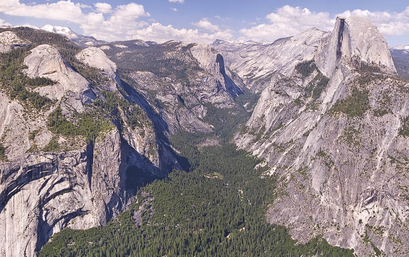
The views from 7,214-foot Glacier Point are among the most spectacular in Yosemite—and, for that matter, in America. Many of Yosemite Valley’s most famous features—Half Dome, Yosemite Falls, Royal Arches, North Dome—can be seen in a single, sweeping panorama. Glacier Point is reached via a short, paved path from the large parking area. Along the way you’ll pass the chalet-style Glacier Point Snack Shop and the small Geology Hut, which features diagrams detailing the geologic processes that shaped Yosemite Valley. Just below the Geology Hut is a pair of free binoculars (great for checking out the ant-like hikers on top of Half Dome) and a metal plaque that points out famous landmarks and distant peaks. Glacier Point itself is a small platform surrounded by a protective railing. Peak over the edge and you’ll stare 3,214 feet straight down to the floor of Yosemite Valley.
At night, Glacier Point’s high elevation, clean air, and lack of light pollution make it one of the best places in California to see the stars. Every Friday and Saturday night in the summer, rangers offer free star constellation talks, and astronomy clubs from across California set up giant telescopes for the public to gaze into. In fact, so many astronomy clubs want to come to Glacier Point to stargaze that the park service only allows one club each weekend, and the dates are booked months in advance. If you like astronomy, a visit to Glacier Point at night is an absolute must.
As you gaze out across Glacier Point, your eyes will immediately be drawn to Half Dome, which dominates the view to the northeast. Behind Half Dome is a striking granite mountain called Clouds Rest. Although Half Dome appears higher from this perspective, Clouds Rest is actually over 1,000 feet higher. The western side of Clouds Rest, which is almost entirely bare granite, tumbles down into Tenaya Canyon. This forboding gorge has been referred to as the “Bermuda Triangle of Yosemite” because so many hikers have gotten lost there.
Until 1882 Glacier Point was only accessible via the 4-mile trail from Yosemite Valley. The trail was built by James McCauley in 1871, and for years he charged a toll of $1 per hiker. In 1878 McCauley opened The Mountain House Hotel at Glacier Point, which was later joined by the Glacier Point Hotel in 1917. Both structures burned down in 1969, however, and neither was rebuilt.
Rating Easy
Distance 2.2 miles, round-trip
Hiking Time 1 hour
Elevation Change 380 feet
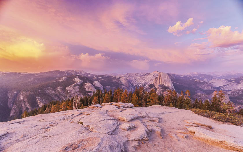
Summary This short hike offers plenty of bang for your buck. At 8,122 feet, Sentinel Dome is the second highest point above the rim of Yosemite Valley (after Half Dome) and sits 1,000 feet higher than Glacier Point. Sentinel Dome’s panoramic views include Half Dome, Yosemite Valley, and many distant High Sierra peaks, which can be identified using a metal plaque embedded in a boulder at the summit. Not far from the plaque is the fallen skeleton of a gnarled Jeffrey pine. This wind-contorted tree, made famous by Ansel Adams, was over 400 years old when it died during a drought in the mid-1970s. Remarkably, the skeleton remained standing until 2003. Sentinel Dome makes a fantastic sunset destination for anyone looking to escape the crowds at Glacier Point. As Dr. Joseph LeConte put it after witnessing a sunset from Sentinel Dome in 1870: “Such a sunset, combined with such a view, I never imagined.”
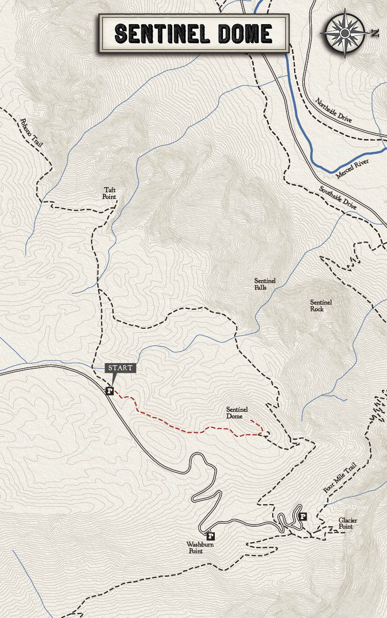
Trailhead The Sentinel Dome trail starts from Taft Point/Sentinel Dome parking area (14 miles east of Chinquapin; 7 miles west of Glacier Point). The parking area is easily identified by its open setting and small restroom.
Rating Easy
Distance 2.2 miles, round-trip
Hiking Time 1 hour
Elevation Change 250 feet
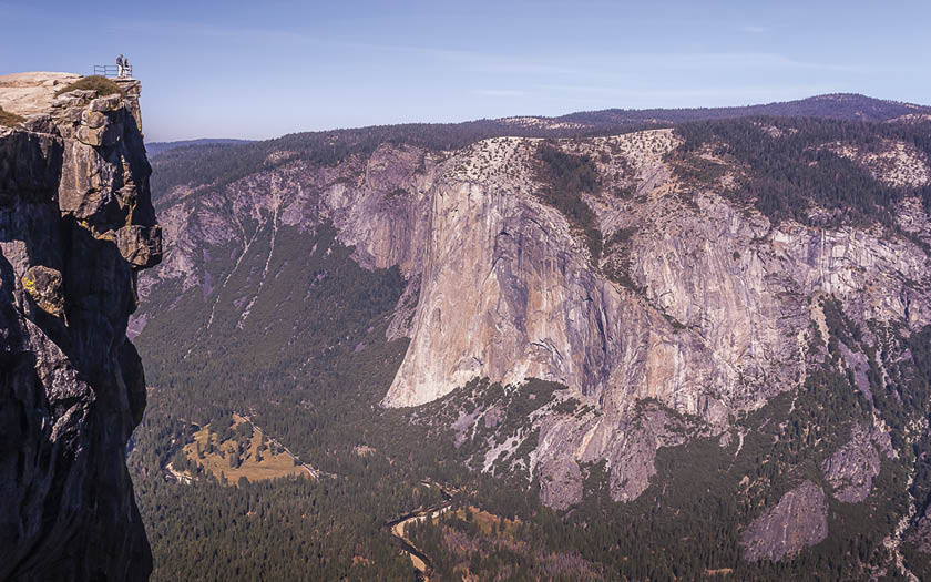
Summary This easy hike drops down and twists through some towering pines before reaching an exposed granite ledge at the edge of Yosemite Valley. A high point along the ledge marks Taft Point, a vertigo-inducing precipice that looms over Yosemite Valley. A small metal railing is all that protects you from the stomach-churning, 3,400-foot drop. Taft Point (7,503 feet) offers great views of Yosemite Falls and the Merced River twisting along the Valley Floor, but the sensational views of El Capitan are what really sets this spot apart. Also keep your eyes out for the famous Taft Point Fissures, natural cracks in the rock that plummet hundreds of feet straight down. A few of the fissures have large rocks lodged in their narrow openings. Taft Point was named for President William Taft, who visited Yosemite in 1909.
Trailhead The Taft Point trail starts from Taft Point/Sentinel Dome parking area (14 miles east of Chinquapin; 2 miles west of Glacier Point). The parking area is easily noticed by its open setting and small restroom.

Rating Modertate
Distance 11.4 miles, round-trip
Hiking Time 6–8 Hours
Elevation Change 1,720 feet
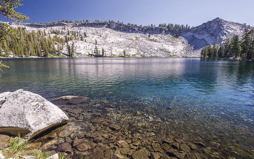
Summary Most hikers who visit Glacier Point Road gravitate to trails along the rim that offer spectacular views of Yosemite Valley. But this beautiful lake, nestled among sparkling granite slopes, is a terrific destination if you’re afraid of heights or enamored with pristine alpine lakes. From the trailhead you’ll pass through 2.5 miles of relatively flat terrain. Bear left at the first trail junction (1.4 miles), then left again at the second (2.7 miles). Next, prepare yourself for the trail’s most difficult stretch: a 1,500-foot vertical ascent. Towards the top of the climb you’ll skirt Horizon Ridge, which offers terrific views of Mount Starr King and the Illilouette Creek Basin. After peaking at 8,720 feet, the trails drops down 200 feet to Ostrander Lake. On the lake’s northern shore you’ll see Ostrander Ski Hut, a rustic stone building where crosscountry skiers can spend the night in the winter.
Trailhead The Ostrander Lake trailhead starts from the Ostrander Lake parking area (9 miles east of Chinquapin; 7 miles south of Glacier Point). Restrooms are available at the parking area.

Rating Moderate
Distance 10.5 miles, round-trip
Hiking Time 4 hours
Elevation Change 540 feet
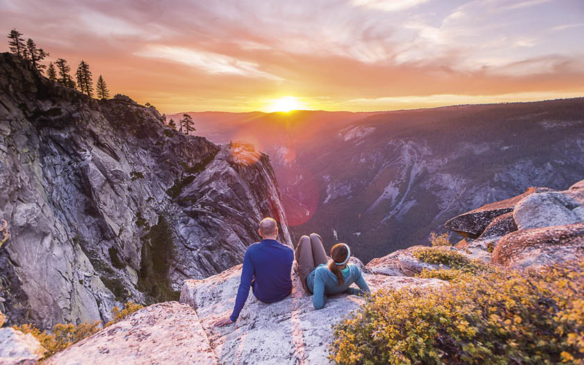
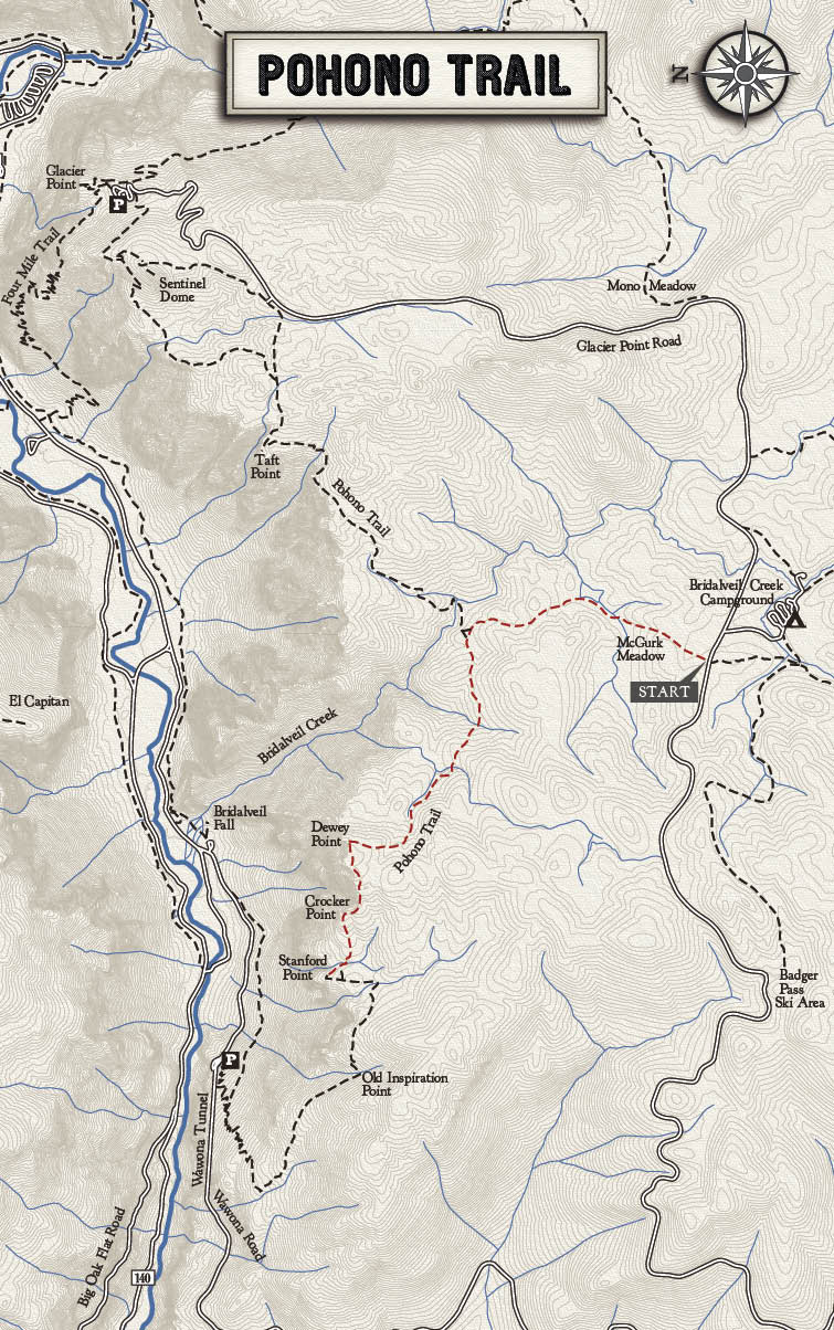
Summary On busy weekends when Yosemite gets crowded and congested, the Pohono trail offers hikers a well-earned sense of solitude. Despite its breathtaking views of Bridalveil Fall, Ribbon Fall, and El Capitan, the Pohono Trail remains relatively uncrowded. While other tourists are trying to find a parking space, you can soak in the Valley’s majesty high above it all. Whether you’re day hiking or backpacking, the Pohono Trail never disappoints. Although the complete 13.8-mile Pohono Trail stretches from Tunnel View to Taft Point, you can reach the most spectacular viewpoints—Dewey Point (above), Crocker Point, Stanford Point—via a hike from Glacier Point Road. The hiking distance listed below is for a round-trip hike from the McGurk Meadow trailhead to Stanford Point. A round-trip hike to Dewey Point is 7.8 miles.
Trailhead The McGurk Meadow trailhead is located 7.5 miles from the start of Glacier Point Road on the left. (Park in the pullout 100 yards up the road.) Follow the trail 1.9 miles to the junction of the Pohono Trail and turn left towards Dewey Point. Note: overnight camping is not allowed to the right of the junction.

Rating Very Strenuous
Distance 46.5 miles
Hiking Time 6–7 days
Elevation Change 7,000 feet
Summary For serious backpackers who aren’t afraid of multiple days in the wilderness and several thousand feet of elevation change, few hikes in the park are as rewarding as the Clark Range. Seldom visited due to its remote, rugged terrain, the Clark Range features pristine alpine lakes, rocky above-treeline landscapes, and the highest pass in the park: Red Peak Pass (11,200 feet). Highlights along the trail include Ottoway Lakes, Red Peak Pass, and gorgeous Red Devil Lake, where enchanting granite shores offer stunning views of the Clark Range during the day and wide open star gazing at night. To finish off the trip in style, reserve a tent cabin at Merced High Sierra Camp and treat yourself to a bed, a hot shower, and a home-cooked meal on your last night. Finish the hike by heading down the Mist Trail to Happy Isles in Yosemite Valley.
Trailhead The hike starts at the Mono Meadows trailhead off Glacier Point Road. Unless you have two cars to shuttle between the start and the finish, leave your car in Yosemite Valley and ride the Glacier Point shuttle to the Mono Meadows trailhead.