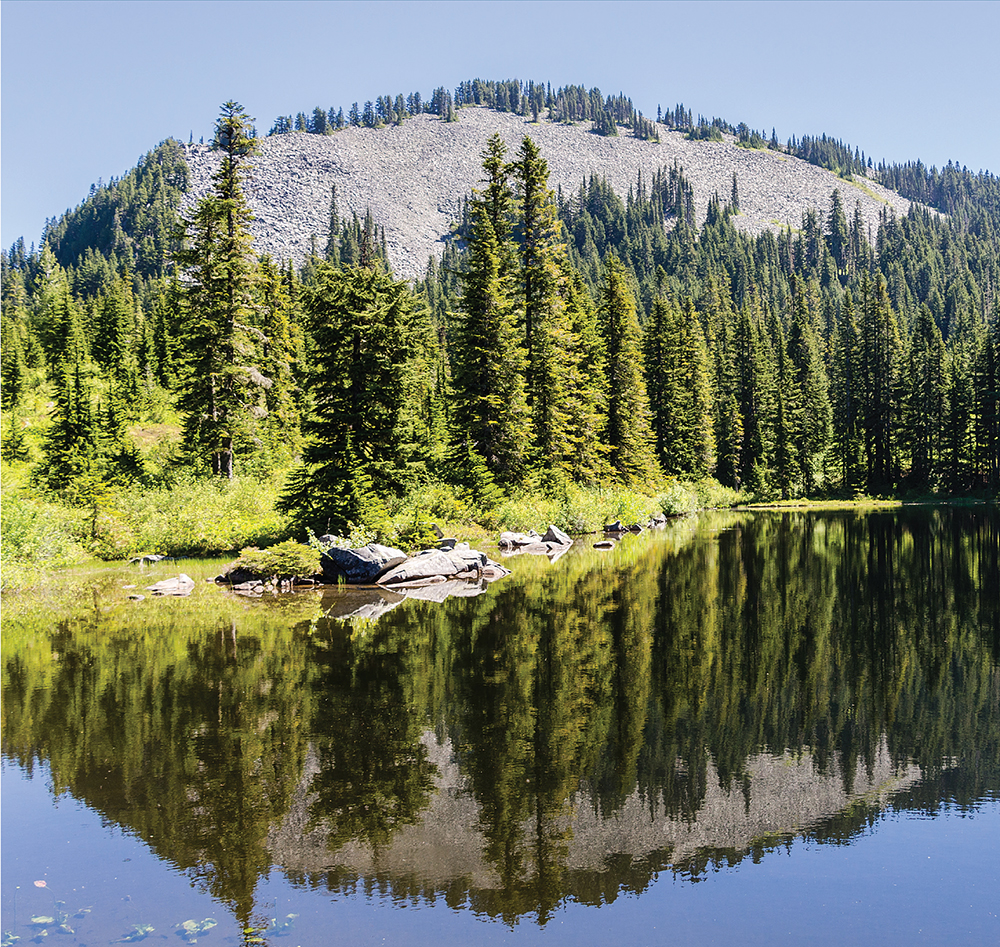
Rainbow Lake reflecting talus-sloped Pratt Mountain (Hike 94)
Rainbow Lake reflecting talus-sloped Pratt Mountain (Hike 94)
This vast wilderness area is filled with countless sawtooth ridges, glacier-carved cirques, and pointed peaks reaching for the sky, all bejeweled with sparkling alpine lakes and tarns. To reach much of its interior, you must stuff your backpack with gear and head out into the wilderness for multiple nights. At the same time, the network of trails often offers so many ways of approaching a particular destination that putting together an itinerary can be challenging.
Backpackers attempting to piece together extended trips through the Alpine Lakes Wilderness can consult many resources, though statewide backpacking guides tend to limit trips to one or two options. For any of the hikes on the Pacific Crest Trail, Hiking the Pacific Crest Trail: Washington by Tami Asars is an excellent resource (see the Bibliography). But in some sources, depending on your destination, there is little or no information on whether a particular route is a good approach or whether another alternative might offer something more. Our own experience of trying to string together day-hike descriptions from multiple guidebooks and maps when planning backpacking trips showed us the need for a better resource for creating longer backpacking routes in the Alpine Lakes Wilderness.
With that in mind, the extended backpack trips in this section have a different format than the other hikes in this book. They are designed as an itinerary, broken down by day, with shorter descriptions of the route and what hikers can expect along the trail, including both elevation gain and loss. Each hiking day is an easily digestible snapshot that not only sketches out the route, but can also be used as a building block for creating your own routes. For example, you want to do the Trail Creek and Deep Lake Loop (Hike 96) but also want to add a few days to visit Spectacle Lake? No problem, simply review Days 2 and 3 of Hike 95 to get an idea of what to expect.
DISTANCE: 34.3 miles
ELEVATION GAIN: 4800 feet
HIGH POINT: 5900 feet
DIFFICULTY: Moderate
HIKING TIME: Allow 4 days
BEST SEASON: Summer to early fall
TRAIL TRAFFIC: Moderate foot traffic near Goldmyer Hot Springs; light foot traffic beyond
PERMIT: Northwest Forest Pass
TRAILHEAD GPS: 47.5173°N, 121.4542°W
MAPS: USGS Snoqualmie Lake, USGS Snoqualmie Pass, USGS Big Snow Mountain, USGS Mount Daniel; Green Trails Alpine Lakes West–Stevens Pass No. 176S
NOTES: Middle Fork Trail #1003 is open to mountain bikes on odd-numbered days from June through October. Before you go, reserve a campsite at Goldmyer Hot Springs for the third night; visit www.goldmyer.org for details.
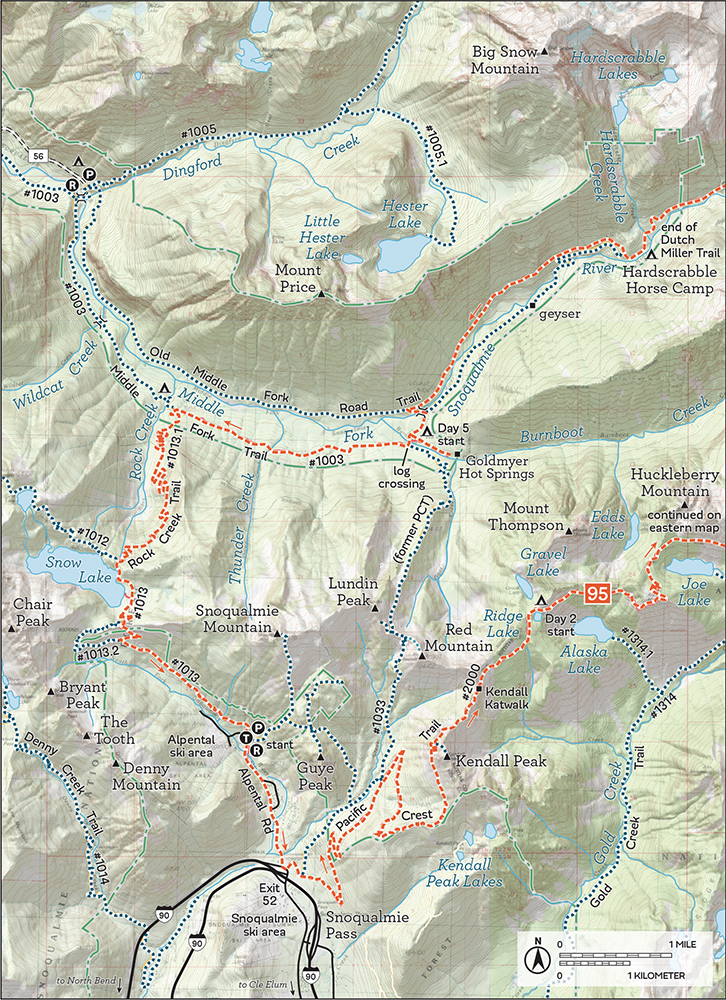
GETTING THERE: Take I-90 to Exit 34 near North Bend. At 468th Avenue just off the freeway, eastbound turn left, westbound turn right. Follow the road past the truck stop for about a half mile until you reach SE Middle Fork Road (Forest Road 56). Turn right and follow this road for a few twists and turns, keeping left when the road splits. After 2.2 miles reach SE Lake Dorothy Road. Turn left and continue 12 miles, crossing the Taylor River Bridge. After the bridge, keep right on FR 56, sometimes labeled FR 5620 or Dingford Creek Road at this point. Continue for about 5 miles to the Dingford Creek Trailhead. Privy available.

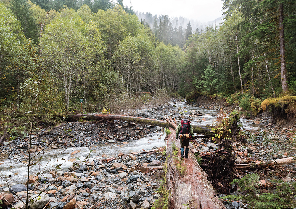
A backpacker crosses Burnboot Creek to reach Goldmyer Hot Springs.
Trek deep into the heart of the Alpine Lake Wilderness on this backpack to the beginnings of the Middle Fork Snoqualmie River. Follow in the footsteps of long-gone prospectors and pack mules out to Williams Lake and Dutch Miller Gap, climbing past rushing waterfalls and through lush meadows to reach captivating vistas, abandoned mines, and alpine tarns.
11.5 miles, 1900 feet elevation gain
From Dingford Creek Trailhead, head down to the Middle Fork Snoqualmie River, crossing on the Dingford Creek Bridge and veering left onto the Middle Fork Trail #1003 at 0.2 mile. Head out toward Goldmyer Hot Springs (Hike 15), crossing bridged Wildcat Creek at 1.6 miles and passing the junction with the Rock Creek Trail #1013.1 (Hike 14) at 2.8 miles.
A mile beyond, reach the most difficult creek crossing of the day, bridgeless Thunder Creek, at 3.8 miles. It’s only challenging during the spring melt, so ford or hop across on stones, continuing to the 5.1-mile mark and Burnboot Creek (aka Burntboot or Burnt Boot). Cross the creek on a log bridge and enter the Goldmyer property just beyond. Pass the caretaker cabin and note the campsites—you’ll be staying here on night three. Follow the trail out of the camping area to the Middle Fork Snoqualmie and a bridge at 5.6 miles. Don’t cross the bridge—turn right to stay on the Middle Fork Trail #1003. Pass soaking pools, bubbling hot springs, and a makeshift warm shower some Good Samaritan built 7.1 miles from the trailhead.
Reach another bridge and cross the river on it, then climb the slopes to reach solid forest road, sometimes called the Old Middle Fork Road Trail, at 8.7 miles. Turn right and uphill, reaching the Hardscrabble Horse Camp and the Dutch Miller Gap Trailhead in 0.3 mile. Camping pads are here if you’re ready to call it quits for the day, but the Alpine Lakes Wilderness boundary is just 0.6 mile down the Dutch Miller Gap Trail #1030, and a couple easy miles beyond that, find Crawford Creek and decent campsites at the 11.5-mile mark.
7.2 miles, 2600 feet elevation gain; 1300 feet lost
From Crawford Creek, continue on the Dutch Miller Gap Trail through old-growth forest with gaps in the canopy offering increasingly better valley views, eventually crossing a sturdy bridge to reach a large meadow in the middle of a river oxbow at 2.8 miles. This is Pedro Camp, with excellent camping and magnificent views of the surrounding crags of Summit Chief, Little Big Chief, and Bears Breast Mountains. Push onward through swaths of huckleberry and underbrush to the 3.6-mile mark and the junction with the Williams Lake Trail #1030.1. Turn left onto it, wandering through parklands to reach lovely Williams Lake at 4.2 miles, surrounded by talus-covered slopes and jutting peaks. Find a campsite and set up camp, preparing for a day hike up to Chain Lakes.
Follow the boot path around the east side of the lake. Curious hikers can find an old adit and rusting tracks in this area. Climb up through boulder fields to reach the Chain Lakes basin at 5.2 miles. Spend some time in this barren, ice-carved landscape looking for mine shafts and abandoned piles of ore. Work your way up the far end of the basin to reach a saddle near La Bohn Lakes for spectacular views of this alpine landscape, 5.7 miles from Crawford Creek Camp. Get your fill before returning to camp at Williams Lake.
10.6 miles, 300 feet elevation gain; 2800 feet lost
Retrace your route from Williams Lake to the junction with the Dutch Miller Gap Trail #1030. Consider whether you want to climb 1.0 mile to Dutch Miller Gap for a view of Lake Ivanhoe (Hike 50) before heading back to Hardscrabble Horse Camp and then the junction with the Middle Fork Trail #1003 at 7.0 miles. Instead of dropping down to the river here, continue on the Old Middle Fork Road Trail to the 9.5-mile mark and a road junction. Head down to the Middle Fork Snoqualmie to find the bridge you passed on Day 1. Cross the river and arrive at the Goldmyer Property at 10.0 miles. Set up camp and hike a short 0.3 mile up to the hot springs for a soak.
5.0 miles, negligible elevation gain; 400 feet lost
From Goldmyer, it is more or less 5.0 miles back to the Dingford Creek Trailhead. You can rehike the Middle Fork Trail #1003 if you prefer the trees, but this route returns to the Old Middle Fork Road Trail to shave off some time and wander down a different path. To close the loop, hike the 0.5 mile back to the Old Middle Fork Road Trail across the river, veer left, and glide back down an unexciting 4.5 miles above the river that returns you to the Dingford Creek Trailhead in record time.
DISTANCE: 23.8 miles
ELEVATION GAIN: 5300 feet
HIGH POINT: 5584 feet
DIFFICULTY: Moderate
HIKING TIME: Allow 3 to 4 days
BEST SEASON: Late spring to late fall
TRAIL TRAFFIC: Heavy foot traffic to Melakwa Lakes and Mason Lake; light foot traffic to Granite Creek Trailhead
PERMITS: Northwest Forest Pass, Discover Pass
MAPS: USGS Snoqualmie Pass, USGS Bandera, USGS Lake Philippa; Green Trails Snoqualmie Pass Gateway No. 207S, Green Trails Mt. Si No. 206S
TRAILHEAD GPS: 47.41525°N, 121.4433°W
NOTE: This through-hike requires two cars. Park one at the Granite Creek Trailhead (Hike 1) and drive to the Denny Creek Trailhead (Hike 28) to begin the hike.
GETTING THERE: For the shuttle vehicle, take I-90 to Exit 34 near North Bend. At 468th Avenue just off the freeway, eastbound turn left, westbound turn right. Follow the road past the truck stop for about a half mile to SE Middle Fork Road (Forest Road 56). Turn right and follow this road for a few twists and turns, keeping left when the road splits. After 2.2 miles reach SE Lake Dorothy Road. Turn left, and continue 3.6 miles to the Granite Creek Trailhead on the right just before crossing the Middle Fork Snoqualmie River. Privy available.
From I-90 between North Bend and Snoqualmie Pass, take Exit 47. Eastbound, turn left to cross over the freeway to a signed T intersection; westbound, turn right to this T intersection. At the T, turn right, heading under the freeway for 0.25 mile to Forest Road 58. Turn left on FR 58 and follow it for 2.5 miles to Denny Creek Campground. Just past the entrance to the campground, turn left onto FR 5830 for 0.25 mile to the road-end trailhead and parking. Privy available.
Depending on how you count them, there are about twenty named alpine lakes between the Pratt River Valley and the Middle Fork Snoqualmie River Valley. Some are frequently visited, others rarely. This cross-country backpack and through-hike skirts the shores of nearly all of them. A lake-bagger’s dream, this tour travels through rugged landscapes, climbing mountainsides to mammoth vistas before dropping into sheltering lake bowls.
7.5 miles, 2300 feet elevation gain; 1100 feet lost
From the Denny Creek Trailhead, follow the Denny Creek Trail #1014 (Hike 28) as it winds under I-90 at 0.5 mile before reaching the Alpine Lakes Wilderness at 0.9 mile. Not far beyond, at 1.1 miles, find the Denny Creek Waterslide. Clock Keekwulee Falls at the 1.7-mile mark before beginning a stiff climb up to Hemlock Pass. Switchback up through talus and thin forest to reach the pass at 3.8 miles. Find the junction with the Melakwa Lake Trail #1011 in the trees near the pass.
Keep right onto the Melakwa Lake Trail to head up and into the narrow granite trough holding Melakwa Lake at 4.2 miles. Wander the cirque, clambering over logjams of silvered snags and marveling at the jagged points of Chair, Bryant, and Kaleetan Peaks. Find Upper Melakwa Lake at 4.4 miles from the trailhead. Settle in for a lunch break before returning to the Melakwa Lake–Denny Creek junction.


After a long climb, you may enjoy a dip in Melakwa Lake as much as these pups.
Stay right on the Melakwa Lake Trail, which drops steeply down into the Pratt River Basin to Lower Tuscohatchie Lake at 6.9 miles, along with the junction for the Kaleetan Lake Trail #1010. Push past both to reach Pratt Lake and the end of the Melakwa Lake Trail at the 7.5-mile mark. Find a campsite and enjoy the quiet solitude of Pratt Lake.
Option: Those wishing to add another day can camp at Lower Tuscohatchie Lake and climb up to Windy Lake and Kaleetan Lake, a 7.0-mile roundtrip journey.
9.6 miles, 2400 feet elevation gain; 2200 feet lost
From Pratt Lake, follow the Pratt Lake Trail #1007 (Hike 26) as it works its way around the lake and up the shoulders of Pratt Mountain for 1.8 miles to reach Pratt Lake Saddle above Olallie Lake (Hike 25) and the junction with the Mount Defiance Trail #1009. Turn right, following the Mount Defiance Trail along the ridge before dropping off and switchbacking up the flanks of Pratt Mountain, with Talapus Lake (Hike 25) coming into view below. Drop down through boulder fields to a trail junction at 3.1 miles. Head left for a quick 0.3-mile side trip down to Island Lake (Hike 24), passing a few tarns before dropping down to an idyllic lakeshore, complete with signature islands.
Return to the Mount Defiance Trail, trekking through meadows to pass Rainbow Lake at 4.0 miles, then the spur to Lake Kulla Kulla at 4.5 miles. Kulla Kulla is a bit challenging to see and even more challenging to access. You can catch it sparkling through the trees, but the better view is from the top of Mount Defiance. At 4.9 miles, reach the junction with the Ira Spring (Mason Lake) Trail #1038 (Hike 22).
Option: Popular Mason Lake is to the left, with viewpoints and lakeshore access about 0.1 mile down the trail, along with the multitudes of day-trippers.
Stay on the Mount Defiance Trail and push up the shoulder of Mount Defiance (Hike 22) on a ridge between Little Mason Lake and Lake Kulla Kulla. Vistas open in wildflower meadows with big views of the Snoqualmie Valley. At 6.1 miles reach an unsigned junction with a well-worn boot path zigzagging up the mountain. Follow it 0.3 mile out to the summit of Mount Defiance for jaw-dropping views of the lakelands below.
Return to the Mount Defiance Trail and traverse the bowl above Spider Lake and below Web Mountain, eventually dropping down to the shores of Thompson Lake (Hike 1). Find the junction with the Thompson Lake Spur Trail #1009.3 at 9.3 miles and push past it around the lake to find campsites near the lake outlet at 9.6 miles.
6.7 miles, 600 feet elevation gain; 3200 feet lost
From Thompson Lake, head back to the Thompson Lake Spur Trail #1009.3, following it as it climbs out of the lake bowl. Crest the ridge at 0.7 mile and reach forest road at the 1.2-mile mark. Descend on wide roads, keeping right and continuing downhill at a junction at 1.8 miles and continuing straight at the next junction 0.1 mile beyond. At 2.3 miles reach another road junction. Veer left and downhill to traverse above Lower Granite Lake and reach Upper Granite Lake in 0.6 mile. Dirty Harry’s Peak sits above.
Retrace your steps and head down the decommissioned logging road alongside the crashing sounds of Granite Creek as it descends into the Middle Fork Snoqualmie Valley. At 5.7 miles find the Granite Creek Connector Trail. Keep to the main trail and reach the trailhead and end of the tour at 6.7 miles.
DISTANCE: 57.6 miles
ELEVATION GAIN: 11,400 feet
HIGH POINT: 5980 feet
DIFFICULTY: Hard
HIKING TIME: Allow 5 to 7 days
BEST SEASON: Summer to early fall
TRAIL TRAFFIC: Moderate to light foot traffic along Middle Fork and Pacific Crest Trails; heavy foot traffic along Snow Lake Trail
PERMIT: Northwest Forest Pass
MAPS: USGS Snoqualmie Pass, USGS Chikamin Peak, USGS Big Snow Mountain, USGS Mount Daniel; Green Trails Snoqualmie Pass No. 207, Green Trails Alpine Lakes West–Stevens Pass No. 176S
TRAILHEAD GPS: 47.4454°N, 121.4235°W
NOTE: Before you go, reserve a campsite at Goldmyer Hot Springs for the fourth night; visit www.goldmyer.org for details.
GETTING THERE: Take I-90 to Snoqualmie Pass. Eastbound take Exit 52 and turn left onto Alpental Road for about 2 miles to a large gravel parking lot. Westbound take Exit 53, turning left under the freeway and soon reaching a T intersection. Turn right onto State Route 906, following the sign pointing toward Alpental. Continue 2.7 miles through the ski area to the parking area. Privy available.
This wide loop climbs though some of the most rugged country within the Alpine Lakes Wilderness. Traverse talus slopes under glacier-clad mountains, camp at lonely creeksides, and spend hours marveling at sparkling alpine lake waters. Wild sections of trail lead to remote lakes, while numerous lakeside camps tempt you to spend yet another night under the stars. This adventure follows the modern Pacific Crest Trail (PCT) out to the vicinity of Waptus Lake, where it trades the new for old, following trail that was once known as the Cascade Crest Trail, the predecessor of the PCT, back to Snoqualmie Pass. For more details about each segment of the route, see the hikes described earlier in this book.
8.6 miles, 2400 feet elevation gain; 100 feet lost
Begin by hiking 1.3 miles back down Alpental Road to the Pacific Crest Trail North–Snoqualmie Pass Trailhead. Head down the Pacific Crest Trail #2000 (PCT) toward Kendall Peak and Kendall Katwalk (Hike 34), passing the junction with the Commonwealth Basin Trail #1033 at 3.9 miles. Continue through wildflower-filled meadows and pika-packed talus fields and ever-better views of Commonwealth Basin. At 6.8 miles reach a boot path that scrambles up to the top of Kendall Peak, a short but worthy side trip up to sweeping views of surrounding mountaintops.
Push deeper into the wilderness, crossing the granite-carved Kendall Katwalk at 7.6 miles. From here follow the ridgetop through talus fields to reach Ridge and Gravel Lakes, 8.6 miles from the trailhead. Follow boot paths around both lakes to find good campsites. Ridge Lake offers views of Alaska Lake below and Alta Mountain, but whether you camp there or not, be sure to take in the views of the Middle Fork Snoqualmie Valley and Mount Price, which stands above Goldmyer Hot Springs (where you will stay on Day 4).

Looking out over the Waptus River Valley toward Waptus Lake from high up on Dutch Miller Gap Trail
12.2 miles, 1800 feet elevation gain; 3800 feet lost
Begin your day by pressing down the PCT, passing a tempting path leading up to Bumble Bee Pass, which provides impressive views of Mount Thompson and Edds Lake below. Continue around the top of Alaska Mountain, revealing Joe Lake below as you crest the ridgetop, then drop down the mountainside to a narrow rib between Edds Lake and Joe Lake. Traverse the open meadows on the slopes of Huckleberry Mountain, enjoying the views from these parklands as the trail rounds the end of the mountain and begins a long climb up the flanks of Chikamin Peak. From these heights, the trail angles slightly downward, continuing to traverse the high country over rocks and boulders beneath Four Brothers.
Eventually climb your way over the top of Chikamin Ridge to find Park Lakes tucked into the basin below. Reach the junction with the Mineral Creek Trail #1331, with access to the Park Lakes, at 7.2 miles.
Option: Excellent camping can be found here for those looking to spend another night in the wild.
Continue to push down the PCT to the 9.6-mile mark to reach the access trail to Spectacle Lake and take this short 0.3-mile climb to an alpine beauty and another tempting place to set up camp. The loop returns you to the PCT, which drops to cross Delate Creek and reach Delate Meadow. Pass the junction with the Pete Lake Trail #1323 at 11.0 miles, staying on the PCT to reach Lemah Creek. If the bridge is still out, ford Lemah Creek to find a campsite at 12.2 miles.

13.6 miles, 2400 feet elevation gain; 2500 feet lost
Continue down the PCT, passing the junction with the Lemah Meadow Trail #1323.2 at 1.3 miles. Stay on the PCT to begin the day’s toil, a long switchbacking climb up a forested arm of Summit Chief Mountain. After many switchbacks, climb past the timberline and into old burn, and finally attain the ridgeline at 6.9 miles. Continue over granite outcroppings through a group of tarns above Escondido Lake, and below Summit Chief Mountain. Round the bowl above Escondidio Lake, and pass the junction with the Waptus Burn Trail #1329.3 at 9.3 miles, before dropping down into the Waptus Lake Basin. Switchback down to the junction with the Dutch Miller Gap Trail #1362 at 13.6 miles, turning left to leave the PCT and find campsites near Chief Creek to bed down for the night.
13.9 miles, 1900 feet elevation gain
Follow the Dutch Miller Gap Trail toward Lake Ivanhoe (Hike 50) as it fords Chief Creek, then begins a long, switchbacking climb up forested slopes, crossing creeks and entering boulder country. Cross Ivanhoe’s outlet creek near the remains of the bridge at 2.4 miles. The trail splits around the lake near here, with either path leading up to Dutch Miller Gap. Opting for the eastern side of the lake rewards you with a tumbling terraced waterfall at 2.9 miles. Climb up to Dutch Miller Gap, reaching it at 3.1 miles and savoring the views from the top: sparkling Ivanhoe below, Waptus in the distance.
Continue through the meadowy gap, dropping into the Middle Fork Snoqualmie Valley and passing the junction with the Williams Lake Trail #1030.1, at 3.9 miles (campsites at that lake are 0.6 mile distant). Stay on the Dutch Miller Gap Trail #1030 (Hike 93) as it descends the river valley and soon pass Pedro Camp at 4.7 miles to eventually arrive at Hardscrabble Horse Camp at 10.0 miles. From here, follow the Old Middle Fork Road Trail, a largely decommissioned forest road, passing the junction with the Middle Fork Trail #1003 in 0.3 mile and reaching a road junction at 12.8 miles. Veer left and down to the Middle Fork Snoqualmie River, crossing a bridge and reaching the Goldmyer property after 13.3 miles of hiking. Check in and end the day by walking up 0.3 mile to soak in the hot springs.
9.3 miles, 2900 feet elevation gain; 1500 feet lost
Leave Goldmyer by heading out to Burnboot Creek (aka Burntboot or Burnt Boot), crossing it on a log bridge to reach the Middle Fork Trail #1003. Follow the river down toward the trailhead, tiptoeing across bridgeless Thunder Creek to reach the Rock Creek Trail #1013.1 (Hike 14) at the 2.5-mile mark.
Turn left and up, beginning a tough climb up the Rock Creek Valley, switchbacking first through forest, then talus, past Rock Creek Falls and up to the trail’s end, where it connects with the High Lakes Trail #1012 (Hike 30) to the right and the Snow Lake Trail #1013 (Hike 29) to the left at 3.5 miles. Veer left, hugging the shore of Snow Lake for 0.5 mile to arrive at the short spur trail leading down to the remains of a cabin. Push upward from the lake, attaining a saddle at the 6.8-mile mark. From here, descend steeply toward the Snow Lake Trailhead, zigzagging past the junctions with the Source Lake Trail #1013.2 and reaching the parking area 9.3 miles from Goldmyer.
DISTANCE: 31.5 miles
ELEVATION GAIN: 5800 feet
HIGH POINT: 5600 feet
DIFFICULTY: Moderate
HIKING TIME: Allow 4 to 6 days
BEST SEASON: Late spring to early fall
TRAIL TRAFFIC: Moderate foot traffic
PERMIT: Northwest Forest Pass
MAPS: USGS The Cradle, USGS Mount Daniel, USGS Polallie Ridge, USGS Davis Peak; Green Trails Alpine Lakes West–Stevens Pass No. 176S
TRAILHEAD GPS: 47.54348°N, 121.0968°W
NOTES: Parking is scarce on summer weekends. Route requires multiple river fords, so do this backpack when water is low and be prepared to get your boots wet.
GETTING THERE: Take I-90 to Roslyn, Exit 80. Eastbound turn left; westbound turn right, following Bullfrog Road 2.8 miles to the traffic circle junction with State Route 903. Follow SR 903 toward Roslyn for 16.6 miles through the town and along Cle Elum Lake to just beyond the Salmon La Sac guard station, where the road splits. Keep right, continuing toward Tucquala Lake along FR 4330 (aka Fish Lake Road or Cle Elum Valley Road) on dirt and gravel for 12.3 miles to the Cathedral Pass Trailhead. Privy available.
Filled with big alpine lakes, snowcapped peaks, and long views, this loop is a nice mix of well-trodden pathways and lesser-known destinations. The route also intersects many other trails, making it easy to add more lakes and mountaintops to your tour.
8.5 miles, 2500 feet elevation gain; 800 feet lost
From the trailhead, follow the Cathedral Pass Trail #1345, crossing into the Alpine Lakes Wilderness at 0.4 mile and ascending to the junction with the Trail Creek Trail #1322 at 2.0 miles. Veer left to follow the Trail Creek Trail as it angles down through thick forest to the junction with the Lake Michael Trail #1336 (Hike 53), 4.7 miles from the trailhead. Turn left and head uphill, climbing over creek beds along a brushy traverse to reach Lake Michael at 8.5 miles. Tucked beneath Goat Mountain, this is a lovely and often overlooked lake. Campsites can be found on either side of the lake outlet.
Option: For even more seclusion, continue another 1.6 miles down increasingly brushy and hard-to-follow trail to climb another 500 feet up to lonely Lake Terence and its solitary campsite.
8.9 miles, 500 feet elevation gain; 2600 feet lost
From Lake Michael, retrace your route 3.8 miles back to Trail Creek Trail. Turn left to descend to a sprawling horse camp and the Waptus River at 6.2 miles. Ford the river to reach the Waptus River Trail #1310 (Hike 48). Keep in mind that you’ll be fording the river again in about a mile. Turn right on the Waptus River Trail and follow it to the Waptus Pass Trail #1329 and a few campsites at 7.1 miles. Keep right to reach the well-signed Waptus Horse Ford Trail #1329.1 in 0.1 mile, fording the wide river again. Continue toward Waptus Lake, rejoining the Waptus River Trail at 7.7 miles. Soon after, reach the lake and the first campsites.


Cathedral Rock soars above golden meadows near the shores of Deep Lake.
Camp here or keep following the trail, passing a few campsites on your way to the junction with the Spade Lake Trail #1337 at the 8.3-mile mark. Note this trail, as you’ll be taking it on the next leg of your journey. There is an excellent campsite a little farther down the trail, set on a rocky bluff overlooking the lake. Find it just beyond a designated horse camp at 8.9 miles. Look for a faint boot path leading off the trail toward the water. For the adventurous, there is also access here to a small rocky island camp, easily reached when the water is low.
Option: Some may want to spend more time near Waptus, as it is easy to add destinations like Lake Ivanhoe (Hike 50) or Spade and Venus Lakes (Hike 49).
9.1 miles, 2600 feet elevation gain
From the bluff camp, retrace your steps back to the Spade Lake Trail #1337, 0.6 mile distant. Turn left and up for 0.2 mile to reach the Pacific Crest Trail #2000 (PCT). Turn right and head up on good tread under a canopy of old growth. Pass the junction with the Spinola Creek Trail #1310.1 at 2.0 miles and continue on the PCT as you climb up the Spinola Creek Valley.
Climb around rocky outcroppings, through talus fields, and over tumbling creeks, passing the Lake Vicente Trail #1365 (Hike 55) at 5.2 miles. The meadows surrounding Deep Lake are just beyond, with a spur trail leading out to good campsites at the 5.6-mile mark. Follow this spur out to marvel at Cathedral Rock and Mount Daniel towering over this tranquil alpine lake. Wander out to the campsites for a better look, or if you’re planning a longer trip, set up camp for the night.
From the junction leave the meadows and climb up the mountainside, switchbacking through open country, to reach the junction with the Peggys Pond Trail #1375 at 8.5 miles near Cathedral Pass. Follow the rough and rocky trail 0.6 mile to Peggys Pond and serene camping against the backdrop of Mount Daniel to end your 9.1-mile day.
5.0 miles, 200 feet elevation gain; 2400 feet lost
Leave Peggys Pond behind, heading back toward the PCT. Turn left on the PCT and reach Cathedral Pass at 0.7 mile. Drop down to connect with the Cathedral Pass Trail #1345 at 0.8 mile and begin your descent on it back to the Cathedral Pass Trailhead. Pass Squaw Lake (Hike 54) at 2.3 miles and reach the junction with the Trail Creek Trail #1322 at 3.0 miles, closing the loop. Finish out your journey by dropping another 2.0 miles back to the trailhead.
DISTANCE: 31.0 miles
ELEVATION GAIN: 4600 feet
HIGH POINT: 6500 feet
DIFFICULTY: Moderate
HIKING TIME: Allow 4 days
BEST SEASON: Summer to early fall
PERMIT: Northwest Forest Pass
TRAIL TRAFFIC: Moderate foot and equestrian traffic below Fourth Creek; light foot traffic beyond
MAPS: USGS Blewett, USGS Enchantment Lakes, USGS Mount Stuart; Green Trails Alpine Lakes East–Stuart Range No. 208SX
TRAILHEAD GPS: 47.4629°N, 120.6733°W
GETTING THERE: Take I-90 to Exit 85, following signs to State Route 970. Merge onto SR 970 and continue 37.9 miles, as SR 970 turns into Highway 97, to Ingalls Creek Road on the left. Turn onto the road, cross the bridge, and keep left at the fork, continuing 1.2 miles to the road end and trailhead. Privy available.
This long out-and-back connects to a half dozen trails as it follows Ingalls Creek beneath the Stuart Range out to Lake Ingalls and Stuart Pass. The farther reaches of this trail are less traveled and sometimes a bit brushy, but the increasingly wild landscape, snowy peaks, and tumbling waters are more than enough to compensate for some overgrown sections. Cap the adventure with a night in Headlight Basin near otherworldly Lake Ingalls.
8.1 miles, 2000 feet elevation gain
Start your journey by following the Ingalls Creek Trail #1215 (Hike 62) as it sets off into the creek valley, following rumbling Ingalls Creek and crossing into the Alpine Lakes Wilderness at 0.3 mile. Pass a swimming hole, then the first campsites under rugged landscape at 1.0 mile. Soon round the edge of the Stuart Range and press deeper into the valley proper. Enjoy wildflowers and an easy grade to the day hikers’ turnaround point at a campsite at the 3.0-mile mark.
Note Three Brothers looming above as you continue on rougher trail, passing increasingly tempting campsites at 4.0 and 4.9 miles. Reach Falls Creek at 5.4 miles, finding an excellent camp and access to a hard-to-follow trail across a ford of Ingalls Creek that leads up the Falls Creek drainage. There’s also a lone grave here, resting place of a cabin owner who died in an avalanche.
Continue onward, passing more camps and the signed junction with the Cascade Creek Trail #1217 at 7.2 miles, another hard-to-follow trail reached by fording Ingalls Creek. From here, the Ingalls Creek Trail enters old wildfire burn. Reach two campsites 0.4 mile before Hardscrabble Creek and set up camp at 8.1 miles from the trailhead.
7.4 miles, 2600 feet elevation gain
Continue farther into the wilderness, climbing steadily. Pass Hardscrabble Creek and access to the Hardscrabble Creek Trail #1218 at 0.4 mile. This is another of those overgrown trails that work their way up the slopes across Ingalls Creek, each with a campsite and all requiring a ford to reach. There’s more up ahead. Press ever onward, navigating brushy trail and blowdowns as you work your way through forest and open talus, passing Fourth Creek Trail #1219 at 2.0 miles, followed by Beverly Turnpike Trail #1391 at 3.6 miles and finally the Longs Pass Trail #1229 at 4.3 miles. From here the trail is increasingly rocky and steep as it crosses the base of Mount Stuart, steadily closing in on the valley’s headwall. Climb the largely open slope to reach a junction just below Stuart Pass at 4.2 miles.

Wilderness camps at lower elevations lack dazzling lakes and broad vistas, but campfires are allowed in these areas.
Before heading left to Lake Ingalls, consider climbing the 0.2 mile up to Stuart Pass for impressive views of Jack Valley, Ingalls Peak, and Mount Stuart as well as Mount Daniel and Glacier Peak in the distance. From here, the Jack Creek Trail #1558 drops down into the Jack Creek drainage. Take a long look down the valley you’ve just climbed up, then head back down the junction.
From the junction, head left (right if you went up to Stuart Pass) and climb a rocky ridge to reach Lake Ingalls. Rest on stone shores next to this icy lake at the foot of Ingalls Peak. To find a campsite, work your way around the south shore to scree-lined Ingalls Way Trail (Hike 60), which leads down into Headlight Basin at the 6.9-mile mark. Soon reach the junction with Ingalls Way Alternate #1390.2. Good campsites can be found down this path at 7.4 miles.
10.1 miles, negligible elevation gain; 3100 feet lost
From Headlight Basin, retrace your steps 0.5 mile back to Lake Ingalls, then drop to the junction below Stuart Pass to rejoin the Ingalls Creek Trail and your old trailside companion Ingalls Creek. Switchback down the headwall, again passing Longs Pass Trail, at 3.1 miles, followed by the Beverly Turnpike Trail at the 3.8-mile mark, leaving the last shoulder of Mount Stuart behind. Pass Fourth Creek Trail at 5.4 miles followed by the Hardscrabble Creek Trail at 7.0 miles where the trail reenters the burnlands. Hike through the campsites from Day 1, resisting the temptation to spend another night here. Instead press downward, passing the Cascade Creek Trail at 8.3 miles before reaching an excellent camp at the junction with the Falls Creek Trail at 10.1 miles.
5.4 miles, negligible elevation change
From Falls Creek, it’s a quick 5.4-mile descent along Ingalls Creek back to the trailhead, passing several campsites on wildflower-lined trail. Linger before reluctantly leaving the wilderness and returning to the parking area.
DISTANCE: 21.8 miles
ELEVATION GAIN: 5600 feet
HIGH POINT: 7100 feet
DIFFICULTY: Hard
HIKING TIME: Allow 3 days
BEST SEASON: Summer to fall
TRAIL TRAFFIC: Moderate foot traffic; light equestrian traffic
PERMIT: Northwest Forest Pass
MAPS: USGS Jack Ridge, USGS Chiwaukum Mountains; Green Trails Alpine Lakes East–Stuart Range No. 208SX
TRAILHEAD GPS: 47.6123°N, 120.9497°W
NOTE: The 3.6-mile gap between the trailheads requires either walking along the road, arranging for a ride, or parking a second vehicle at the endpoint trailhead.
GETTING THERE: Take Highway 2 to Icicle Creek Road (Forest Road 76) just west of Leavenworth. Turn onto Icicle Creek Road and continue as the pavement turns to gravel at 12.5 miles, and then keep right at the Y just beyond. If you’re bringing an extra vehicle to shuttle between the trailheads, the Chatter Creek Trailhead is on the right at 14.9 miles, just before the Chatter Creek guard station. At 16.7 miles reach Rock Island Campground. Turn left, crossing Icicle Creek on a bridge, and continue another 1.8 miles to the Icicle Creek Trailhead, 18.5 miles from Highway 2. Privy available.
This loop explores the rugged tundra and windswept passes of the Chiwaukum Mountains, fabled highland of alpine lakes. Challenging to reach, this land of snow and stone has a harsh and captivating beauty. The route outlined here suggests three days, but hikers could spend much more time exploring these lake basins.
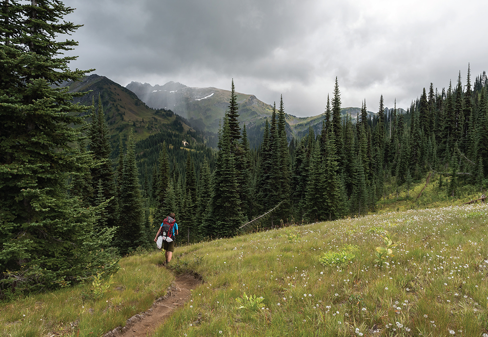
A storm closing in on Frosty Pass
9.1 miles, 2600 feet elevation gain
From the Icicle Creek Trailhead, follow the Icicle Creek Trail #1551 (Hike 91) into the trees, crossing the Alpine Lakes Wilderness Boundary at 0.3 mile. Glide down easy trail, passing French Creek Camp at 1.5 miles and the junction with the French Creek Trail #1595 0.2 mile beyond. Press onward, passing the French Ridge Trail #1564 at 2.1 miles. At the 5.0-mile mark reach the junction with the Frosty–Wildhorse Trail #1592 and turn up onto it, beginning the first of many steep climbs on this route.
Switchback your way up the mountainside, crossing Doughgod Creek, to reach Frosty Creek’s hanging valley. Soon the trail tucks in alongside the creek, cutting through alternating sections of forest and brush before climbing the headwall of the cirque and delivering you to the ledge above Lake Margaret at 9.1 miles. Find camps near the lake outlet and enjoy the greenery of this pretty lake bowl at the base of Snowgrass Mountain on the edge of the high country.
4.9 miles, 1600 feet elevation gain; 1300 feet lost
From Lake Margaret, continue your climb up the headwall to Frosty Pass, reaching it at 0.5 mile.
Option: From the pass you can drop into the Wildhorse Creek Valley (Hike 76), continuing down #1592, known as the Wildhorse Creek Trail on this side of Frosty Pass. Trek out to the well-signed Lake Grace Trail #1578, and then follow it as it climbs sharply up 1300 feet to Lake Grace. It’s 2.0 miles from the pass to the lake, but if you pursue this option, consider being leisurely and spending the night. Grace Lake makes for a tranquil night’s sleep, and there’s enough to explore in the lake basin to fill up another day.

From Frosty Pass, follow the Icicle Ridge Trail #1570 as it leaves the timberline and traverses a high, open shoulder of Snowgrass Mountain. Enjoy big views of the Icicle Creek Valley and the snow-covered peaks rising in the distance. Mount Rainier makes a showing on a good day. After 1.2 miles, reach a spur trail leading down to Lake Mary. Consider taking the short 0.2-mile trek down to the lakeshore for a better look and some exploration before continuing onward.
Back on the main trail, climb up and around a hefty ridge and cross over Marys Pass to the south face of Snowgrass Mountain and Upper Florence Lake tucked below the next ridge. Find a junction at 2.6 miles where a side trail heads south to Upper Florence Lake. If you want to see it, switchback down to a broad bench and out 0.4 mile to the water’s edge. Quiet campsites await by that lakeshore for those who want to linger.
Continue the tour by climbing over another of Snowgrass’s ridges to traverse a bowl above Spanish Camp Creek, then climb the flanks of a ridge to reach Ladies Pass and the junction with the Chiwaukum Creek Trail #1571 at 3.4 miles. Veer left and switchback steeply down to reach Lake Flora, with long views of the Chiwaukum Creek Valley, and camp 4.9 miles from Frosty Pass.
7.8 miles, 1400 feet elevation gain; 4500 feet lost
From Lake Flora, climb 1.5 miles back up to the junction at Ladies Pass, veering left onto the Icicle Ridge Trail and climbing up the shoulders of Cape Horn to attain the ridgeline above Lake Edna (Hike 87) at 1.9 miles. Drop steeply for 0.3 mile through snow-scrubbed moonscape to the granite shores of Lake Edna. Linger here and enjoy Edna’s cold beauty before descending a rocky gully another 0.3 mile to the junction with the Chatter Creek Trail #1580.
Bear right, working your way through marshy meadows, then a boulder-filled basin. Climb up, up, and over Icicle Ridge to switchback down through talus fields and finally reach brushy Chatter Creek Basin. It’s a long, slightly overgrown, somewhat rough slog down toward the trailhead, with scattered campsites along the way. You’ll find relief shortly after you exit the Alpine Lakes Wilderness at the 6.6-mile mark, not much more than a mile from the end. Cross Chatter Creek on a study bridge and follow well-built trail for the remainder of the day’s 7.8-mile hike.
DISTANCE: 33.3 miles
ELEVATION GAIN: 6400 feet
HIGH POINT: 6400 feet
DIFFICULTY: Hard
HIKING TIME: Allow 4 to 5 days
BEST SEASON: Late spring to fall
TRAIL TRAFFIC: Moderate foot traffic; light equestrian traffic
MAPS: USGS Chiwaukum Mountains, USGS The Cradle, USGS Jack Ridge; Green Trails Alpine Lakes East–Stuart Range No. 208SX, Green Trails Alpine Lakes West–Stevens Pass No. 176S
PERMIT: Northwest Forest Pass
TRAILHEAD GPS: 47.6123°N, 120.9497°W
NOTE: Camping prohibited within 200 feet of Cradle Lake.

The Cradle and the wildflower-laden meadows of Snowall Creek Valley
GETTING THERE: Take Highway 2 to Icicle Creek Road (Forest Road 76) just west of Leavenworth. Turn onto Icicle Creek Road and continue as the pavement turns to gravel at 12.5 miles. Keep right at the Y just beyond. At 16.7 miles reach Rock Island Campground. Turn left, crossing over Icicle Creek on a bridge, and continue another 1.8 miles to the Icicle Creek Trailhead, 18.5 miles from Highway 2. Privy available.
This loop visits less-traveled lakes that some rank among the most beautiful in the Alpine Lakes Wilderness. Long, lonely stretches of creekside trail offer solitude, and the ever-constant presence of the Cradle is welcome company on the sometimes-difficult journey.
9.1 miles, 2300 feet elevation gain
Start by following the Icicle Creek Trail #1551 (Hike 91) into the trees, entering the Alpine Lakes Wilderness in 0.3 mile and making quick work of the wide and nearly flat trail to reach French Creek Camp at 1.5 miles. Cross the bridge spanning French Creek and reach the French Creek Trail #1595 at the 1.7-mile mark. Turn left onto it to climb up the creek valley through alternating sections of forest and open slope, passing the French Ridge Trail #1564 at 5.2 miles and the junction with the Snowall–Cradle Lake Trail #1560 at 6.2 miles. Note the campsite at this junction: you will be calling it home at the end of Day 3.

Press onward to the 7.2-mile mark to reach the Klonaqua Lakes Trail #1563 (Hike 92), turning right onto it to climb a very steep set of switchbacks. At 8.6 miles note a cairn-marked junction with a rough boot path that leads up past Bobs Lake to one of the upper and arguably prettier Klonaqua Lakes. Beyond the junction, reach steep-shored lower Klonaqua Lake and good campsites, resting at the base of Granite Mountain at 9.1 miles.
9.6 miles, 1700 feet elevation gain; 2800 feet lost
From Klonaqua Lakes, drop 1.9 zigzagging miles down to rejoin the French Creek Trail. Head right, continuing your trek deeper into the creek valley. At 5.6 miles reach the junction with the Meadow Creek Trail #1559. Here, the French Creek Trail continues up to Sprite Lake (Hike 52); instead veer left onto the Meadow Creek Trail, following the sometimes-faint pathway through meadows and forest.
Climb up to a saddle between the French Creek and Meadow Creek Valleys at 6.4 miles, soon dropping down through talus fields to reach spur trail #1559.1, which leads up the slope to the top of the divide to connect with the North Scatter Creek Trail #1328.1 at 7.0 miles. Stay on the main trail, pushing another 2.6 miles, to reach the junction with the Snowall–Cradle Lake Trail #1560 and the end of a 9.6-mile day. Camps here make a good stopping point to rest up before the steep climb up to Cradle Lake.
8.4 miles, 2400 feet elevation gain; 3000 feet lost
Begin your day with a long climbing traverse through the trees to a set of tight switchbacks along the Snowall–Cradle Lake Trail. Pingpong up the mountainside to attain a ridge, following it to the junction with the largely abandoned trail leading out toward Blackjack Ridge and Bootjack Mountain (Hike 90) at 2.1 miles. Stay on the main trail for another 0.5 mile, rounding a rocky rib, then climbing through parklands to arrive at gorgeous Cradle Lake, surrounded by wildflower meadows, orange-hued boulders, and the rounded peak of Highchair Mountain. Spend some time exploring these shores before going around the lake and climbing up and out of this lovely alpine basin.
Reach the top lip of the basin at 3.1 miles, tipping into wildflower meadows and rock gardens as you descend. The trail is sometimes indistinct and may require occasional routefinding as you work your way down to the valley floor and Snowall Creek. Push down through this long glacier-carved trench, following Snowall Creek as it passes between the Cradle and Highchair Mountain, rushing to meet French Creek at the 8.4-mile mark. Ford or find a bridge across French Creek to reach the Snowall Creek camp you passed on Day 1.
6.2 miles, 500 feet lost
From the Snowall Creek camp, retrace your path back to the trailhead, passing the French Ridge Trail at 1.0 mile and reconnecting with the Icicle Creek Trail at the 4.5-mile mark. Veer right, crossing the bridge over French Creek and then passing French Camp at 4.7 miles. The last stretch of trail quickly disappears beneath your boots, and you soon find yourself emerging from the trees at the Icicle Creek Trailhead, ending your adventure a short 6.2 miles from camp.
DISTANCE: 67.6 miles
ELEVATION GAIN: 14,200 feet
HIGH POINT: 5980 feet
DIFFICULTY: Hard
HIKING TIME: Allow 6 to 8 days
BEST SEASON: Summer to early fall
TRAIL TRAFFIC: Moderate foot traffic
PERMIT: Northwest Forest Pass
TRAILHEAD GPS: 47.42787°N, 121.4134°W
MAPS: USGS Snoqualmie Pass, USGS Chikamin Peak, USGS Big Snow Mountain, USGS Mount Daniel; Green Trails Snoqualmie Pass No. 207, Green Trails Alpine Lakes West–Stevens Pass No. 176S
NOTES: This hike requires a second vehicle, coordination with friends, or a shuttle service. You can find shuttles for hire to PCT through-hikers with a little research online.
GETTING THERE: Take I-90 to Snoqualmie Pass. Eastbound take Exit 52 and turn left under the freeway toward Alpental, and in a few thousand feet turn right onto a small spur road marked “Pacific Crest Trail.” Westbound take Exit 53, turning left under the freeway, soon reaching a T intersection. Turn right onto State Route 906, following the sign pointing toward Alpental. Continue 0.7 mile through the ski area to a small spur road marked “Pacific Crest Trail.” Follow the spur road to two large parking areas. The first is reserved for stock; hikers should continue to the farther parking lot and trailhead. Privy available.
The grand tour of the Alpine Lake Wilderness—a stretch of the Pacific Crest Trail that many consider to be among the best the trail has to offer. This jaw-dropping wilderness romp from Snoqualmie Pass to Stevens Pass encounters lake after alpine lake, offers endless vistas of sharp peaks and glaciated mountainsides, and wanders through wildflower-flecked tundra and meadowlands. If you want to experience the essence of the Alpine Lakes Wilderness in a single backpacking trip, this is it. This route moves at breakneck speed, so consider adding an intervening day or two to help smooth the journey.
7.1 miles, 2400 feet elevation gain; 100 feet lost
From the trailhead, follow the Pacific Crest Trail #2000 (PCT) toward Kendall Peak and Katwalk (Hike 34), reaching the junction with the Commonwealth Basin Trail #1033 (Hike 33) at 2.4 miles. Continue past it, rolling through boulder-covered slopes, skipping over creeks, and enjoying the wildflowers. Find the scramble route up to the summit of Kendall Peak at 5.3 miles, a side trip worth the effort for the commanding 360-degree views from the top. Cross Kendall Katwalk at 6.1 miles and continue along a rocky ridgetop through talus fields to reach Ridge and Gravel Lakes, 7.1 miles from the trailhead. Both lakes have good camping and even better vistas.
12.2 miles, 1800 feet elevation gain; 3800 feet lost
From Ridge and Gravel Lakes, continue on the PCT down past a side trail leading up to Bumble Bee Pass, another quick climb that offers impressive views of towering Mount Thompson and Edds Lake below. Climb upward, across the flanks of Alaska Mountain, revealing Joe Lake below as you climb around a ridge, then drop down the mountainside to a narrow rib between Edds Lake and Joe Lake. Traverse Huckleberry Mountain’s open slopes, crossing alpine meadows and enjoying the stunning views. Round one of Huckleberry Mountain’s ridges to begin a long climb up toward the craggy heights of Chikamin Peak.

Trap Lake from the Pacific Crest Trail below Trap Pass
From this high point, the trail descends slightly, traversing vast fields of rocks and boulders beneath Four Brothers. Follow the trail as it climbs over the top of Chikamin Ridge and discover Park Lakes tucked into the basin below. Push on to the junction with the Mineral Creek Trail #1331 (Hike 45) to the right at 7.2 miles, with access to the Park Lakes and good camping.
The PCT continues to drop, switchbacking down to reach the access trail to Spectacle Lake at 9.6 miles. Take this short 0.3-mile loop trail to climb to a gorgeous alpine lake and a good stopping point for those looking to spend another night in the wilderness. Where the Spectacle Lake loop trail rejoins the PCT, descend steeply to cross Delate Creek and reach Delate Meadow and sections of old burn. Pass the Pete Lake Trail #1323 (Hike 46) junction at 11.0 miles, continuing onward until you reach Lemah Creek. Find a way across Lemah Creek, fording if you must. On the other side, choose a campsite to end your day after a long 12.2 miles of hiking.
13.6 miles, 2400 feet elevation gain; 2500 feet lost
From Lemah Creek, push onward along the PCT, passing the junction with the Lemah Meadow Trail #1323.2 at 1.3 miles. From here, begin a long, steep climb up one of Summit Chief Mountain’s many ridges, switchbacking over and over again. Eventually push out of the trees and enter another old burn, continuing to climb and crest the ridge at 6.9 miles. Continue over granite country, winding between the Escondido Tarns above Escondido Lake in the shadow of Summit Chief Mountain.
Continue to contour around the slopes above Escondido Lake, reaching the Waptus Burn Trail #1329.3 junction at the 9.3-mile mark. Stick with the PCT, following it into the Waptus Lake Basin, switchbacking steeply down to meet the Dutch Miller Gap Trail #1362 at 13.6 miles. Here, head left for a short jaunt off the PCT to find campsites near Chief Creek to set up camp for the night. Those willing to put in a little more distance can trek down to Waptus Lake (Hike 48) for lakeside camping.
10.4 miles, 2600 feet elevation gain
From Chief Creek Camp, proceed down the PCT, passing the junction with the Waptus River Trail #1310 at 0.9 mile, staying high above Waptus Lake. Continue through the trees, crossing the Spade Lake Trail #1337 at 2.2 miles. Stay under the canopy of old growth, passing yet another junction, this time with the Spinola Creek Trail #1310.1 at the 3.4-mile mark. Continue up the Spinola Creek Valley, climbing around rocky outcroppings, through talus fields, and over tumbling creeks, passing the Lake Vicente Trail #1365 at 6.6 miles. The meadows surrounding Deep Lake (Hike 55) are just beyond, with a spur trail leading out to good campsites at 7.0 miles. Take a moment to marvel at Cathedral Rock and Mount Daniel towering over this tranquil alpine lake. Wander out to the campsites for a better look, or if planning a longer trip, set up camp for the night.
From the junction, press upward, leaving the meadows and climbing the mountainside, switchbacking through open country to pass the junction with the Peggys Pond Trail #1375 at 9.9 miles. Continue up and over Cathedral Pass to reach the Cathedral Pass Trail #1345 (Hike 59). Leave the PCT here to find camping at a lovely alpine tarn just down the Cathedral Pass Trail at 10.4 miles.
12.3 miles, 2100 feet elevation gain; 2800 feet lost
From the tarn, return to the PCT and head out toward Deception Pass (Hike 59), cutting through a broad ledge of parkland, passing tarns and enjoying views of the Hyas Lakes as you progress. Drop down through the trees to two difficult creek crossings, the first at 2.0 miles, the next at 3.2 miles. Use caution when waters are high. From the second creek crossing, the trail angles up, climbing to Deception Pass after 4.9 miles of hiking. In this broad hollow find a number of trails, including the Deception Pass Trail #1376 (Hike 59), the Marmot Lake Trail #1066 (Hike 58), and the Deception Creek Trail #1059 (Hike 69). There’s a lot of potential for adventure in this area, but for now, stay on the PCT.
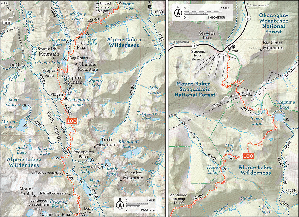
Climb higher on the valley wall above Deception Creek, then begin a long traverse out to Deception Lakes (Hike 69), passing the Deception Lakes Trail #1059.2 junction at 8.2 miles, just below the lakes. Climb up to Deception Lakes, skirting the lakeshore and reaching the junction with the Surprise Mountain Trail #1063 at the 8.8-mile mark. Stay left on the PCT, pushing up the flanks of Surprise Mountain to arrive at Pieper Pass at 9.8 miles. Find enormous views of dazzling Glacier Lake and Surprise Lake (Hike 70) below, the snowy crowns of Mount Daniel and Mount Hinman and countless others. Spend some time up here enjoying the panorama before switchbacking down through the talus to Glacier Lake and your camp for the night at 12.3 miles.
13.1 miles, 2900 feet of elevation gain; 3300 feet lost
From Glacier Lake, continue your journey along the PCT. Pass the Surprise Lake Trail #1060 junction at 0.4 mile, keeping right on the PCT. Climb up the boulder-strewn slopes toward Trap Pass, switchbacking steeply, gaining the pass at 1.9 miles. Drop into a basin high above shimmering Trap Lake (Hike 71), traversing open slopes down to a spur trail at 3.1 miles leading down to the shores of Trap Lake. Stick to the main trail, and spend the next 2.6 miles trekking across a long ridge just at the edge of the tree line, crossing alpine meadows and enjoying long views of the surrounding landscape.
Eventually round a ridge and drop down to Hope Lake (Hike 72) and the junction with Tunnel Creek Trail #1061 at 5.6 miles. Pressing onward, reach Mig Lake 0.7 mile distant. Either of these lakes would make for a decent stopping point if you’d like to add a day. Another excellent stopping point is Josephine Lake (Hike 73), reached at the 8.8-mile mark. Here too is the Icicle Creek Trail #1551 (Hike 91). Continue down the PCT, passing Lake Susan Jane at 9.3 miles and crossing the bowl above Mill Creek. Climb your last climb, up to the ridge above Mill Creek, reaching the top at 11.1 miles. From here, drop down through the Stevens Pass ski area to the trailhead and odyssey’s end, at 13.1 miles for the day, and clocking in at 67.6 miles of trail.